
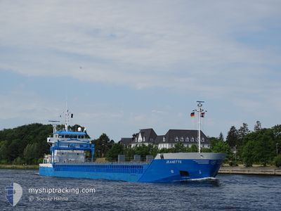
NEERBORG
General Cargo
Current Trip
| Time Travelled | 1 day |
|---|---|
| Remaining Time | 1 day |
| Distance Travelled | 274.45 nm |
| Remaining Distance | 349.17 nm |
| AVG Speed | 10.3 Noeuds |
| MAX Speed | 12.2 Noeuds |
| AVG Wind | 9.1 knots |
| MAX Wind | 13 knots |
| MIN Temp | -0.5°C / 31.1°F |
| MAX Temp | 1.8°C / 35.24°F |
| Tirant d eau | 4.2 m |
| Position reçue | 8 h, 35 m depuis |
Current Position
| Longitude | 20.27767° |
|---|---|
| Latitude | 63.10051° |
| Etat | Under way using engine |
| Vitesse | 9.9 Noeuds |
| Parcours | 194.5° |
| Zone | Gulf of Bothnia |
| Station | T-AIS |
| Position reçue | 8 h, 35 m depuis |
Info
Information
The current position of NEERBORG is in Gulf of Bothnia with coordinates 63.10051° / 20.27767° as reported on 2024-04-27 09:52 by AIS to our vessel tracker app. The vessel's current speed is 9.9 Noeuds and is heading at the port of KOTKA. The estimated time of arrival as calculated by MyShipTracking vessel tracking app is 2024-04-29 01:41 LT
The vessel NEERBORG (IMO: 9357509, MMSI: 244562000) is a General Cargo that was built in 2007 ( 17 Age ). It's sailing under the flag of [NL] Netherlands.
In this page you can find informations about the vessels current position, last detected port calls, and current voyage information. If the vessels is not in coverage by AIS you will find the latest position.
The current position of NEERBORG is detected by our AIS receivers and we are not responsible for the reliability of the data. The last position was recorded while the vessel was in Coverage by the Ais receivers of our vessel tracking app.
The current draught of NEERBORG as reported by AIS is 4.2 meters
Weather
| Temperature | 0.8°C / 33.44°F |
|---|---|
| Wind Speed | 2 knots |
| Direction | 87° E |
| Pressure | 1016.6 hPa |
| Humidity | 97.9 % |
| Cloud Coverage | 100 % |
Featured Company
Last Port Calls
| Port | Arrival | Departure | Time In Port |
|---|---|---|---|
| 2024-04-24 20:44 | 2024-04-26 13:08 | 1 d | |
| 2024-04-18 05:52 | 2024-04-18 21:18 | 15 h | |
| 2024-04-08 07:40 | 2024-04-10 11:04 | 2 d | |
| 2024-04-04 16:02 | 2024-04-05 14:15 | 22 h | |
| 2024-03-30 16:12 | 2024-04-03 16:15 | 4 d | |
| 2024-03-22 13:45 | 2024-03-25 20:17 | 3 d | |
| 2024-03-11 17:25 | 2024-03-12 22:20 | 1 d | |
| 2024-03-08 08:51 | 2024-03-08 08:54 | 3 m | |
| 2024-03-02 15:57 | 2024-03-06 18:18 | 4 d | |
| 2024-02-28 22:02 | 2024-03-02 15:18 | 2 d |
Last Trips
| Origin | Departure | Destination | Arrival | Distance | |
|---|---|---|---|---|---|
| 2024-04-18 23:18 | 2024-04-24 23:44 | 1384.83 nm | |||
| 2024-04-10 13:04 | 2024-04-18 07:52 | 1044.59 nm | |||
| 2024-04-05 16:15 | 2024-04-08 09:40 | 647.41 nm | |||
| 2024-04-03 18:15 | 2024-04-04 18:02 | 236.96 nm | |||
| 2024-03-25 21:17 | 2024-03-30 17:12 | 1114.70 nm | |||
| 2024-03-12 23:20 | 2024-03-22 14:45 | 247.75 nm | |||
| 2024-03-08 09:54 | 2024-03-11 18:25 | 904.87 nm | |||
| 2024-03-06 19:18 | 2024-03-08 09:51 | 378.59 nm | |||
| 2024-03-02 16:18 | 2024-03-02 16:57 | 4.88 nm | |||
| 2024-02-07 02:02 | 2024-02-28 23:02 | 2082.06 nm |
Events
| Heure | Evenement | Détails | Position/ Destination | Info |
|---|---|---|---|---|
| 2024-04-27 10:00 | Etat Changé | Default Under way using engine |
63.07896 / 20.26584
FIKTK
|
Vitesse: 9.9 kn Parcours: 194.5° |
| 2024-04-27 09:52 | Hors de la zone couverte |
63.10051 / 20.27767
Gulf of Bothnia
FIKTK
|
Vitesse: 9.9 kn Parcours: 194.5° |
|
| 2024-04-27 09:52 | Etat Changé | Under way using engine Default |
63.10225 / 20.27870
FIKTK
|
Vitesse: 10 kn Parcours: 194° |
| 2024-04-27 09:28 | Etat Changé | Default Under way using engine |
63.16402 / 20.31402
FIKTK
|
Vitesse: 9.8 kn Parcours: 196.6° |
| 2024-04-27 07:53 | Changement de zone | Finnish part of the Gulf of Bothnia Swedish part of the Gulf of Bothnia |
63.40930 / 20.55192
Gulf of Bothnia
FIKTK
|
Vitesse: 9.7 kn Parcours: 211.2° |
| 2024-04-27 07:51 | Tirant d'eau modifié | 4.2 5.6 |
63.41291 / 20.55694
FIKTK
|
Vitesse: 9.7 kn Parcours: 215.9° |
| 2024-04-27 07:51 | Changement de destination | FIKTK FITOR VIA NOK |
63.41291 / 20.55694
FIKTK
|
Vitesse: 9.7 kn Parcours: 215.9° |
| 2024-04-27 07:51 | Changement d'ETA | 2024/04/29 04:00 2024/04/24 06:00 |
63.41291 / 20.55694
FIKTK
|
Vitesse: 9.7 kn Parcours: 215.9° |
| 2024-04-27 07:51 | Etat Changé | Under way using engine Default |
63.41339 / 20.55772
FITOR VIA NOK
|
Vitesse: 9.6 kn Parcours: 220° |
| 2024-04-27 07:44 | Etat Changé | Default Under way using engine |
63.42645 / 20.58159
FITOR VIA NOK
|
Vitesse: 7 kn Parcours: 213.3° |