
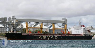
JABAL AR RAWDAH
Cargo
Current Trip
| Trip Time | 1 day |
|---|---|
| Trip Distance | 388.56 nm |
| AVG Speed | 10.8 Noeuds |
| MAX Speed | 14.8 Noeuds |
| Tirant d eau | 11.8 m |
| AVG Wind | 9 knots |
| MAX Wind | 18.2 knots |
| MIN Temp | 22.5°C / 72.5°F |
| MAX Temp | 28.3°C / 82.94°F |
| Position reçue | 18 h, 44 m depuis |
Current Position
| Longitude | --- |
|---|---|
| Latitude | --- |
| Etat | Under way using engine |
| Vitesse | 8.3 Noeuds |
| Parcours | 40.4° |
| Zone | South Atlantic Ocean |
| Station | T-AIS |
| Position reçue | 18 h, 44 m depuis |
Info
Information
The current position of JABAL AR RAWDAH is in South Atlantic Ocean with coordinates -23.14266° / -43.28630° as reported on 2025-02-16 22:36 by AIS to our vessel tracker app. The vessel's current speed is 8.3 Noeuds and is currently inside the port of RIO DE JANEIRO.
The vessel JABAL AR RAWDAH (IMO: 9722041, MMSI: 538007195) is a Cargo It's sailing under the flag of [MH] Marshall Is.
In this page you can find informations about the vessels current position, last detected port calls, and current voyage information. If the vessels is not in coverage by AIS you will find the latest position.
The current position of JABAL AR RAWDAH is detected by our AIS receivers and we are not responsible for the reliability of the data. The last position was recorded while the vessel was in Coverage by the Ais receivers of our vessel tracking app.
The current draught of JABAL AR RAWDAH as reported by AIS is 11.8 meters
Weather
| Temperature | 32°C / 89.6°F |
|---|---|
| Wind Speed | 7 knots |
| Direction | 127° SE |
| Pressure | 1009.8 hPa |
| Humidity | 46.5 % |
| Cloud Coverage | --- |
Featured Company
Last Port Calls
| Port | Arrival | Departure | Time In Port |
|---|---|---|---|
| 2025-02-17 02:00 | |||
| 2025-02-06 12:31 | 2025-02-15 06:00 | 8 d |
Most Visited Ports (Last year)
| Port | Arrivals | |
|---|---|---|
| 2 | ||
| 1 | ||
| 1 | ||
| 1 | ||
| 1 | ||
| 1 |
Last Trips
| Origin | Departure | Destination | Arrival | Distance | |
|---|---|---|---|---|---|
| 2025-02-15 03:00 | 2025-02-16 23:00 | 388.56 nm | |||
| 2024-11-25 15:36 | 2025-02-06 09:31 | 66.34 nm |
Events
| Heure | Evenement | Détails | Position/ Destination | Info |
|---|---|---|---|---|
| 2025-02-17 02:06 | Arret |
-22.89162 / -43.19519
[BR] RIO DE JANEIRO
|
Vitesse: 0.2 kn Parcours: 95° |
|
| 2025-02-17 02:00 | Port d'arrivée |
|
-22.89150 / -43.19474
[BR] RIO DE JANEIRO
|
Vitesse: 0.8 kn Parcours: 87° |
| 2025-02-16 22:38 | Etat Changé | Default Under way using engine |
-23.13905 / -43.28306
PARANAGUA
|
Vitesse: 8.3 kn Parcours: 40.4° |
| 2025-02-16 22:36 | Etat Changé | Under way using engine Default |
-23.14266 / -43.28630
PARANAGUA
|
Vitesse: 8.5 kn Parcours: 39° |
| 2025-02-16 22:36 | Hors de la zone couverte |
-23.14266 / -43.28630
South Atlantic Ocean
|
Vitesse: 8.3 kn Parcours: 40.4° |
|
| 2025-02-16 22:29 | Dans la zone couverte |
-23.14266 / -43.28630
South Atlantic Ocean
|
Vitesse: 8.3 kn Parcours: 40.4° |
|
| 2025-02-15 06:00 | Démarrage | 1.16 nm, East of PARANAGUA |
-25.49600 / -48.49696
PARANAGUA
|
Vitesse: 9.3 kn Parcours: 79° |
| 2025-02-15 06:00 | PORT DE DEPART |
|
-25.49600 / -48.49696
PARANAGUA
|
Vitesse: 3 kn Parcours: 75° |