
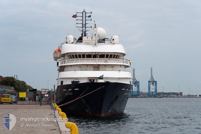
ISLAND SKY
Passengers Ship
Current Trip
| Time Travelled | 18 h, 53 mins |
|---|---|
| Remaining Time | --- |
| Distance Travelled | 246.56 nm |
| Remaining Distance | 6.68 nm |
| AVG Speed | 12.7 Noeuds |
| MAX Speed | 14.1 Noeuds |
| AVG Wind | 10.9 knots |
| MAX Wind | 20 knots |
| MIN Temp | 18.5°C / 65.3°F |
| MAX Temp | 23°C / 73.4°F |
| Tirant d eau | 4.3 m |
| Position reçue | 2 m depuis |
Current Position
| Longitude | -4.40659° |
|---|---|
| Latitude | 36.67921° |
| Etat | Under way using engine |
| Vitesse | 10.3 Noeuds |
| Parcours | 326.8° |
| Zone | Alboran Sea |
| Station | T-AIS |
| Position reçue | 2 m depuis |
Info
Information
The current position of ISLAND SKY is in Alboran Sea with coordinates 36.67921° / -4.40659° as reported on 2024-09-10 06:25 by AIS to our vessel tracker app. The vessel's current speed is 10.3 Noeuds and is heading at the port of MALAGA. The estimated time of arrival as calculated by MyShipTracking vessel tracking app is 2024-09-10 06:27 LT
The vessel ISLAND SKY (IMO: 8802894, MMSI: 311743000) is a Passengers Ship that was built in 1992 ( 32 Age ). It's sailing under the flag of [BS] Bahamas.
In this page you can find informations about the vessels current position, last detected port calls, and current voyage information. If the vessels is not in coverage by AIS you will find the latest position.
The current position of ISLAND SKY is detected by our AIS receivers and we are not responsible for the reliability of the data. The last position was recorded while the vessel was in Coverage by the Ais receivers of our vessel tracking app.
The current draught of ISLAND SKY as reported by AIS is 4.3 meters
Weather
| Temperature | 21.5°C / 70.7°F |
|---|---|
| Wind Speed | 5 knots |
| Direction | 326° NW |
| Pressure | 1016.7 hPa |
| Humidity | 44.5 % |
| Cloud Coverage | --- |
Featured Company
Last Port Calls
| Port | Arrival | Departure | Time In Port |
|---|---|---|---|
| 2024-09-09 06:36 | 2024-09-09 11:34 | 4 h | |
| 2024-09-08 06:00 | 2024-09-08 17:18 | 11 h | |
| 2024-09-07 06:39 | 2024-09-07 17:26 | 10 h | |
| 2024-09-06 06:12 | 2024-09-06 18:20 | 12 h | |
| 2024-09-05 04:44 | 2024-09-05 16:17 | 11 h | |
| 2024-09-02 06:19 | 2024-09-02 17:14 | 10 h | |
| 2024-08-31 05:17 | 2024-08-31 16:59 | 11 h | |
| 2024-08-26 21:07 | 2024-08-27 21:19 | 1 d | |
| 2024-08-25 07:55 | 2024-08-25 21:06 | 13 h | |
| 2024-08-24 06:14 | 2024-08-24 19:22 | 13 h |
Most Visited Ports (Last year)
| Port | Arrivals | |
|---|---|---|
| 4 | ||
| 4 | ||
| 4 | ||
| 3 | ||
| 3 | ||
| 3 |
Last Trips
| Origin | Departure | Destination | Arrival | Distance | |
|---|---|---|---|---|---|
| 2024-09-08 18:18 | 2024-09-09 07:36 | 159.83 nm | |||
| 2024-09-07 18:26 | 2024-09-08 07:00 | 137.80 nm | |||
| 2024-09-06 20:20 | 2024-09-07 07:39 | 140.59 nm | |||
| 2024-09-05 18:17 | 2024-09-06 08:12 | 148.49 nm | |||
| 2024-09-02 18:14 | 2024-09-05 06:44 | 579.80 nm | |||
| 2024-08-31 17:59 | 2024-09-02 07:19 | 369.46 nm | |||
| 2024-08-27 22:19 | 2024-08-31 06:17 | 356.08 nm | |||
| 2024-08-25 22:06 | 2024-08-26 22:07 | 180.79 nm | |||
| 2024-08-24 20:22 | 2024-08-25 08:55 | 134.68 nm | |||
| 2024-08-23 19:47 | 2024-08-24 07:14 | 85.98 nm |
Events
| Heure | Evenement | Détails | Position/ Destination | Info |
|---|---|---|---|---|
| 2024-09-10 06:15 | Etat Changé | Under way using engine Default |
36.65320 / -4.39456
ES AGP
|
Vitesse: 11.1 kn Parcours: 4° |
| 2024-09-10 05:27 | Etat Changé | Default Under way using engine |
36.50554 / -4.46812
ES AGP
|
Vitesse: 12.7 kn Parcours: 34.2° |
| 2024-09-10 04:02 | Etat Changé | Under way using engine Default |
36.30443 / -4.73150
ES AGP
|
Vitesse: 12.5 kn Parcours: 50° |
| 2024-09-10 03:59 | Etat Changé | Default Under way using engine |
36.29763 / -4.74142
ES AGP
|
Vitesse: 12.6 kn Parcours: 49.9° |
| 2024-09-10 03:45 | Etat Changé | Under way using engine Default |
36.26620 / -4.78723
ES AGP
|
Vitesse: 12.6 kn Parcours: 51° |
| 2024-09-10 03:31 | Etat Changé | Default Under way using engine |
36.23451 / -4.83202
ES AGP
|
Vitesse: 12.5 kn Parcours: 48.3° |
| 2024-09-10 03:25 | Etat Changé | Under way using engine Default |
36.22005 / -4.85181
ES AGP
|
Vitesse: 12.6 kn Parcours: 48° |
| 2024-09-10 03:07 | Etat Changé | Default Under way using engine |
36.17860 / -4.90930
ES AGP
|
Vitesse: 12.3 kn Parcours: 50.7° |
| 2024-09-10 02:40 | Changement de zone | Spanish part of the Alboran Sea Gibraltarian part of the Alboran Sea |
36.12040 / -4.99420
Alboran Sea
ES AGP
|
Vitesse: 12.5 kn Parcours: 48.4° |
| 2024-09-10 02:33 | Etat Changé | Under way using engine Default |
36.10284 / -5.01823
ES AGP
|
Vitesse: 12.8 kn Parcours: 41° |