
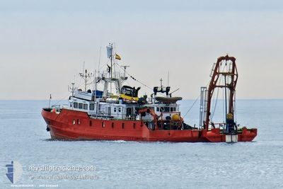
INVESTIGADOR I
Research/Survey Vessel
Current Trip
| Time Travelled | 6 h, 1 mins |
|---|---|
| Remaining Time | 3 days |
| Distance Travelled | 37.17 nm |
| Remaining Distance | 901.01 nm |
| AVG Speed | 9 Noeuds |
| MAX Speed | 9.6 Noeuds |
| AVG Wind | 6.6 knots |
| MAX Wind | 13 knots |
| MIN Temp | 14.9°C / 58.82°F |
| MAX Temp | 18.1°C / 64.58°F |
| Tirant d eau | 5.2 m |
| Position reçue | 4 h, 37 m depuis |
Current Position
| Longitude | --- |
|---|---|
| Latitude | --- |
| Etat | Under way using engine |
| Vitesse | 8.4 Noeuds |
| Parcours | 198.9° |
| Zone | North Atlantic Ocean |
| Station | T-AIS |
| Position reçue | 4 h, 37 m depuis |
Info
Information
The current position of INVESTIGADOR I is in North Atlantic Ocean with coordinates 42.12425° / -8.96173° as reported on 2024-10-18 09:52 by AIS to our vessel tracker app. The vessel's current speed is 8.4 Noeuds and is heading at the port of TENERIFE. The estimated time of arrival as calculated by MyShipTracking vessel tracking app is 2024-10-22 13:17 LT
The vessel INVESTIGADOR I (IMO: 5283669, MMSI: 224822000) is a Research/Survey Vessel that was built in 1961 ( 63 Age ). It's sailing under the flag of [ES] Spain.
In this page you can find informations about the vessels current position, last detected port calls, and current voyage information. If the vessels is not in coverage by AIS you will find the latest position.
The current position of INVESTIGADOR I is detected by our AIS receivers and we are not responsible for the reliability of the data. The last position was recorded while the vessel was in Coverage by the Ais receivers of our vessel tracking app.
The current draught of INVESTIGADOR I as reported by AIS is 5.2 meters
Weather
| Temperature | 18.3°C / 64.94°F |
|---|---|
| Wind Speed | 9 knots |
| Direction | 265° W |
| Pressure | 1023.4 hPa |
| Humidity | 87.9 % |
| Cloud Coverage | 100 % |
Featured Company
Events
| Heure | Evenement | Détails | Position/ Destination | Info |
|---|---|---|---|---|
| 2024-10-18 10:02 | Etat Changé | Default Under way using engine |
42.10352 / -8.97354
TENERIFE
|
Vitesse: 8.4 kn Parcours: 198.9° |
| 2024-10-18 09:52 | Hors de la zone couverte |
42.12425 / -8.96173
North Atlantic Ocean
TENERIFE
|
Vitesse: 8.4 kn Parcours: 198.9° |
|
| 2024-10-18 09:41 | Etat Changé | Under way using engine Default |
42.14840 / -8.94867
TENERIFE
|
Vitesse: 8.4 kn Parcours: 247° |
| 2024-10-18 09:30 | Etat Changé | Default Under way using engine |
42.15800 / -8.91665
TENERIFE
|
Vitesse: 8.7 kn Parcours: 247.9° |
| 2024-10-18 08:29 | PORT DE DEPART |
|
42.23691 / -8.75384
TENERIFE
|
Vitesse: 8.3 kn Parcours: 259° |
| 2024-10-18 08:21 | Etat Changé | Under way using engine Moored |
42.23010 / -8.74138
[ES] VIGO
|
Vitesse: 5.3 kn Parcours: 60° |
| 2024-10-18 08:19 | Démarrage |
42.22965 / -8.74398
[ES] VIGO
|
Vitesse: 5 kn Parcours: 87° |
|
| 2024-10-18 08:15 | Changement de destination | TENERIFE VIGO |
42.22942 / -8.74652
[ES] VIGO
|
Vitesse: Parcours: 61° |
| 2024-10-18 08:15 | Changement d'ETA | 2024/10/22 22:00 2025/08/17 08:00 |
42.22942 / -8.74652
[ES] VIGO
|
Vitesse: Parcours: 61° |
| 2024-10-18 08:10 | Dans la zone couverte |
42.22948 / -8.74655
North Atlantic Ocean
[ES] VIGO
|
Vitesse: Parcours: 161.6° |