

INTERVENTION
Wing in ground

Current Trip
FRUCKVN239BRDG102752
| Time Travelled | 1 day |
|---|---|
| Remaining Time | --- |
| Distance Travelled | 29.15 nm |
| Remaining Distance | --- |
| AVG Speed | 6.4 Noeuds |
| MAX Speed | 6.8 Noeuds |
| AVG Wind | 4.7 knots |
| MAX Wind | 8.7 knots |
| MIN Temp | 3.8°C / 38.84°F |
| MAX Temp | 11.1°C / 51.98°F |
| Tirant d eau | 0 m |
| Position reçue | 1 d depuis |
Current Position
| Longitude | --- |
|---|---|
| Latitude | --- |
| Etat | Under way using engine |
| Vitesse | 5.8 Noeuds |
| Parcours | 118° |
| Zone | North Sea |
| Station | T-AIS |
| Position reçue | 1 d depuis |
Information
The current position of INTERVENTION is in North Sea with coordinates 52.40698° / 9.74180° as reported on 2025-03-25 10:42 by AIS to our vessel tracker app. The vessel's current speed is 5.8 Noeuds
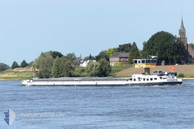
The vessel INTERVENTION (MMSI: 244071611) is a Wing in ground It's sailing under the flag of [NL] Netherlands.
In this page you can find informations about the vessels current position, last detected port calls, and current voyage information. If the vessels is not in coverage by AIS you will find the latest position.
The current position of INTERVENTION is detected by our AIS receivers and we are not responsible for the reliability of the data. The last position was recorded while the vessel was in Coverage by the Ais receivers of our vessel tracking app.
Weather
| Temperature | 10.7°C / 51.26°F |
|---|---|
| Wind Speed | 8 knots |
| Direction | 268° W |
| Pressure | 1018.5 hPa |
| Humidity | 60.7 % |
| Cloud Coverage | 20 % |


Featured Company
Last Port Calls
| Port | Arrival | Departure | Time In Port |
|---|---|---|---|
| 2025-03-24 21:25 | 2025-03-25 06:31 | 9 h | |
| 2025-03-18 19:15 | 2025-03-19 08:03 | 12 h | |
| 2025-03-18 12:09 | 2025-03-18 17:29 | 5 h | |
| 2025-03-17 23:57 | 2025-03-18 11:03 | 11 h | |
| 2025-03-16 11:23 | 2025-03-17 20:42 | 1 d | |
| 2025-03-10 18:48 | 2025-03-13 17:28 | 2 d | |
| 2025-03-07 10:20 | 2025-03-07 10:30 | 10 m | |
| 2025-03-05 22:19 | 2025-03-06 13:05 | 14 h | |
| 2025-02-27 10:10 | 2025-02-28 14:18 | 1 d | |
| 2025-02-15 12:47 | 2025-02-17 10:41 | 1 d |
Last Trips
| Origin | Departure | Destination | Arrival | Distance | |
|---|---|---|---|---|---|
| 2025-03-19 08:03 | 2025-03-24 21:25 | 220.68 nm | |||
| 2025-03-18 17:29 | 2025-03-18 19:15 | 9.10 nm | |||
| 2025-03-18 11:03 | 2025-03-18 12:09 | 3.32 nm | |||
| 2025-03-17 20:42 | 2025-03-17 23:57 | 15.26 nm | |||
| 2025-03-13 17:28 | 2025-03-16 11:23 | 166.76 nm | |||
| 2025-03-07 10:30 | 2025-03-10 18:48 | 62.36 nm | |||
| 2025-03-06 13:05 | 2025-03-07 10:20 | 76.58 nm | |||
| 2025-02-28 14:18 | 2025-03-05 22:19 | 69.29 nm | |||
| 2025-02-17 10:41 | 2025-02-27 10:10 | 307.28 nm | |||
| 2025-02-12 11:38 | 2025-02-15 12:47 | 111.83 nm |
Events
| Heure | Evenement | Détails | Position/ Destination | Info |
|---|---|---|---|---|
| 2025-03-25 10:42 | Hors de la zone couverte |
52.40698 / 9.74180
North Sea
|
Vitesse: 5.8 kn Parcours: 118° |
|
| 2025-03-25 10:24 | Dans la zone couverte |
52.42153 / 9.69958
North Sea
|
Vitesse: 5.5 kn Parcours: 118.9° |
|
| 2025-03-25 09:04 | Hors de la zone couverte |
52.40788 / 9.49479
North Sea
|
Vitesse: 6.3 kn Parcours: 79.4° |
|
| 2025-03-25 08:11 | Dans la zone couverte |
52.38929 / 9.35219
North Sea
|
Vitesse: 6.1 kn Parcours: 84.7° |
|
| 2025-03-25 06:15 | Hors de la zone couverte |
52.31871 / 9.07216
North Sea
|
Vitesse: 6 kn Parcours: 53.9° |
|
| 2025-03-25 05:31 | PORT DE DEPART |
|
52.30302 / 8.96578
FRUCKVN239BRDG102752
|
Vitesse: 6.2 kn Parcours: 102.3° |
| 2025-03-25 05:21 | Dans la zone couverte |
52.30397 / 8.93795
North Sea
[DE] MINDEN
|
Vitesse: 6.8 kn Parcours: 87.4° |
|
| 2025-03-24 20:27 | Hors de la zone couverte |
52.30205 / 8.89729
North Sea
[DE] MINDEN
|
Vitesse: 0.3 kn Parcours: 79.1° |
|
| 2025-03-24 20:25 | Etat Changé | Moored Under way using engine |
52.30188 / 8.89705
[DE] MINDEN
|
Vitesse: 0.5 kn Parcours: 511° |
| 2025-03-24 20:25 | Arret |
52.30188 / 8.89705
[DE] MINDEN
|
Vitesse: 0.3 kn Parcours: 511° |