
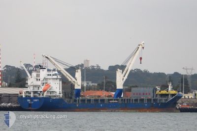
INDUSTRIAL SWIFT
Cargo
Current Trip
AUPTL
| Time Travelled | 24 days |
|---|---|
| Remaining Time | --- |
| Distance Travelled | 7473.61 nm |
| Remaining Distance | --- |
| AVG Speed | 14 Noeuds |
| MAX Speed | 15.6 Noeuds |
| AVG Wind | 11.9 knots |
| MAX Wind | 25 knots |
| MIN Temp | 16.4°C / 61.52°F |
| MAX Temp | 24.8°C / 76.64°F |
| Tirant d eau | 6.4 m |
| Position reçue | 1 d depuis |
Current Position
| Longitude | 151.03279° |
|---|---|
| Latitude | -23.36105° |
| Etat | At anchor |
| Vitesse | 0.1 Noeuds |
| Parcours | 89° |
| Zone | Coral Sea |
| Station | T-AIS |
| Position reçue | 1 d depuis |
Info
Information
The current position of INDUSTRIAL SWIFT is in Coral Sea with coordinates -23.36105° / 151.03279° as reported on 2024-06-04 05:51 by AIS to our vessel tracker app. The vessel's current speed is 0.1 Noeuds
The vessel INDUSTRIAL SWIFT (IMO: 9741152, MMSI: 636017393) is a Cargo It's sailing under the flag of [LR] Liberia.
In this page you can find informations about the vessels current position, last detected port calls, and current voyage information. If the vessels is not in coverage by AIS you will find the latest position.
The current position of INDUSTRIAL SWIFT is detected by our AIS receivers and we are not responsible for the reliability of the data. The last position was recorded while the vessel was in Coverage by the Ais receivers of our vessel tracking app.
The current draught of INDUSTRIAL SWIFT as reported by AIS is 6.4 meters
Weather
| Temperature | 21.9°C / 71.42°F |
|---|---|
| Wind Speed | 15 knots |
| Direction | 20° NNE |
| Pressure | 1014.6 hPa |
| Humidity | 80.7 % |
| Cloud Coverage | 78 % |
Featured Company
Last Port Calls
| Port | Arrival | Departure | Time In Port |
|---|---|---|---|
| 2024-05-09 21:29 | 2024-05-11 09:17 | 1 d | |
| 2024-04-30 20:48 | 2024-05-03 11:25 | 2 d | |
| 2024-04-28 00:28 | 2024-04-29 12:31 | 1 d | |
| 2024-04-21 20:31 | 2024-04-22 08:44 | 12 h | |
| 2024-04-19 14:27 | 2024-04-19 21:09 | 6 h | |
| 2024-04-07 19:18 | 2024-04-07 20:08 | 49 m | |
| 2024-04-01 16:59 | 2024-04-02 00:38 | 7 h |
Most Visited Ports (Last year)
| Port | Arrivals | |
|---|---|---|
| 2 | ||
| 2 | ||
| 2 | ||
| 2 | ||
| 1 | ||
| 1 |
Last Trips
| Origin | Departure | Destination | Arrival | Distance | |
|---|---|---|---|---|---|
| 2024-05-03 11:25 | 2024-05-09 21:29 | 891.19 nm | |||
| 2024-04-29 12:31 | 2024-04-30 20:48 | 6.64 nm | |||
| 2024-04-22 08:44 | 2024-04-28 00:28 | 821.29 nm | |||
| 2024-04-19 21:09 | 2024-04-21 20:31 | 434.87 nm | |||
| 2024-04-07 20:08 | 2024-04-19 14:27 | 3155.11 nm | |||
| 2024-04-02 00:38 | 2024-04-07 19:18 | 1796.26 nm | |||
| 2024-03-22 18:22 | 2024-04-01 16:59 | 3190.73 nm |
Events
| Heure | Evenement | Détails | Position/ Destination | Info |
|---|---|---|---|---|
| 2024-06-04 05:57 | Etat Changé | Default At anchor |
-23.36111 / 151.03278
AUPTL
|
Vitesse: 0.1 kn Parcours: 89° |
| 2024-06-04 05:51 | Etat Changé | At anchor Default |
-23.36105 / 151.03279
AUPTL
|
Vitesse: 0.1 kn Parcours: 82° |
| 2024-06-04 05:51 | Hors de la zone couverte |
-23.36105 / 151.03279
Coral Sea
|
Vitesse: 0.1 kn Parcours: 161.8° |
|
| 2024-06-04 05:09 | Etat Changé | Default At anchor |
-23.36111 / 151.03279
AUPTL
|
Vitesse: Parcours: 84° |
| 2024-06-04 05:03 | Detecté en mer | Australian part of the Coral Sea |
-23.36111 / 151.03283
Coral Sea
|
Vitesse: Parcours: 163.3° |
| 2024-06-04 05:03 | Etat Changé | At anchor Default |
-23.36111 / 151.03283
AUPTL
|
Vitesse: 0.1 kn Parcours: 86° |
| 2024-06-04 05:03 | Dans la zone couverte |
-23.36111 / 151.03283
Coral Sea
|
Vitesse: Parcours: 163.3° |
|
| 2024-06-02 14:57 | Arret | 16.4 nm, North East of PORT ALMA |
-23.36065 / 151.03516
AUPTL
|
Vitesse: 0.2 kn Parcours: 233° |
| 2024-05-28 21:20 | Etat Changé | Default Under way using engine |
-24.39526 / 179.89838
AUPTL
|
Vitesse: 14.2 kn Parcours: 269.4° |
| 2024-05-28 21:14 | Hors de la zone couverte |
-24.39527 / 179.92130
South Pacific Ocean
|
Vitesse: 14.2 kn Parcours: 269.4° |