
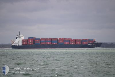
INDEPENDENT PRIMERO
Container Ship
Current Trip
| Time Travelled | 12 h, 12 mins |
|---|---|
| Remaining Time | 7 h, 43 mins |
| Distance Travelled | 408.78 nm |
| Remaining Distance | 154.48 nm |
| AVG Speed | 42.5 Noeuds |
| MAX Speed | 42.5 Noeuds |
| AVG Wind | 4.5 knots |
| MAX Wind | 8 knots |
| MIN Temp | 12.1°C / 53.78°F |
| MAX Temp | 17.1°C / 62.78°F |
| Tirant d eau | 9.9 m |
| Position reçue | 2 m depuis |
Current Position
| Longitude | -5.80125° |
|---|---|
| Latitude | 49.98378° |
| Etat | Under way using engine |
| Vitesse | 19 Noeuds |
| Parcours | 289° |
| Zone | English Channel |
| Station | T-AIS |
| Position reçue | 2 m depuis |
Info
Information
The current position of INDEPENDENT PRIMERO is in English Channel with coordinates 49.98378° / -5.80125° as reported on 2024-05-18 00:24 by AIS to our vessel tracker app. The vessel's current speed is 19 Noeuds and is heading at the port of CORK. The estimated time of arrival as calculated by MyShipTracking vessel tracking app is 2024-05-18 08:09 LT
The vessel INDEPENDENT PRIMERO (IMO: 9298636, MMSI: 255805626) is a Container Ship that was built in 2005 ( 19 Age ). It's sailing under the flag of [PT] Portugal.
In this page you can find informations about the vessels current position, last detected port calls, and current voyage information. If the vessels is not in coverage by AIS you will find the latest position.
The current position of INDEPENDENT PRIMERO is detected by our AIS receivers and we are not responsible for the reliability of the data. The last position was recorded while the vessel was in Coverage by the Ais receivers of our vessel tracking app.
The current draught of INDEPENDENT PRIMERO as reported by AIS is 9.9 meters
Weather
| Temperature | 13.8°C / 56.84°F |
|---|---|
| Wind Speed | 7 knots |
| Direction | 36° NE |
| Pressure | 1013.4 hPa |
| Humidity | 86.4 % |
| Cloud Coverage | 100 % |
Featured Company
Last Port Calls
| Port | Arrival | Departure | Time In Port |
|---|---|---|---|
| 2024-05-17 10:00 | 2024-05-17 12:14 | 2 h | |
| 2024-05-17 08:13 | 2024-05-17 09:31 | 1 h | |
| 2024-05-16 20:49 | 2024-05-17 07:48 | 10 h | |
| 2024-05-16 16:31 | 2024-05-16 19:42 | 3 h | |
| 2024-05-16 15:37 | 2024-05-16 15:40 | 3 m | |
| 2024-05-16 15:24 | 2024-05-16 15:25 | 1 m | |
| 2024-05-15 18:35 | 2024-05-15 20:10 | 1 h | |
| 2024-05-15 15:45 | 2024-05-15 15:46 | 0 m | |
| 2024-05-14 15:24 | 2024-05-15 14:31 | 23 h | |
| 2024-05-14 09:28 | 2024-05-14 09:28 | 0 m |
Most Visited Ports (Last year)
| Port | Arrivals | |
|---|---|---|
| 24 | ||
| 21 | ||
| 15 | ||
| 5 | ||
| 4 | ||
| 3 |
Last Trips
| Origin | Departure | Destination | Arrival | Distance | |
|---|---|---|---|---|---|
| 2024-05-17 10:31 | 2024-05-17 11:00 | 11.50 nm | |||
| 2024-05-17 08:48 | 2024-05-17 09:13 | 11.48 nm | |||
| 2024-05-16 20:42 | 2024-05-16 21:49 | 70.34 nm | |||
| 2024-05-16 16:40 | 2024-05-16 17:31 | 17.13 nm | |||
| 2024-05-16 16:25 | 2024-05-16 16:37 | 28.06 nm | |||
| 2024-05-15 22:10 | 2024-05-16 16:24 | 479.92 nm | |||
| 2024-05-15 16:46 | 2024-05-15 20:35 | 138.13 nm | |||
| 2024-05-15 16:31 | 2024-05-15 16:45 | 99.78 nm | |||
| 2024-05-14 10:28 | 2024-05-14 17:24 | 273.74 nm | |||
| 2024-05-14 10:28 | 2024-05-14 10:28 | 273.74 nm |
Events
| Heure | Evenement | Détails | Position/ Destination | Info |
|---|---|---|---|---|
| 2024-05-18 00:01 | Changement de zone | United Kingdom part of the Celtic Sea United Kingdom part of the English Channel |
49.95030 / -5.62617
Celtic Sea
IEORK
|
Vitesse: 18.9 kn Parcours: 285.5° |
| 2024-05-17 18:47 | Dans la zone couverte |
50.23008 / -3.06528
English Channel
IEORK
|
Vitesse: 19.3 kn Parcours: 256° |
|
| 2024-05-17 18:37 | Changement d'ETA | 2024/05/18 09:30 2024/05/18 10:30 |
50.81197 / -1.20469
IEORK
|
Vitesse: 20 kn Parcours: 274.7° |
| 2024-05-17 16:48 | Hors de la zone couverte |
50.81197 / -1.20469
English Channel
IEORK
|
Vitesse: 20 kn Parcours: 274.7° |
|
| 2024-05-17 16:30 | Démarrage | 1.82 nm, North East of SWANAGE |
50.63526 / -1.92403
IEORK
|
Vitesse: 7 kn Parcours: 170.4° |
| 2024-05-17 16:16 | Arret | 2.01 nm, North East of SWANAGE |
50.63919 / -1.92514
IEORK
|
Vitesse: Parcours: 0° |
| 2024-05-17 16:15 | Démarrage | 2.08 nm, North East of SWANAGE |
50.64003 / -1.92390
IEORK
|
Vitesse: 13 kn Parcours: 222.3° |
| 2024-05-17 16:13 | Arret | 2.31 nm, North East of SWANAGE |
50.64363 / -1.92164
IEORK
|
Vitesse: Parcours: 0° |
| 2024-05-17 14:45 | Démarrage | 1.65 nm, South East of PORTSMOUTH ANCH |
50.75140 / -1.07355
IEORK
|
Vitesse: 98 kn Parcours: 107.9° |
| 2024-05-17 14:33 | Etat Changé | Default Under way using engine |
50.81173 / -1.20701
IEORK
|
Vitesse: 17.1 kn Parcours: 253.7° |