
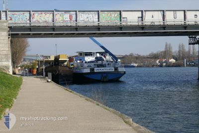
IMMACULATA
Cargo
Current Trip
LE HAVRE
| Time Travelled | 2 days |
|---|---|
| Remaining Time | --- |
| Distance Travelled | 92.39 nm |
| Remaining Distance | --- |
| AVG Speed | 9.8 Noeuds |
| MAX Speed | 12.6 Noeuds |
| AVG Wind | 11.3 knots |
| MAX Wind | 14 knots |
| MIN Temp | 3.9°C / 39.02°F |
| MAX Temp | 6.3°C / 43.34°F |
| Tirant d eau | 2 m |
| Position reçue | 1 d depuis |
Current Position
| Longitude | --- |
|---|---|
| Latitude | --- |
| Etat | Moored |
| Vitesse | 6.5 Noeuds |
| Parcours | 78.2° |
| Zone | English Channel |
| Station | T-AIS |
| Position reçue | 1 d depuis |
Info
Information
The current position of IMMACULATA is in English Channel with coordinates 49.20527° / 1.26489° as reported on 2024-12-10 11:19 by AIS to our vessel tracker app. The vessel's current speed is 6.5 Noeuds
The vessel IMMACULATA (MMSI: 226016410) is a Cargo It's sailing under the flag of [FR] France.
In this page you can find informations about the vessels current position, last detected port calls, and current voyage information. If the vessels is not in coverage by AIS you will find the latest position.
The current position of IMMACULATA is detected by our AIS receivers and we are not responsible for the reliability of the data. The last position was recorded while the vessel was in Coverage by the Ais receivers of our vessel tracking app.
The current draught of IMMACULATA as reported by AIS is 2 meters
Weather
| Temperature | 5.4°C / 41.72°F |
|---|---|
| Wind Speed | 12 knots |
| Direction | 42° NE |
| Pressure | 1027.2 hPa |
| Humidity | 85 % |
| Cloud Coverage | 100 % |
Featured Company
Last Port Calls
| Port | Arrival | Departure | Time In Port |
|---|---|---|---|
| 2024-12-09 17:13 | 2024-12-09 18:59 | 1 h | |
| 2024-12-08 19:59 | 2024-12-09 17:07 | 21 h | |
| 2024-12-07 12:13 | 2024-12-08 19:51 | 1 d | |
| 2024-12-06 09:39 | 2024-12-07 05:08 | 19 h | |
| 2024-12-04 09:43 | 2024-12-04 09:47 | 4 m | |
| 2024-12-03 05:02 | 2024-12-04 08:15 | 1 d | |
| 2024-12-02 21:23 | 2024-12-03 04:53 | 7 h | |
| 2024-11-30 20:58 | 2024-12-01 06:08 | 9 h | |
| 2024-11-27 00:50 | 2024-11-27 02:08 | 1 h | |
| 2024-11-25 18:02 | 2024-11-27 00:41 | 1 d |
Most Visited Ports (Last year)
| Port | Arrivals | |
|---|---|---|
| 158 | ||
| 34 | ||
| 28 | ||
| 27 | ||
| 21 | ||
| 2 |
Last Trips
| Origin | Departure | Destination | Arrival | Distance | |
|---|---|---|---|---|---|
| 2024-12-09 18:07 | 2024-12-09 18:13 | 0.54 nm | |||
| 2024-12-08 20:51 | 2024-12-08 20:59 | 1.26 nm | |||
| 2024-12-07 06:08 | 2024-12-07 13:13 | 54.88 nm | |||
| 2024-12-04 10:47 | 2024-12-06 10:39 | 118.67 nm | |||
| 2024-12-04 09:15 | 2024-12-04 10:43 | 17.99 nm | |||
| 2024-12-03 05:53 | 2024-12-03 06:02 | 0.91 nm | |||
| 2024-12-01 07:08 | 2024-12-02 22:23 | 75.66 nm | |||
| 2024-11-27 03:08 | 2024-11-30 21:58 | 106.48 nm | |||
| 2024-11-27 01:41 | 2024-11-27 01:50 | 0.92 nm | |||
| 2024-11-25 18:51 | 2024-11-25 19:02 | 1.47 nm |
Events
| Heure | Evenement | Détails | Position/ Destination | Info |
|---|---|---|---|---|
| 2024-12-10 11:19 | Hors de la zone couverte |
49.20527 / 1.26489
English Channel
|
Vitesse: 6.5 kn Parcours: 78.2° |
|
| 2024-12-10 10:01 | Démarrage | 6.98 nm, East of MARTOT |
49.31226 / 1.23938
LE HAVRE
|
Vitesse: 5.2 kn Parcours: 96.1° |
| 2024-12-10 09:45 | Arret | 6.86 nm, East of MARTOT |
49.31244 / 1.23632
LE HAVRE
|
Vitesse: 0.3 kn Parcours: 95° |
| 2024-12-10 09:43 | Démarrage | 6.81 nm, East of MARTOT |
49.31252 / 1.23510
LE HAVRE
|
Vitesse: 3.3 kn Parcours: 94° |
| 2024-12-10 09:09 | Arret | 6.7 nm, East of MARTOT |
49.31237 / 1.23233
LE HAVRE
|
Vitesse: 0.3 kn Parcours: 82° |
| 2024-12-10 01:39 | Démarrage | 1.46 nm, South West of RADICATEL |
49.47313 / .45350
LE HAVRE
|
Vitesse: 3.7 kn Parcours: 92° |
| 2024-12-09 20:11 | Arret | 1.62 nm, South West of RADICATEL |
49.47292 / .44927
LE HAVRE
|
Vitesse: 0.3 kn Parcours: 94° |
| 2024-12-09 18:59 | PORT DE DEPART |
|
49.49479 / .23304
LE HAVRE
|
Vitesse: 7.4 kn Parcours: 104° |
| 2024-12-09 18:34 | Démarrage |
49.47645 / .17505
[FR] LE HAVRE
|
Vitesse: 5.5 kn Parcours: 50° |
|
| 2024-12-09 18:03 | Changement de destination | LE HAVRE PONTROUTE DE GENNEVI |
49.47552 / .17252
[FR] LE HAVRE
|
Vitesse: Parcours: 68° |