
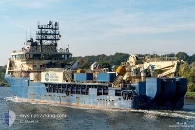
ILE D OUESSANT
Offshore Supply Ship
Current Trip
NOR SNOVIT FIELD
| Time Travelled | 5 days |
|---|---|
| Remaining Time | --- |
| Distance Travelled | 1408.02 nm |
| Remaining Distance | --- |
| AVG Speed | 10.3 Noeuds |
| MAX Speed | 12.8 Noeuds |
| AVG Wind | 19.8 knots |
| MAX Wind | 27 knots |
| MIN Temp | 7.7°C / 45.86°F |
| MAX Temp | 13.9°C / 57.02°F |
| Tirant d eau | 6.2 m |
| Position reçue | 1 m depuis |
Current Position
| Longitude | 21.15038° |
|---|---|
| Latitude | 71.56146° |
| Etat | Restricted manoeuverability |
| Vitesse | 0.9 Noeuds |
| Parcours | 123° |
| Zone | Norwegian Sea |
| Station | T-AIS |
| Position reçue | 1 m depuis |
Info
Information
The current position of ILE D OUESSANT is in Norwegian Sea with coordinates 71.56146° / 21.15038° as reported on 2024-06-05 08:00 by AIS to our vessel tracker app. The vessel's current speed is 0.9 Noeuds
The vessel ILE D OUESSANT (IMO: 9427108, MMSI: 228370600) is a Offshore Supply Ship that was built in 2011 ( 13 Age ). It's sailing under the flag of [FR] France.
In this page you can find informations about the vessels current position, last detected port calls, and current voyage information. If the vessels is not in coverage by AIS you will find the latest position.
The current position of ILE D OUESSANT is detected by our AIS receivers and we are not responsible for the reliability of the data. The last position was recorded while the vessel was in Coverage by the Ais receivers of our vessel tracking app.
The current draught of ILE D OUESSANT as reported by AIS is 6.2 meters
Weather
| Temperature | 7.7°C / 45.86°F |
|---|---|
| Wind Speed | 16 knots |
| Direction | 90° E |
| Pressure | 1009.9 hPa |
| Humidity | 80.6 % |
| Cloud Coverage | 15 % |
Featured Company
Last Trips
| Origin | Departure | Destination | Arrival | Distance | |
|---|---|---|---|---|---|
| 2024-05-18 10:31 | 2024-05-18 14:29 | 30.01 nm | |||
| 2024-05-11 10:40 | 2024-05-11 15:58 | 29.48 nm | |||
| 2024-05-03 16:35 | 2024-05-05 10:24 | 401.04 nm | |||
| 2024-04-30 16:36 | 2024-05-02 14:42 | 123.60 nm | |||
| 2024-03-01 18:18 | 2024-04-29 21:45 | 3900.88 nm |
Events
| Heure | Evenement | Détails | Position/ Destination | Info |
|---|---|---|---|---|
| 2024-06-05 07:58 | Arret |
71.56153 / 21.15123
NOR SNOVIT FIELD
|
Vitesse: 0.3 kn Parcours: 125° |
|
| 2024-06-05 07:52 | Etat Changé | Restricted manoeuverability Under way sailing |
71.56153 / 21.14675
NOR SNOVIT FIELD
|
Vitesse: 2.5 kn Parcours: 78° |
| 2024-06-03 23:27 | Dans la zone couverte |
67.36804 / 9.09855
Norwegian Sea
NOR SNOVIT FIELD
|
Vitesse: 11.3 kn Parcours: 24° |
|
| 2024-06-03 04:24 | Hors de la zone couverte |
64.08919 / 5.40909
Norwegian Sea
NOR SNOVIT FIELD
|
Vitesse: 11.2 kn Parcours: 23° |
|
| 2024-06-02 11:35 | Changement de zone | Norwegian part of the Norwegian Sea Norwegian part of the North Sea |
61.00567 / 4.18578
Norwegian Sea
NOR SNOVIT FIELD
|
Vitesse: 11.2 kn Parcours: 2° |
| 2024-06-02 09:48 | Etat Changé | Under way sailing Restricted manoeuverability |
60.68168 / 4.18650
NOR SNOVIT FIELD
|
Vitesse: 6.6 kn Parcours: 350° |
| 2024-06-02 09:35 | Démarrage | 17.03 nm, South West of FEDJE |
60.66480 / 4.18800
NOR SNOVIT FIELD
|
Vitesse: 3.1 kn Parcours: 357° |
| 2024-06-02 02:45 | Etat Changé | Restricted manoeuverability Under way using engine |
60.66329 / 4.18776
NOR SNOVIT FIELD
|
Vitesse: 0.5 kn Parcours: 356° |
| 2024-06-02 02:28 | Arret | 17.14 nm, South West of FEDJE |
60.66266 / 4.18597
NOR SNOVIT FIELD
|
Vitesse: 0.3 kn Parcours: 8° |
| 2024-05-31 22:55 | Changement de zone | Norwegian part of the North Sea Danish part of the North Sea |
56.40516 / 4.36306
North Sea
NOR SNOVIT FIELD
|
Vitesse: 9.4 kn Parcours: 357° |