
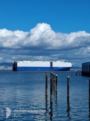
HYPERION RAY
Cargo
Current Trip
| Time Travelled | 10 days |
|---|---|
| Remaining Time | --- |
| Distance Travelled | 3456.50 nm |
| Remaining Distance | --- |
| AVG Speed | 14.8 Noeuds |
| MAX Speed | 20.7 Noeuds |
| AVG Wind | 9.4 knots |
| MAX Wind | 34 knots |
| MIN Temp | --- |
| MAX Temp | 12.6°C / 54.68°F |
| Tirant d eau | 8.9 m |
| Position reçue | 6 d depuis |
Current Position
| Longitude | --- |
|---|---|
| Latitude | --- |
| Etat | Under way using engine |
| Vitesse | 13.4 Noeuds |
| Parcours | 271° |
| Zone | North Pacific Ocean |
| Station | T-AIS |
| Position reçue | 6 d depuis |
Information
The current position of HYPERION RAY is in North Pacific Ocean with coordinates 46.20634° / -125.09971° as reported on 2025-03-12 07:35 by AIS to our vessel tracker app. The vessel's current speed is 13.4 Noeuds and is heading at the port of TOYOHASHI. The estimated time of arrival as calculated by MyShipTracking vessel tracking app is 2025-03-24 07:00 LT
The vessel HYPERION RAY (IMO: 9690559, MMSI: 311000322) is a Cargo It's sailing under the flag of [BS] Bahamas.
In this page you can find informations about the vessels current position, last detected port calls, and current voyage information. If the vessels is not in coverage by AIS you will find the latest position.
The current position of HYPERION RAY is detected by our AIS receivers and we are not responsible for the reliability of the data. The last position was recorded while the vessel was in Coverage by the Ais receivers of our vessel tracking app.
The current draught of HYPERION RAY as reported by AIS is 8.9 meters
Weather
| Temperature | 1.9°C / 35.42°F |
|---|---|
| Wind Speed | 9 knots |
| Direction | 343° NNW |
| Pressure | 981.9 hPa |
| Humidity | 86.4 % |
| Cloud Coverage | 91 % |
Featured Company
Last Port Calls
| Port | Arrival | Departure | Time In Port |
|---|---|---|---|
| 2025-03-07 21:03 | 2025-03-08 19:18 | 22 h | |
| 2025-03-06 15:23 | 2025-03-07 18:04 | 1 d | |
| 2025-03-04 15:16 | 2025-03-05 01:09 | 9 h | |
| 2025-02-26 20:03 | 2025-02-28 21:59 | 2 d | |
| 2025-02-24 03:13 | 2025-02-24 21:23 | 18 h | |
| 2025-02-22 11:53 | 2025-02-22 20:23 | 8 h | |
| 2025-02-17 23:21 | 2025-02-19 11:59 | 1 d | |
| 2025-02-14 18:48 | 2025-02-15 02:18 | 7 h | |
| 2025-02-10 14:30 | 2025-02-12 19:54 | 2 d | |
| 2025-01-31 13:23 | 2025-02-01 22:31 | 1 d |
Last Trips
| Origin | Departure | Destination | Arrival | Distance | |
|---|---|---|---|---|---|
| 2025-03-07 18:04 | 2025-03-07 21:03 | 31.42 nm | |||
| 2025-03-05 01:09 | 2025-03-06 15:23 | 470.75 nm | |||
| 2025-02-28 21:59 | 2025-03-04 15:16 | 1303.29 nm | |||
| 2025-02-24 21:23 | 2025-02-26 20:03 | 731.73 nm | |||
| 2025-02-22 20:23 | 2025-02-24 03:13 | 225.73 nm | |||
| 2025-02-19 11:59 | 2025-02-22 11:53 | 823.48 nm | |||
| 2025-02-15 02:18 | 2025-02-17 23:21 | 603.74 nm | |||
| 2025-02-12 19:54 | 2025-02-14 18:48 | 780.16 nm | |||
| 2025-02-01 22:31 | 2025-02-10 14:30 | 2352.71 nm | |||
| 2025-01-11 18:56 | 2025-01-31 13:23 | 7214.36 nm |
Events
| Heure | Evenement | Détails | Position/ Destination | Info |
|---|---|---|---|---|
| 2025-03-12 07:39 | Etat Changé | Default Under way using engine |
46.20658 / -125.12342
JP THS
|
Vitesse: 13.4 kn Parcours: 271° |
| 2025-03-12 07:35 | Hors de la zone couverte |
46.20634 / -125.09971
North Pacific Ocean
JP THS
|
Vitesse: 13.4 kn Parcours: 271° |
|
| 2025-03-12 06:00 | Changement d'ETA | 2025/03/23 22:00 2025/03/25 01:00 |
46.20187 / -124.55801
JP THS
|
Vitesse: 14.7 kn Parcours: 273.4° |
| 2025-03-11 23:22 | Etat Changé | Under way using engine Default |
45.88807 / -122.80111
JP THS
|
Vitesse: 14.6 kn Parcours: 330° |
| 2025-03-11 23:08 | Dans la zone couverte |
45.89650 / -122.80522
North Pacific Ocean
JP THS
|
Vitesse: 10.9 kn Parcours: 344.8° |
|
| 2025-03-11 22:27 | Changement d'ETA | 2025/03/25 01:00 2025/03/25 19:00 |
45.68906 / -122.77508
JP THS
|
Vitesse: 14.4 kn Parcours: 2° |
| 2025-03-11 22:17 | Changement d'ETA | 2025/03/25 19:00 2025/03/25 17:30 |
45.66041 / -122.76588
JP THS
|
Vitesse: 10.6 kn Parcours: 332° |
| 2025-03-11 22:12 | Démarrage | 2.34 nm, North West of VANCOUVER |
45.65263 / -122.75868
JP THS
|
Vitesse: 5.7 kn Parcours: 326° |
| 2025-03-11 21:48 | Tirant d'eau modifié | 8.9 9 |
45.64650 / -122.75593
JP THS
|
Vitesse: Parcours: 136° |
| 2025-03-11 21:48 | Changement d'ETA | 2025/03/25 17:30 2025/03/24 17:30 |
45.64650 / -122.75593
JP THS
|
Vitesse: Parcours: 136° |