
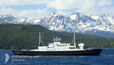
HORDALAND
Ro-Ro/Passenger Ship
Current Trip
HUSOY
| Time Travelled | 25 days |
|---|---|
| Remaining Time | --- |
| Distance Travelled | 39.63 nm |
| Remaining Distance | --- |
| AVG Speed | 10.1 Noeuds |
| MAX Speed | 12.3 Noeuds |
| AVG Wind | 3.4 knots |
| MAX Wind | 6 knots |
| MIN Temp | 5.8°C / 42.44°F |
| MAX Temp | 9°C / 48.2°F |
| Tirant d eau | 3.4 m |
| Position reçue | 4 m depuis |
Current Position
| Longitude | --- |
|---|---|
| Latitude | --- |
| Etat | Moored |
| Vitesse | |
| Parcours | 123° |
| Zone | North Sea |
| Station | T-AIS |
| Position reçue | 4 m depuis |
Info
Information
The current position of HORDALAND is in North Sea with coordinates 59.33959° / 6.22878° as reported on 2026-01-04 03:26 by AIS to our vessel tracker app. The vessel's current speed is 0 Noeuds
The vessel HORDALAND (IMO: 7805203, MMSI: 257283400) is a Ro-Ro/Passenger Ship that was built in 1979 ( 47 Age ). It's sailing under the flag of [NO] Norway.
In this page you can find informations about the vessels current position, last detected port calls, and current voyage information. If the vessels is not in coverage by AIS you will find the latest position.
The current position of HORDALAND is detected by our AIS receivers and we are not responsible for the reliability of the data. The last position was recorded while the vessel was in Coverage by the Ais receivers of our vessel tracking app.
The current draught of HORDALAND as reported by AIS is 3.4 meters
Weather
| Temperature | -10.5°C / 13.1°F |
|---|---|
| Wind Speed | 7 knots |
| Direction | 87° E |
| Pressure | 1001.7 hPa |
| Humidity | 50.7 % |
| Cloud Coverage | 38 % |
Featured Company
Last Trips
| Origin | Departure | Destination | Arrival | Distance |
|---|
Events
| Heure | Evenement | Détails | Position/ Destination | Info |
|---|---|---|---|---|
| 2026-01-04 01:14 | Etat Changé | Moored Default |
59.33961 / 6.22871
HUSOY
|
Vitesse: Parcours: 123° |
| 2026-01-04 01:07 | Etat Changé | Default Moored |
59.33959 / 6.22867
HUSOY
|
Vitesse: Parcours: 123° |
| 2026-01-03 23:02 | Etat Changé | Moored Default |
59.33961 / 6.22862
HUSOY
|
Vitesse: Parcours: 124° |
| 2026-01-03 22:55 | Etat Changé | Default Moored |
59.33963 / 6.22864
HUSOY
|
Vitesse: Parcours: 123° |
| 2026-01-03 16:14 | Etat Changé | Moored Default |
59.33965 / 6.22869
HUSOY
|
Vitesse: Parcours: 123° |
| 2026-01-03 16:02 | Etat Changé | Default Moored |
59.33961 / 6.22872
HUSOY
|
Vitesse: Parcours: 123° |
| 2026-01-03 06:38 | Etat Changé | Moored Default |
59.33965 / 6.22867
HUSOY
|
Vitesse: Parcours: 123° |
| 2026-01-03 06:32 | Etat Changé | Default Moored |
59.33962 / 6.22864
HUSOY
|
Vitesse: Parcours: 123° |
| 2026-01-03 02:38 | Etat Changé | Moored Default |
59.33961 / 6.22866
HUSOY
|
Vitesse: Parcours: 123° |
| 2026-01-03 02:32 | Etat Changé | Default Moored |
59.33962 / 6.22865
HUSOY
|
Vitesse: Parcours: 122° |