
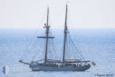
HMS GLADAN
Sailing
Current Trip
| Time Travelled | 2 days |
|---|---|
| Remaining Time | --- |
| Distance Travelled | 30.85 nm |
| Remaining Distance | --- |
| AVG Speed | 5.4 Noeuds |
| MAX Speed | 8.3 Noeuds |
| AVG Wind | 22.2 knots |
| MAX Wind | 26.3 knots |
| MIN Temp | 11.8°C / 53.24°F |
| MAX Temp | 14.7°C / 58.46°F |
| Tirant d eau | 4.2 m |
| Position reçue | 2 d depuis |
Current Position
| Longitude | -8.41919° |
|---|---|
| Latitude | 43.86400° |
| Etat | Under way sailing |
| Vitesse | 8.3 Noeuds |
| Parcours | 348.8° |
| Zone | North Atlantic Ocean |
| Station | T-AIS |
| Position reçue | 2 d depuis |
Info
Information
The current position of HMS GLADAN is in North Atlantic Ocean with coordinates 43.86400° / -8.41919° as reported on 2024-05-04 00:20 by AIS to our vessel tracker app. The vessel's current speed is 8.3 Noeuds
The vessel HMS GLADAN (MMSI: 265404000) is a Sailing It's sailing under the flag of [SE] Sweden.
In this page you can find informations about the vessels current position, last detected port calls, and current voyage information. If the vessels is not in coverage by AIS you will find the latest position.
The current position of HMS GLADAN is detected by our AIS receivers and we are not responsible for the reliability of the data. The last position was recorded while the vessel was in Coverage by the Ais receivers of our vessel tracking app.
The current draught of HMS GLADAN as reported by AIS is 4.2 meters
Weather
| Temperature | 14.1°C / 57.38°F |
|---|---|
| Wind Speed | 22 knots |
| Direction | 229° SW |
| Pressure | 1010.4 hPa |
| Humidity | 96.9 % |
| Cloud Coverage | 100 % |
Featured Company
Last Port Calls
| Port | Arrival | Departure | Time In Port |
|---|---|---|---|
| 2024-05-01 07:33 | 2024-05-03 18:40 | 2 d | |
| 2024-03-26 13:12 | 2024-04-24 09:31 | 28 d | |
| 2024-03-13 14:24 |
Most Visited Ports (Last year)
| Port | Arrivals | |
|---|---|---|
| 4 | ||
| 3 | ||
| 3 | ||
| 2 | ||
| 2 | ||
| 2 |
Last Trips
| Origin | Departure | Destination | Arrival | Distance | |
|---|---|---|---|---|---|
| 2024-04-24 10:31 | 2024-05-01 09:33 | 503.07 nm | |||
| 2024-03-13 14:24 | 2024-03-26 13:12 | 833.24 nm |
Events
| Heure | Evenement | Détails | Position/ Destination | Info |
|---|---|---|---|---|
| 2024-05-04 00:20 | Hors de la zone couverte |
43.86400 / -8.41919
North Atlantic Ocean
FR BES
|
Vitesse: 8.3 kn Parcours: 348.8° |
|
| 2024-05-03 19:27 | Démarrage | 3.71 nm, North West of CORUNA |
43.41530 / -8.41050
FR BES
|
Vitesse: 4.2 kn Parcours: 20° |
| 2024-05-03 19:27 | Etat Changé | Under way sailing Under way using engine |
43.41492 / -8.41056
FR BES
|
Vitesse: 3.5 kn Parcours: 352° |
| 2024-05-03 19:22 | Arret | 3.61 nm, North West of CORUNA |
43.41387 / -8.40887
FR BES
|
Vitesse: 0.2 kn Parcours: 253° |
| 2024-05-03 18:40 | PORT DE DEPART |
|
43.36686 / -8.37055
FR BES
|
Vitesse: 6.2 kn Parcours: 4° |
| 2024-05-03 18:23 | Démarrage |
43.36475 / -8.39688
[ES] CORUNA
|
Vitesse: 4.4 kn Parcours: 106° |
|
| 2024-05-03 18:13 | Etat Changé | Under way using engine Moored |
43.36486 / -8.39941
[ES] CORUNA
|
Vitesse: Parcours: 93° |
| 2024-05-03 12:23 | Changement d'ETA | 2024/05/08 08:00 2024/05/01 08:00 |
43.36486 / -8.39940
[ES] CORUNA
|
Vitesse: 0.1 kn Parcours: 93° |
| 2024-05-03 12:22 | Changement de destination | FR BES ES LCG |
43.36487 / -8.39940
[ES] CORUNA
|
Vitesse: Parcours: 94° |
| 2024-05-02 12:13 | Dans la zone couverte |
43.36486 / -8.39940
North Atlantic Ocean
[ES] CORUNA
|
Vitesse: Parcours: 73.4° |