

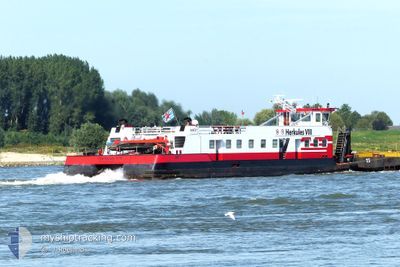
HERKULES VIII
Cargo

Current Trip
| Time Travelled | 19 h, 38 mins |
|---|---|
| Remaining Time | --- |
| Distance Travelled | 83.67 nm |
| Remaining Distance | --- |
| AVG Speed | 5.1 Noeuds |
| MAX Speed | 7.2 Noeuds |
| AVG Wind | 7.1 knots |
| MAX Wind | 10.3 knots |
| MIN Temp | 6.7°C / 44.06°F |
| MAX Temp | 13.3°C / 55.94°F |
| Tirant d eau | 2.7 m |
| Position reçue | 3 h, 16 m depuis |
Current Position
| Longitude | --- |
|---|---|
| Latitude | --- |
| Etat | Under way using engine |
| Vitesse | 4.6 Noeuds |
| Parcours | 109° |
| Zone | North Sea |
| Station | T-AIS |
| Position reçue | 3 h, 16 m depuis |
Information
The current position of HERKULES VIII is in North Sea with coordinates 51.84617° / 6.14310° as reported on 2025-03-28 23:16 by AIS to our vessel tracker app. The vessel's current speed is 4.6 Noeuds
The vessel HERKULES VIII (MMSI: 253242471) is a Cargo It's sailing under the flag of [LU] Luxembourg.
In this page you can find informations about the vessels current position, last detected port calls, and current voyage information. If the vessels is not in coverage by AIS you will find the latest position.
The current position of HERKULES VIII is detected by our AIS receivers and we are not responsible for the reliability of the data. The last position was recorded while the vessel was in Coverage by the Ais receivers of our vessel tracking app.
The current draught of HERKULES VIII as reported by AIS is 2.7 meters
Weather
| Temperature | 8.5°C / 47.3°F |
|---|---|
| Wind Speed | 8 knots |
| Direction | 336° NNW |
| Pressure | 1012.3 hPa |
| Humidity | 85.3 % |
| Cloud Coverage | 100 % |


Featured Company
Last Port Calls
| Port | Arrival | Departure | Time In Port |
|---|---|---|---|
| 2025-03-27 11:13 | 2025-03-28 07:54 | 20 h | |
| 2025-03-26 19:00 | 2025-03-26 20:03 | 1 h | |
| 2025-03-25 22:27 | 2025-03-26 18:30 | 20 h | |
| 2025-03-25 16:44 | 2025-03-25 17:45 | 1 h | |
| 2025-03-25 04:05 | 2025-03-25 06:59 | 2 h | |
| 2025-03-23 20:42 | 2025-03-23 23:20 | 2 h | |
| 2025-03-22 01:24 | 2025-03-23 04:39 | 1 d | |
| 2025-03-20 13:25 | 2025-03-20 19:11 | 5 h | |
| 2025-03-19 20:36 | 2025-03-19 22:47 | 2 h | |
| 2025-03-19 18:24 | 2025-03-19 20:17 | 1 h |
Most Visited Ports (Last year)
| Port | Arrivals | |
|---|---|---|
| 148 | ||
| 113 | ||
| 91 | ||
| 9 | ||
| 7 | ||
| 6 |
Last Trips
| Origin | Departure | Destination | Arrival | Distance | |
|---|---|---|---|---|---|
| 2025-03-26 20:03 | 2025-03-27 11:13 | 121.36 nm | |||
| 2025-03-26 18:30 | 2025-03-26 19:00 | 2.08 nm | |||
| 2025-03-25 17:45 | 2025-03-25 22:27 | 38.43 nm | |||
| 2025-03-25 06:59 | 2025-03-25 16:44 | 43.15 nm | |||
| 2025-03-23 23:20 | 2025-03-25 04:05 | 122.74 nm | |||
| 2025-03-23 04:39 | 2025-03-23 20:42 | 122.45 nm | |||
| 2025-03-20 19:11 | 2025-03-22 01:24 | 121.61 nm | |||
| 2025-03-19 22:47 | 2025-03-20 13:25 | 121.27 nm | |||
| 2025-03-19 20:17 | 2025-03-19 20:36 | 1.67 nm | |||
| 2025-03-19 14:41 | 2025-03-19 18:24 | 37.16 nm |
Events
| Heure | Evenement | Détails | Position/ Destination | Info |
|---|---|---|---|---|
| 2025-03-28 23:16 | Hors de la zone couverte |
51.84617 / 6.14310
North Sea
DINTELHAVEN
|
Vitesse: 4.6 kn Parcours: 111.2° |
|
| 2025-03-28 15:59 | Dans la zone couverte |
51.84527 / 5.41153
North Sea
DINTELHAVEN
|
Vitesse: 4.5 kn Parcours: 26.9° |
|
| 2025-03-28 14:28 | Hors de la zone couverte |
51.81798 / 5.26304
North Sea
DINTELHAVEN
|
Vitesse: 5.2 kn Parcours: 84° |
|
| 2025-03-28 14:01 | Etat Changé | Under way using engine Default |
51.80952 / 5.20555
DINTELHAVEN
|
Vitesse: 5.3 kn Parcours: 115° |
| 2025-03-28 13:57 | Etat Changé | Default Under way using engine |
51.81052 / 5.19646
DINTELHAVEN
|
Vitesse: 5.3 kn Parcours: 117.5° |
| 2025-03-28 10:28 | Etat Changé | Under way using engine Default |
51.82072 / 4.66899
DINTELHAVEN
|
Vitesse: 6.4 kn Parcours: 51° |
| 2025-03-28 10:22 | Etat Changé | Default Under way using engine |
51.81322 / 4.65342
DINTELHAVEN
|
Vitesse: 6.9 kn Parcours: 38.5° |
| 2025-03-28 07:01 | Tirant d'eau modifié | 2.7 2.1 |
51.91829 / 4.17770
DINTELHAVEN
|
Vitesse: 6.5 kn Parcours: 141.4° |
| 2025-03-28 07:01 | Changement d'ETA | 2025/03/29 14:00 2025/03/26 13:00 |
51.91829 / 4.17770
DINTELHAVEN
|
Vitesse: 6.5 kn Parcours: 141.4° |
| 2025-03-28 06:54 | PORT DE DEPART |
|
51.92676 / 4.16631
DINTELHAVEN
|
Vitesse: 6.6 kn Parcours: 137° |