
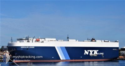
HERCULES LEADER
Vehicles Carrier
Current Trip
| Time Travelled | 9 days |
|---|---|
| Remaining Time | 1 day |
| Distance Travelled | 3470.76 nm |
| Remaining Distance | 931.16 nm |
| AVG Speed | 15.8 Noeuds |
| MAX Speed | 18 Noeuds |
| AVG Wind | 13.8 knots |
| MAX Wind | 27.7 knots |
| MIN Temp | 12.8°C / 55.04°F |
| MAX Temp | 26.8°C / 80.24°F |
| Tirant d eau | 9.2 m |
| Position reçue | 10 h, 48 m depuis |
Current Position
| Longitude | -64.98818° |
|---|---|
| Latitude | 21.69375° |
| Etat | Under way using engine |
| Vitesse | 16.9 Noeuds |
| Parcours | 226.3° |
| Zone | North Atlantic Ocean |
| Station | T-AIS |
| Position reçue | 10 h, 48 m depuis |
Info
Information
The current position of HERCULES LEADER is in North Atlantic Ocean with coordinates 21.69375° / -64.98818° as reported on 2024-06-06 13:39 by AIS to our vessel tracker app. The vessel's current speed is 16.9 Noeuds and is heading at the port of CARTAGENA. The estimated time of arrival as calculated by MyShipTracking vessel tracking app is 2024-06-08 21:36 LT
The vessel HERCULES LEADER (IMO: 9531753, MMSI: 432803000) is a Vehicles Carrier that was built in 2011 ( 13 Age ). It's sailing under the flag of [JP] Japan.
In this page you can find informations about the vessels current position, last detected port calls, and current voyage information. If the vessels is not in coverage by AIS you will find the latest position.
The current position of HERCULES LEADER is detected by our AIS receivers and we are not responsible for the reliability of the data. The last position was recorded while the vessel was in Coverage by the Ais receivers of our vessel tracking app.
The current draught of HERCULES LEADER as reported by AIS is 9.2 meters
Weather
| Temperature | 26°C / 78.8°F |
|---|---|
| Wind Speed | 11 knots |
| Direction | 135° SE |
| Pressure | 1015.5 hPa |
| Humidity | 86.2 % |
| Cloud Coverage | 100 % |
Featured Company
Last Port Calls
| Port | Arrival | Departure | Time In Port |
|---|---|---|---|
| 2024-05-28 04:12 | 2024-05-28 18:38 | 14 h | |
| 2024-05-24 23:00 | 2024-05-26 14:00 | 1 d | |
| 2024-05-23 00:30 | 2024-05-24 00:19 | 23 h | |
| 2024-05-13 06:15 | 2024-05-13 18:31 | 12 h | |
| 2024-05-04 18:36 | 2024-05-05 14:19 | 19 h | |
| 2024-05-03 23:55 | 2024-05-04 10:18 | 10 h | |
| 2024-04-04 01:33 | 2024-04-04 11:14 | 9 h |
Most Visited Ports (Last year)
| Port | Arrivals | |
|---|---|---|
| 2 | ||
| 2 | ||
| 2 | ||
| 2 | ||
| 2 | ||
| 2 |
Last Trips
| Origin | Departure | Destination | Arrival | Distance | |
|---|---|---|---|---|---|
| 2024-05-26 16:00 | 2024-05-28 05:12 | 263.65 nm | |||
| 2024-05-24 02:19 | 2024-05-25 01:00 | 331.08 nm | |||
| 2024-05-13 21:31 | 2024-05-23 02:30 | 3170.88 nm | |||
| 2024-05-05 17:19 | 2024-05-13 09:15 | 685.00 nm | |||
| 2024-05-04 13:18 | 2024-05-04 21:36 | 13.12 nm | |||
| 2024-04-04 16:44 | 2024-05-04 02:55 | 11629.55 nm | |||
| 2024-03-31 17:46 | 2024-04-04 07:03 | 1458.59 nm |
Events
| Heure | Evenement | Détails | Position/ Destination | Info |
|---|---|---|---|---|
| 2024-06-06 13:39 | Hors de la zone couverte |
21.69375 / -64.98818
North Atlantic Ocean
CO CTG
|
Vitesse: 16.9 kn Parcours: 226.3° |
|
| 2024-06-06 12:57 | Detecté en mer | British Virgin Islands part of the North Atlantic Ocean |
21.83569 / -64.83473
North Atlantic Ocean
CO CTG
|
Vitesse: 17.4 kn Parcours: 223.8° |
| 2024-06-06 12:57 | Dans la zone couverte |
21.83569 / -64.83473
North Atlantic Ocean
CO CTG
|
Vitesse: 17.4 kn Parcours: 223.8° |
|
| 2024-05-29 06:52 | Etat Changé | Default Under way using engine |
49.62928 / -4.58663
CO CTG
|
Vitesse: 15.8 kn Parcours: 252.5° |
| 2024-05-29 06:47 | Hors de la zone couverte |
49.63593 / -4.55438
English Channel
CO CTG
|
Vitesse: 15.8 kn Parcours: 252.5° |
|
| 2024-05-29 03:28 | Changement de zone | United Kingdom part of the English Channel Guernsey part of the English Channel |
49.95751 / -3.22646
English Channel
CO CTG
|
Vitesse: 17 kn Parcours: 256.8° |
| 2024-05-29 03:27 | Etat Changé | Under way using engine Default |
49.95884 / -3.21767
CO CTG
|
Vitesse: 16.9 kn Parcours: 260° |
| 2024-05-29 03:00 | Etat Changé | Default Under way using engine |
49.98718 / -3.02588
CO CTG
|
Vitesse: 16 kn Parcours: 242.3° |
| 2024-05-29 02:42 | Etat Changé | Under way using engine Default |
50.01678 / -2.91215
CO CTG
|
Vitesse: 16.3 kn Parcours: 254° |
| 2024-05-29 02:32 | Etat Changé | Default Under way using engine |
50.02932 / -2.84432
CO CTG
|
Vitesse: 16.1 kn Parcours: 253.8° |