
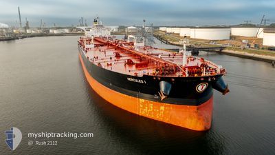
HERCULES I
Tanker
Current Trip
HIGH SEA
| Time Travelled | --- |
|---|---|
| Remaining Time | --- |
| Distance Travelled | 10500.84 nm |
| Remaining Distance | --- |
| AVG Speed | 11 Noeuds |
| MAX Speed | 15.9 Noeuds |
| AVG Wind | 10.3 knots |
| MAX Wind | 28.1 knots |
| MIN Temp | 24.2°C / 75.56°F |
| MAX Temp | 31.6°C / 88.88°F |
| Tirant d eau | 11 m |
| Position reçue | 11 h, 4 m depuis |
Current Position
| Longitude | --- |
|---|---|
| Latitude | --- |
| Etat | Under way using engine |
| Vitesse | 12.2 Noeuds |
| Parcours | 302.6° |
| Zone | Malacca Strait |
| Station | T-AIS |
| Position reçue | 11 h, 4 m depuis |
Info
Information
The current position of HERCULES I is in Malacca Strait with coordinates 1.24928° / 103.39190° as reported on 2024-12-25 05:00 by AIS to our vessel tracker app. The vessel's current speed is 12.2 Noeuds
The vessel HERCULES I (IMO: 9723124, MMSI: 538006822) is a Tanker It's sailing under the flag of [MH] Marshall Is.
In this page you can find informations about the vessels current position, last detected port calls, and current voyage information. If the vessels is not in coverage by AIS you will find the latest position.
The current position of HERCULES I is detected by our AIS receivers and we are not responsible for the reliability of the data. The last position was recorded while the vessel was in Coverage by the Ais receivers of our vessel tracking app.
The current draught of HERCULES I as reported by AIS is 11 meters
Weather
| Temperature | 27.1°C / 80.78°F |
|---|---|
| Wind Speed | 4 knots |
| Direction | 64° ENE |
| Pressure | 1011.9 hPa |
| Humidity | 77.1 % |
| Cloud Coverage | 71 % |
Featured Company
Last Port Calls
Most Visited Ports (Last year)
| Port | Arrivals | |
|---|---|---|
| 2 | ||
| 2 |
Last Trips
| Origin | Departure | Destination | Arrival | Distance |
|---|
Events
| Heure | Evenement | Détails | Position/ Destination | Info |
|---|---|---|---|---|
| 2024-12-25 05:05 | Etat Changé | Default Under way using engine |
1.25951 / 103.37786
HIGH SEA
|
Vitesse: 12.2 kn Parcours: 302.6° |
| 2024-12-25 05:00 | Hors de la zone couverte |
1.24928 / 103.39190
Malacca Strait
HIGH SEA
|
Vitesse: 12.2 kn Parcours: 302.6° |
|
| 2024-12-25 04:41 | Detecté en mer | Malaysian part of the Malacca Strait |
1.22944 / 103.45539
Malacca Strait
HIGH SEA
|
Vitesse: 12.4 kn Parcours: 283° |
| 2024-12-25 04:02 | Changement de zone | Malaysian part of the Singapore Strait Indonesian part of the Singapore Strait |
1.20047 / 103.58365
Singapore Strait
HIGH SEA
|
Vitesse: 11.1 kn Parcours: 286.9° |
| 2024-12-25 03:59 | Changement de destination | HIGH SEA SGSIN |
1.19701 / 103.59300
HIGH SEA
|
Vitesse: 11 kn Parcours: 295.2° |
| 2024-12-25 03:59 | Changement d'ETA | 2024/12/25 03:57 2024/12/24 02:49 |
1.19701 / 103.59300
HIGH SEA
|
Vitesse: 11 kn Parcours: 295.2° |
| 2024-12-25 03:14 | Changement de zone | Indonesian part of the Singapore Strait Singaporean part of the Singapore Strait |
1.14002 / 103.71972
Singapore Strait
|
Vitesse: 11.1 kn Parcours: 275.2° |
| 2024-12-25 01:31 | Démarrage | 2.88 nm, East of SINGAPORE |
1.25215 / 103.90225
SGSIN
|
Vitesse: 3.2 kn Parcours: 85° |
| 2024-12-25 01:24 | Etat Changé | Under way using engine At anchor |
1.25048 / 103.90025
SGSIN
|
Vitesse: 0.3 kn Parcours: 39° |
| 2024-12-24 02:49 | Tirant d'eau modifié | 11 0 |
1.24965 / 103.89920
|
Vitesse: 0.1 kn Parcours: 47° |