
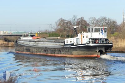
HENDRIK
Cargo
Current Trip
WORMER
| Time Travelled | 12 h, 38 mins |
|---|---|
| Remaining Time | --- |
| Distance Travelled | 43.98 nm |
| Remaining Distance | --- |
| AVG Speed | 6.9 Noeuds |
| MAX Speed | 10.3 Noeuds |
| AVG Wind | 4.5 knots |
| MAX Wind | 6 knots |
| MIN Temp | 10.4°C / 50.72°F |
| MAX Temp | 16.1°C / 60.98°F |
| Tirant d eau | 1 m |
| Position reçue | 1 m depuis |
Current Position
| Longitude | 5.53782° |
|---|---|
| Latitude | 51.81652° |
| Etat | Under way using engine |
| Vitesse | 8.6 Noeuds |
| Parcours | 277.9° |
| Zone | North Sea |
| Station | T-AIS |
| Position reçue | 1 m depuis |
Info
Information
The current position of HENDRIK is in North Sea with coordinates 51.81652° / 5.53782° as reported on 2024-05-08 18:32 by AIS to our vessel tracker app. The vessel's current speed is 8.6 Noeuds
The vessel HENDRIK (MMSI: 244670871) is a Cargo It's sailing under the flag of [NL] Netherlands.
In this page you can find informations about the vessels current position, last detected port calls, and current voyage information. If the vessels is not in coverage by AIS you will find the latest position.
The current position of HENDRIK is detected by our AIS receivers and we are not responsible for the reliability of the data. The last position was recorded while the vessel was in Coverage by the Ais receivers of our vessel tracking app.
The current draught of HENDRIK as reported by AIS is 1 meters
Weather
| Temperature | 14°C / 57.2°F |
|---|---|
| Wind Speed | 6 knots |
| Direction | 352° N |
| Pressure | 1027.5 hPa |
| Humidity | 83.8 % |
| Cloud Coverage | 100 % |
Featured Company
Last Port Calls
| Port | Arrival | Departure | Time In Port |
|---|---|---|---|
| 2024-05-07 11:47 | 2024-05-08 05:55 | 18 h | |
| 2024-05-06 15:53 | 2024-05-07 09:00 | 17 h | |
| 2024-05-03 15:25 | 2024-05-06 13:35 | 2 d | |
| 2024-05-03 13:52 | 2024-05-03 14:13 | 20 m | |
| 2024-05-02 15:31 | 2024-05-02 16:50 | 1 h | |
| 2024-05-02 12:18 | 2024-05-02 12:39 | 21 m | |
| 2024-05-02 11:08 | 2024-05-02 11:40 | 31 m | |
| 2024-05-01 10:53 | 2024-05-02 08:12 | 21 h | |
| 2024-05-01 10:08 | 2024-05-01 10:39 | 31 m | |
| 2024-04-30 19:24 | 2024-05-01 07:42 | 12 h |
Most Visited Ports (Last year)
| Port | Arrivals | |
|---|---|---|
| 74 | ||
| 48 | ||
| 36 | ||
| 29 | ||
| 26 | ||
| 15 |
Last Trips
| Origin | Departure | Destination | Arrival | Distance | |
|---|---|---|---|---|---|
| 2024-05-07 11:00 | 2024-05-07 13:47 | 18.00 nm | |||
| 2024-05-06 15:35 | 2024-05-06 17:53 | 17.89 nm | |||
| 2024-05-03 16:13 | 2024-05-03 17:25 | 4.23 nm | |||
| 2024-05-02 18:50 | 2024-05-03 15:52 | 19.62 nm | |||
| 2024-05-02 14:39 | 2024-05-02 17:31 | 11.80 nm | |||
| 2024-05-02 13:40 | 2024-05-02 14:18 | 1.87 nm | |||
| 2024-05-02 10:12 | 2024-05-02 13:08 | 17.69 nm | |||
| 2024-05-01 12:39 | 2024-05-01 12:53 | 2.03 nm | |||
| 2024-05-01 09:42 | 2024-05-01 12:08 | 18.09 nm | |||
| 2024-04-30 15:48 | 2024-04-30 21:24 | 29.33 nm |
Events
| Heure | Evenement | Détails | Position/ Destination | Info |
|---|---|---|---|---|
| 2024-05-08 17:54 | Démarrage | 0.25 nm, North East of RAVENSTEIN |
51.80042 / 5.65470
WORMER
|
Vitesse: 7.3 kn Parcours: 328.3° |
| 2024-05-08 14:04 | Arret | 0.19 nm, North East of RAVENSTEIN |
51.79866 / 5.65570
WORMER
|
Vitesse: 0.3 kn Parcours: 511° |
| 2024-05-08 12:19 | Démarrage | 0.74 nm, North West of LITHOIJEN |
51.80909 / 5.45673
WORMER
|
Vitesse: 4.4 kn Parcours: 84.3° |
| 2024-05-08 12:04 | Arret | 0.84 nm, North West of LITHOIJEN |
51.80892 / 5.45352
WORMER
|
Vitesse: Parcours: 511° |
| 2024-05-08 11:19 | Dans la zone couverte |
51.80160 / 5.38103
North Sea
|
Vitesse: 5.6 kn Parcours: 27.9° |
|
| 2024-05-08 09:53 | Hors de la zone couverte |
51.80149 / 5.35262
North Sea
|
Vitesse: 1.6 kn Parcours: 138.5° |
|
| 2024-05-08 09:01 | Démarrage | 0.86 nm, North East of TIEL |
51.89899 / 5.45554
WORMER
|
Vitesse: 4.9 kn Parcours: 152.9° |
| 2024-05-08 08:51 | Arret | 0.94 nm, North East of TIEL |
51.90104 / 5.45406
WORMER
|
Vitesse: 0.1 kn Parcours: 511° |
| 2024-05-08 05:55 | PORT DE DEPART |
|
52.05336 / 5.10357
WORMER
|
Vitesse: 6.2 kn Parcours: 150.6° |
| 2024-05-08 05:49 | Démarrage |
52.06213 / 5.09604
[NL] UTRECHT
|
Vitesse: 5.6 kn Parcours: 152.2° |