
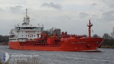
HELGA ESSBERGER
Oil/Chemical Tanker
Current Trip
| Time Travelled | 5 days |
|---|---|
| Remaining Time | --- |
| Distance Travelled | 1367.97 nm |
| Remaining Distance | 2.66 nm |
| AVG Speed | 10.9 Noeuds |
| MAX Speed | 16.6 Noeuds |
| AVG Wind | 10.1 knots |
| MAX Wind | 23.6 knots |
| MIN Temp | 1.4°C / 34.52°F |
| MAX Temp | 13.3°C / 55.94°F |
| Tirant d eau | 6.5 m |
| Position reçue | 8 h, 9 m depuis |
Current Position
| Longitude | -1.50657° |
|---|---|
| Latitude | 43.52835° |
| Etat | Moored |
| Vitesse | |
| Parcours | 97° |
| Zone | Bay of Biscay |
| Station | T-AIS |
| Position reçue | 8 h, 9 m depuis |
Info
Information
The current position of HELGA ESSBERGER is in Bay of Biscay with coordinates 43.52835° / -1.50657° as reported on 2024-04-26 12:26 by AIS to our vessel tracker app. The vessel's current speed is 0 Noeuds and is heading at the port of BAYONNE. The estimated time of arrival as calculated by MyShipTracking vessel tracking app is 2024-04-26 05:30 LT
The vessel HELGA ESSBERGER (IMO: 9172155, MMSI: 255806196) is a Oil/Chemical Tanker that was built in 1999 ( 25 Age ). It's sailing under the flag of [PT] Portugal.
In this page you can find informations about the vessels current position, last detected port calls, and current voyage information. If the vessels is not in coverage by AIS you will find the latest position.
The current position of HELGA ESSBERGER is detected by our AIS receivers and we are not responsible for the reliability of the data. The last position was recorded while the vessel was in Coverage by the Ais receivers of our vessel tracking app.
The current draught of HELGA ESSBERGER as reported by AIS is 6.5 meters
Weather
| Temperature | 11.8°C / 53.24°F |
|---|---|
| Wind Speed | 4 knots |
| Direction | 58° ENE |
| Pressure | 1003 hPa |
| Humidity | 94.5 % |
| Cloud Coverage | 100 % |
Featured Company
Last Port Calls
| Port | Arrival | Departure | Time In Port |
|---|---|---|---|
| 2024-04-20 13:53 | 2024-04-21 03:16 | 13 h | |
| 2024-04-17 05:03 | 2024-04-17 15:49 | 10 h | |
| 2024-04-16 05:47 | 2024-04-16 14:43 | 8 h | |
| 2024-04-15 06:58 | 2024-04-15 16:11 | 9 h | |
| 2024-04-13 15:24 | 2024-04-14 10:29 | 19 h | |
| 2024-04-05 12:00 | 2024-04-08 05:26 | 2 d | |
| 2024-04-01 22:00 | 2024-04-02 19:54 | 21 h | |
| 2024-03-28 05:36 | 2024-03-29 09:22 | 1 d | |
| 2024-03-26 19:46 | 2024-03-27 11:07 | 15 h | |
| 2024-03-24 21:15 | 2024-03-25 13:18 | 16 h |
Last Trips
| Origin | Departure | Destination | Arrival | Distance | |
|---|---|---|---|---|---|
| 2024-04-17 17:49 | 2024-04-20 15:53 | 685.93 nm | |||
| 2024-04-16 16:43 | 2024-04-17 07:03 | 107.45 nm | |||
| 2024-04-15 19:11 | 2024-04-16 07:47 | 131.31 nm | |||
| 2024-04-14 13:29 | 2024-04-15 09:58 | 208.87 nm | |||
| 2024-04-08 07:26 | 2024-04-13 18:24 | 1293.25 nm | |||
| 2024-04-02 20:54 | 2024-04-05 14:00 | 760.11 nm | |||
| 2024-03-29 10:22 | 2024-04-01 23:00 | 1040.63 nm | |||
| 2024-03-27 12:07 | 2024-03-28 06:36 | 6.16 nm | |||
| 2024-03-25 14:18 | 2024-03-26 20:46 | 343.68 nm | |||
| 2024-03-18 10:23 | 2024-03-24 22:15 | 1161.03 nm |
Events
| Heure | Evenement | Détails | Position/ Destination | Info |
|---|---|---|---|---|
| 2024-04-26 12:26 | Hors de la zone couverte |
43.52835 / -1.50657
Bay of Biscay
|
Vitesse: Parcours: 352° |
|
| 2024-04-26 06:29 | Etat Changé | Moored Under way using engine |
43.52835 / -1.50658
SEHEL > FRBAY
|
Vitesse: Parcours: 98° |
| 2024-04-26 05:59 | Arret | 2.52 nm, North West of BAYONNE |
43.52834 / -1.50676
SEHEL > FRBAY
|
Vitesse: 0.3 kn Parcours: 97° |
| 2024-04-26 03:24 | Changement d'ETA | 2024/04/26 05:30 2024/04/26 05:00 |
43.82529 / -1.78505
SEHEL > FRBAY
|
Vitesse: 9.5 kn Parcours: 150.9° |
| 2024-04-26 03:06 | Tirant d'eau modifié | 6.5 6.6 |
43.87021 / -1.82168
SEHEL > FRBAY
|
Vitesse: 11.6 kn Parcours: 149.7° |
| 2024-04-26 03:06 | Changement d'ETA | 2024/04/26 05:00 2024/04/26 06:00 |
43.87021 / -1.82168
SEHEL > FRBAY
|
Vitesse: 11.6 kn Parcours: 149.7° |
| 2024-04-26 02:32 | Etat Changé | Under way using engine Default |
43.96807 / -1.90270
SEHEL > FRBAY
|
Vitesse: 12.2 kn Parcours: 148° |
| 2024-04-26 02:30 | Etat Changé | Default Under way using engine |
43.97238 / -1.90644
SEHEL > FRBAY
|
Vitesse: 12.1 kn Parcours: 148.7° |
| 2024-04-26 02:25 | Etat Changé | Under way using engine Default |
43.98813 / -1.92002
SEHEL > FRBAY
|
Vitesse: 12.1 kn Parcours: 148° |
| 2024-04-26 02:22 | Etat Changé | Default Under way using engine |
43.99765 / -1.92823
SEHEL > FRBAY
|
Vitesse: 12.1 kn Parcours: 148.6° |