

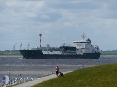
HAPPY KESTREL
Tanker D

Current Trip
ESTAR>===BANCO DEL H
| Time Travelled | 5 days |
|---|---|
| Remaining Time | --- |
| Distance Travelled | 539.89 nm |
| Remaining Distance | --- |
| AVG Speed | 11.6 Noeuds |
| MAX Speed | 13.8 Noeuds |
| AVG Wind | 13.9 knots |
| MAX Wind | 33 knots |
| MIN Temp | 11.5°C / 52.7°F |
| MAX Temp | 16.4°C / 61.52°F |
| Tirant d eau | 6.6 m |
| Position reçue | 1 d depuis |
Current Position
| Longitude | --- |
|---|---|
| Latitude | --- |
| Etat | At anchor |
| Vitesse | 0.1 Noeuds |
| Parcours | 303° |
| Zone | North Atlantic Ocean |
| Station | T-AIS |
| Position reçue | 1 d depuis |
Information
The current position of HAPPY KESTREL is in North Atlantic Ocean with coordinates 36.08472° / -6.29341° as reported on 2025-03-26 23:22 by AIS to our vessel tracker app. The vessel's current speed is 0.1 Noeuds
The vessel HAPPY KESTREL (IMO: 9543043, MMSI: 219221000) is a Tanker D It's sailing under the flag of [DK] Denmark.
In this page you can find informations about the vessels current position, last detected port calls, and current voyage information. If the vessels is not in coverage by AIS you will find the latest position.
The current position of HAPPY KESTREL is detected by our AIS receivers and we are not responsible for the reliability of the data. The last position was recorded while the vessel was in Coverage by the Ais receivers of our vessel tracking app.
The current draught of HAPPY KESTREL as reported by AIS is 6.6 meters
Weather
| Temperature | 15.1°C / 59.18°F |
|---|---|
| Wind Speed | 6 knots |
| Direction | 358° N |
| Pressure | 1016 hPa |
| Humidity | 73.2 % |
| Cloud Coverage | 2 % |


Featured Company
Last Port Calls
| Port | Arrival | Departure | Time In Port |
|---|---|---|---|
| 2025-03-21 13:49 | 2025-03-22 16:12 | 1 d | |
| 2025-03-10 14:55 | 2025-03-12 18:39 | 2 d | |
| 2025-03-07 07:17 | 2025-03-08 13:36 | 1 d | |
| 2025-02-26 16:23 | 2025-02-27 12:36 | 20 h | |
| 2025-02-24 02:12 | 2025-02-24 10:20 | 8 h | |
| 2025-02-15 08:53 | 2025-02-16 13:59 | 1 d | |
| 2025-01-28 18:01 | 2025-01-31 11:02 | 2 d | |
| 2025-01-24 09:08 | 2025-01-25 16:22 | 1 d |
Most Visited Ports (Last year)
| Port | Arrivals | |
|---|---|---|
| 7 | ||
| 6 | ||
| 4 | ||
| 3 | ||
| 3 | ||
| 1 |
Last Trips
| Origin | Departure | Destination | Arrival | Distance | |
|---|---|---|---|---|---|
| 2025-03-12 18:39 | 2025-03-21 13:49 | 2009.12 nm | |||
| 2025-03-08 13:36 | 2025-03-10 14:55 | 92.01 nm | |||
| 2025-02-27 12:36 | 2025-03-07 07:17 | 1561.42 nm | |||
| 2025-02-24 10:20 | 2025-02-26 16:23 | 10.60 nm | |||
| 2025-02-16 13:59 | 2025-02-24 02:12 | 1694.59 nm | |||
| 2025-01-31 11:02 | 2025-02-15 08:53 | 1353.47 nm | |||
| 2025-01-25 16:22 | 2025-01-28 18:01 | 705.74 nm | |||
| 2024-12-13 05:39 | 2025-01-24 09:08 | 2532.12 nm |
Events
| Heure | Evenement | Détails | Position/ Destination | Info |
|---|---|---|---|---|
| 2025-03-26 23:25 | Etat Changé | Default At anchor |
36.08477 / -6.29338
ESTAR>===BANCO DEL H
|
Vitesse: 0.1 kn Parcours: 303° |
| 2025-03-26 23:22 | Hors de la zone couverte |
36.08472 / -6.29341
North Atlantic Ocean
|
Vitesse: 0.1 kn Parcours: 33.6° |
|
| 2025-03-26 21:43 | Etat Changé | At anchor Default |
36.08476 / -6.29335
ESTAR>===BANCO DEL H
|
Vitesse: 0.1 kn Parcours: 293° |
| 2025-03-26 21:31 | Etat Changé | Default At anchor |
36.08482 / -6.29328
ESTAR>===BANCO DEL H
|
Vitesse: 0.1 kn Parcours: 296° |
| 2025-03-26 21:28 | Etat Changé | At anchor Default |
36.08481 / -6.29336
ESTAR>===BANCO DEL H
|
Vitesse: 0.1 kn Parcours: 296° |
| 2025-03-26 21:25 | Etat Changé | Default At anchor |
36.08481 / -6.29338
ESTAR>===BANCO DEL H
|
Vitesse: 0.1 kn Parcours: 295° |
| 2025-03-26 21:13 | Etat Changé | At anchor Default |
36.08489 / -6.29329
ESTAR>===BANCO DEL H
|
Vitesse: 0.1 kn Parcours: 290° |
| 2025-03-26 20:52 | Etat Changé | Default At anchor |
36.08490 / -6.29329
ESTAR>===BANCO DEL H
|
Vitesse: Parcours: 284° |
| 2025-03-26 20:22 | Etat Changé | At anchor Default |
36.08498 / -6.29324
ESTAR>===BANCO DEL H
|
Vitesse: Parcours: 290° |
| 2025-03-26 20:13 | Dans la zone couverte |
36.08498 / -6.29324
North Atlantic Ocean
|
Vitesse: Parcours: 8.2° |