
HANNE
Cargo
Current Trip
ONSEVIG
| Time Travelled | --- |
|---|---|
| Remaining Time | --- |
| Distance Travelled | 190.25 nm |
| Remaining Distance | --- |
| AVG Speed | 5.3 Noeuds |
| MAX Speed | 7.7 Noeuds |
| AVG Wind | 10.7 knots |
| MAX Wind | 23.9 knots |
| MIN Temp | 6.9°C / 44.42°F |
| MAX Temp | 17.6°C / 63.68°F |
| Tirant d eau | 1.8 m |
| Position reçue | 4 m depuis |
Current Position
| Longitude | 11.10723° |
|---|---|
| Latitude | 54.94741° |
| Etat | Moored |
| Vitesse | |
| Parcours | --- |
| Zone | Kattegat |
| Station | T-AIS |
| Position reçue | 4 m depuis |
Info
Information
The current position of HANNE is in Kattegat with coordinates 54.94741° / 11.10723° as reported on 2024-07-08 16:48 by AIS to our vessel tracker app. The vessel's current speed is 0 Noeuds
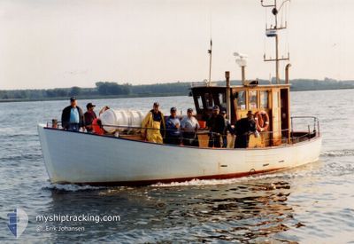
The vessel HANNE (MMSI: 219000805) is a Cargo It's sailing under the flag of [DK] Denmark.
In this page you can find informations about the vessels current position, last detected port calls, and current voyage information. If the vessels is not in coverage by AIS you will find the latest position.
The current position of HANNE is detected by our AIS receivers and we are not responsible for the reliability of the data. The last position was recorded while the vessel was in Coverage by the Ais receivers of our vessel tracking app.
The current draught of HANNE as reported by AIS is 1.8 meters
Weather
| Temperature | 17.2°C / 62.96°F |
|---|---|
| Wind Speed | 12 knots |
| Direction | 252° WSW |
| Pressure | 1017.7 hPa |
| Humidity | 70.8 % |
| Cloud Coverage | --- |
Featured Company
Last Port Calls
Most Visited Ports (Last year)
| Port | Arrivals |
|---|
Last Trips
| Origin | Departure | Destination | Arrival | Distance |
|---|
Events
| Heure | Evenement | Détails | Position/ Destination | Info |
|---|---|---|---|---|
| 2024-07-07 15:39 | Etat Changé | Moored Engaged in Fishing |
54.94742 / 11.10723
ONSEVIG
|
Vitesse: Parcours: 511° |
| 2024-07-01 13:06 | Arret | 5.12 nm, North East of TARS |
54.94741 / 11.10719
ONSEVIG
|
Vitesse: Parcours: 511° |
| 2024-07-01 12:31 | Dans la zone couverte |
54.94640 / 11.03405
Kattegat
ONSEVIG
|
Vitesse: 6.2 kn Parcours: 52.4° |
|
| 2024-07-01 06:49 | Hors de la zone couverte |
54.92576 / 10.97477
Kattegat
ONSEVIG
|
Vitesse: 6.7 kn Parcours: 238.7° |
|
| 2024-07-01 06:48 | Changement d'ETA | 2024/07/01 15:00 2025/06/29 19:00 |
54.92641 / 10.97665
ONSEVIG
|
Vitesse: 6.6 kn Parcours: 241.3° |
| 2024-07-01 06:42 | Etat Changé | Engaged in Fishing Moored |
54.93288 / 10.99405
ONSEVIG
|
Vitesse: 6.6 kn Parcours: 234.6° |
| 2024-07-01 05:56 | Démarrage | 5.13 nm, North East of TARS |
54.94856 / 11.10464
ONSEVIG
|
Vitesse: 5.7 kn Parcours: 334° |
| 2024-07-01 05:11 | Changement d'ETA | 2025/06/29 19:00 2024/06/29 19:00 |
54.94741 / 11.10721
ONSEVIG
|
Vitesse: Parcours: 511° |
| 2024-07-01 05:11 | Dans la zone couverte |
54.94741 / 11.10721
Kattegat
|
Vitesse: Parcours: 323.8° |
|
| 2024-06-30 18:41 | Hors de la zone couverte |
54.94740 / 11.10722
Kattegat
|
Vitesse: Parcours: 308.9° |