

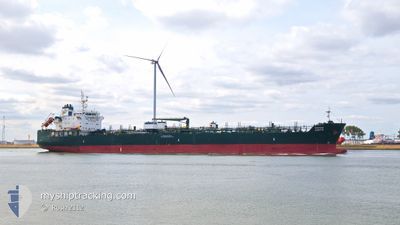
HAFNIA AZOTIC
Tanker

Current Trip
PANAMA
| Time Travelled | 16 days |
|---|---|
| Remaining Time | --- |
| Distance Travelled | 4529.62 nm |
| Remaining Distance | --- |
| AVG Speed | 11.9 Noeuds |
| MAX Speed | 14.6 Noeuds |
| AVG Wind | 13.3 knots |
| MAX Wind | 29.8 knots |
| MIN Temp | 18.4°C / 65.12°F |
| MAX Temp | 30.6°C / 87.08°F |
| Tirant d eau | 10.8 m |
| Position reçue | 3 d depuis |
Current Position
| Longitude | --- |
|---|---|
| Latitude | --- |
| Etat | Under way using engine |
| Vitesse | 12.6 Noeuds |
| Parcours | 286.4° |
| Zone | North Pacific Ocean |
| Station | T-AIS |
| Position reçue | 3 d depuis |
Information
The current position of HAFNIA AZOTIC is in North Pacific Ocean with coordinates 15.00367° / -113.74685° as reported on 2025-02-12 04:32 by AIS to our vessel tracker app. The vessel's current speed is 12.6 Noeuds
The vessel HAFNIA AZOTIC (IMO: 9719757, MMSI: 538005788) is a Tanker It's sailing under the flag of [MH] Marshall Is.
In this page you can find informations about the vessels current position, last detected port calls, and current voyage information. If the vessels is not in coverage by AIS you will find the latest position.
The current position of HAFNIA AZOTIC is detected by our AIS receivers and we are not responsible for the reliability of the data. The last position was recorded while the vessel was in Coverage by the Ais receivers of our vessel tracking app.
The current draught of HAFNIA AZOTIC as reported by AIS is 10.8 meters
Weather
| Temperature | 19°C / 66.2°F |
|---|---|
| Wind Speed | 13 knots |
| Direction | 78° ENE |
| Pressure | 1026.4 hPa |
| Humidity | 68.6 % |
| Cloud Coverage | 19 % |


Featured Company
Last Port Calls
| Port | Arrival | Departure | Time In Port |
|---|---|---|---|
| 2025-01-28 11:03 | 2025-01-29 19:19 | 1 d | |
| 2025-01-15 21:52 | 2025-01-18 20:54 | 2 d | |
| 2025-01-12 21:58 | 2025-01-15 19:00 | 2 d |
Most Visited Ports (Last year)
| Port | Arrivals | |
|---|---|---|
| 2 | ||
| 2 | ||
| 1 | ||
| 1 | ||
| 1 | ||
| 1 |
Last Trips
| Origin | Departure | Destination | Arrival | Distance | |
|---|---|---|---|---|---|
| 2025-01-18 14:54 | 2025-01-28 07:03 | 2328.86 nm | |||
| 2025-01-15 13:00 | 2025-01-15 15:52 | 17.45 nm | |||
| 2024-11-11 14:28 | 2025-01-12 15:58 | 10361.16 nm |
Events
| Heure | Evenement | Détails | Position/ Destination | Info |
|---|---|---|---|---|
| 2025-02-12 04:38 | Etat Changé | Default Under way using engine |
15.01071 / -113.77062
PANAMA
|
Vitesse: 12.6 kn Parcours: 286.4° |
| 2025-02-12 04:32 | Etat Changé | Under way using engine Default |
15.00367 / -113.74685
PANAMA
|
Vitesse: 12.6 kn Parcours: 287° |
| 2025-02-12 04:32 | Hors de la zone couverte |
15.00367 / -113.74685
North Pacific Ocean
|
Vitesse: 12.6 kn Parcours: 286.4° |
|
| 2025-02-12 03:47 | Etat Changé | Default Under way using engine |
14.96133 / -113.59155
PANAMA
|
Vitesse: 12.6 kn Parcours: 284.9° |
| 2025-02-12 03:24 | Etat Changé | Under way using engine Default |
14.94108 / -113.51267
PANAMA
|
Vitesse: 12.5 kn Parcours: 284° |
| 2025-02-12 03:23 | Etat Changé | Default Under way using engine |
14.93977 / -113.50746
PANAMA
|
Vitesse: 12.5 kn Parcours: 284.7° |
| 2025-02-12 03:12 | Etat Changé | Under way using engine Default |
14.93020 / -113.46904
PANAMA
|
Vitesse: 12.4 kn Parcours: 285° |
| 2025-02-12 02:29 | Etat Changé | Default Under way using engine |
14.89708 / -113.31845
PANAMA
|
Vitesse: 12.4 kn Parcours: 280.1° |
| 2025-02-12 01:45 | Etat Changé | Under way using engine Default |
14.86502 / -113.16453
PANAMA
|
Vitesse: 12.4 kn Parcours: 283° |
| 2025-02-12 01:14 | Etat Changé | Default Under way using engine |
14.84178 / -113.05893
PANAMA
|
Vitesse: 12.5 kn Parcours: 283.3° |