
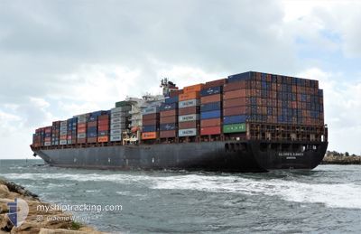
GSL CHRISTEL ELISABE
Container Ship
Current Trip
| Time Travelled | 9 days |
|---|---|
| Remaining Time | --- |
| Distance Travelled | 3779.53 nm |
| Remaining Distance | 87.20 nm |
| AVG Speed | 17.4 Noeuds |
| MAX Speed | 21.2 Noeuds |
| AVG Wind | 14.3 knots |
| MAX Wind | 27.9 knots |
| MIN Temp | 19.3°C / 66.74°F |
| MAX Temp | 30°C / 86°F |
| Tirant d eau | 12.4 m |
| Position reçue | 2 d depuis |
Current Position
| Longitude | 113.72484° |
|---|---|
| Latitude | -5.08858° |
| Etat | Under way using engine |
| Vitesse | 20.1 Noeuds |
| Parcours | 285.1° |
| Zone | Java Sea |
| Station | T-AIS |
| Position reçue | 2 d depuis |
Info
Information
The current position of GSL CHRISTEL ELISABE is in Java Sea with coordinates -5.08858° / 113.72484° as reported on 2024-05-06 15:12 by AIS to our vessel tracker app. The vessel's current speed is 20.1 Noeuds and is heading at the port of TANJUNG PELEPAS. The estimated time of arrival as calculated by MyShipTracking vessel tracking app is 2024-05-08 08:00 LT
The vessel GSL CHRISTEL ELISABE (IMO: 9280641, MMSI: 636015685) is a Container Ship that was built in 2004 ( 20 Age ). It's sailing under the flag of [LR] Liberia.
In this page you can find informations about the vessels current position, last detected port calls, and current voyage information. If the vessels is not in coverage by AIS you will find the latest position.
The current position of GSL CHRISTEL ELISABE is detected by our AIS receivers and we are not responsible for the reliability of the data. The last position was recorded while the vessel was in Coverage by the Ais receivers of our vessel tracking app.
The current draught of GSL CHRISTEL ELISABE as reported by AIS is 12.4 meters
Weather
| Temperature | 29°C / 84.2°F |
|---|---|
| Wind Speed | 6 knots |
| Direction | 141° SE |
| Pressure | 1009.1 hPa |
| Humidity | 76.8 % |
| Cloud Coverage | 86 % |
Featured Company
Last Port Calls
| Port | Arrival | Departure | Time In Port |
|---|---|---|---|
| 2024-04-25 00:24 | 2024-04-29 16:44 | 4 d | |
| 2024-04-19 23:15 | 2024-04-23 01:27 | 3 d | |
| 2024-04-05 19:18 | 2024-04-07 04:03 | 1 d | |
| 2024-04-04 00:34 | 2024-04-05 18:38 | 1 d | |
| 2024-04-02 06:21 | 2024-04-03 01:13 | 18 h | |
| 2024-03-16 17:29 | 2024-03-22 08:52 | 5 d |
Most Visited Ports (Last year)
| Port | Arrivals | |
|---|---|---|
| 16 | ||
| 14 | ||
| 8 | ||
| 6 |
Last Trips
| Origin | Departure | Destination | Arrival | Distance | |
|---|---|---|---|---|---|
| 2024-04-23 11:27 | 2024-04-25 10:24 | 555.76 nm | |||
| 2024-04-07 12:03 | 2024-04-20 09:15 | 4817.49 nm | |||
| 2024-04-06 02:38 | 2024-04-06 03:18 | 2.78 nm | |||
| 2024-04-03 09:13 | 2024-04-04 08:34 | 56.10 nm | |||
| 2024-03-22 18:52 | 2024-04-02 14:21 | 3885.58 nm | |||
| 2024-02-27 09:58 | 2024-03-17 03:29 | 4333.05 nm |
Events
| Heure | Evenement | Détails | Position/ Destination | Info |
|---|---|---|---|---|
| 2024-05-08 10:42 | Arret |
1.53667 / 104.80167
TANJUNG PELEPAS
|
Vitesse: Parcours: -1° |
|
| 2024-05-06 15:21 | Etat Changé | Default Under way using engine |
-5.07500 / 113.67667
TANJUNG PELEPAS
|
Vitesse: 20.1 kn Parcours: 285.1° |
| 2024-05-06 15:12 | Changement de zone | Indonesian part of the Java Sea Australian part of the Coral Sea |
-5.08858 / 113.72484
Java Sea
TANJUNG PELEPAS
|
Vitesse: 20.1 kn Parcours: 285.1° |
| 2024-05-06 15:12 | Etat Changé | Under way using engine Default |
-5.08858 / 113.72484
TANJUNG PELEPAS
|
Vitesse: 20 kn Parcours: 285° |
| 2024-05-06 15:12 | Hors de la zone couverte |
-5.08858 / 113.72484
Java Sea
TANJUNG PELEPAS
|
Vitesse: 20.1 kn Parcours: 285.1° |
|
| 2024-05-06 15:06 | Dans la zone couverte |
-5.08858 / 113.72484
Java Sea
TANJUNG PELEPAS
|
Vitesse: 20.1 kn Parcours: 285.1° |
|
| 2024-05-01 18:11 | Etat Changé | Default Under way using engine |
-16.43963 / 145.64255
TANJUNG PELEPAS
|
Vitesse: 17.1 kn Parcours: 343.4° |
| 2024-05-01 18:05 | Hors de la zone couverte |
-16.47075 / 145.65220
Coral Sea
TANJUNG PELEPAS
|
Vitesse: 17.1 kn Parcours: 343.4° |
|
| 2024-05-01 17:51 | Changement de destination | TANJUNG PELEPAS YORKEYS KNOB P/STN |
-16.52741 / 145.68634
TANJUNG PELEPAS
|
Vitesse: 17.2 kn Parcours: 324° |
| 2024-05-01 17:51 | Changement d'ETA | 2024/05/08 08:00 2024/05/01 17:00 |
-16.52741 / 145.68634
TANJUNG PELEPAS
|
Vitesse: 17.2 kn Parcours: 324° |