
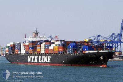
GSL CHRISTEN
Container Ship
Current Trip
| Time Travelled | 3 days |
|---|---|
| Remaining Time | 12 days |
| Distance Travelled | 1328.19 nm |
| Remaining Distance | 4455.29 nm |
| AVG Speed | 14.9 Noeuds |
| MAX Speed | 16.1 Noeuds |
| AVG Wind | 12.4 knots |
| MAX Wind | 25.3 knots |
| MIN Temp | 22.7°C / 72.86°F |
| MAX Temp | 31°C / 87.8°F |
| Tirant d eau | 12.3 m |
| Position reçue | Maintenant |
Current Position
| Longitude | 139.98899° |
|---|---|
| Latitude | 34.81235° |
| Etat | Under way using engine |
| Vitesse | 15.3 Noeuds |
| Parcours | 52° |
| Zone | North Pacific Ocean |
| Station | T-AIS |
| Position reçue | Maintenant |
Info
Information
The current position of GSL CHRISTEN is in North Pacific Ocean with coordinates 34.81235° / 139.98899° as reported on 2024-06-26 16:02 by AIS to our vessel tracker app. The vessel's current speed is 15.3 Noeuds and is heading at the port of VANCOUVER. The estimated time of arrival as calculated by MyShipTracking vessel tracking app is 2024-07-08 17:21 LT
The vessel GSL CHRISTEN (IMO: 9229324, MMSI: 636019760) is a Container Ship that was built in 2002 ( 22 Age ). It's sailing under the flag of [LR] Liberia.
In this page you can find informations about the vessels current position, last detected port calls, and current voyage information. If the vessels is not in coverage by AIS you will find the latest position.
The current position of GSL CHRISTEN is detected by our AIS receivers and we are not responsible for the reliability of the data. The last position was recorded while the vessel was in Coverage by the Ais receivers of our vessel tracking app.
The current draught of GSL CHRISTEN as reported by AIS is 12.3 meters
Weather
| Temperature | 22.9°C / 73.22°F |
|---|---|
| Wind Speed | 10 knots |
| Direction | 43° NE |
| Pressure | 1013.4 hPa |
| Humidity | 87.6 % |
| Cloud Coverage | 100 % |
Featured Company
Last Port Calls
| Port | Arrival | Departure | Time In Port |
|---|---|---|---|
| 2024-06-22 12:08 | 2024-06-22 23:47 | 11 h | |
| 2024-06-20 05:13 | 2024-06-21 07:17 | 1 d | |
| 2024-06-19 06:10 | 2024-06-20 00:06 | 17 h | |
| 2024-06-17 15:23 | 2024-06-18 04:33 | 13 h | |
| 2024-05-30 17:00 | 2024-06-01 12:50 | 1 d | |
| 2024-05-27 21:46 | 2024-05-30 08:30 | 2 d | |
| 2024-05-11 18:53 | 2024-05-12 08:21 | 13 h | |
| 2024-05-09 07:00 | 2024-05-10 06:52 | 23 h | |
| 2024-05-08 05:17 | 2024-05-09 02:30 | 21 h | |
| 2024-05-06 09:46 | 2024-05-07 03:33 | 17 h |
Most Visited Ports (Last year)
| Port | Arrivals | |
|---|---|---|
| 9 | ||
| 5 | ||
| 5 | ||
| 5 | ||
| 4 | ||
| 4 |
Last Trips
| Origin | Departure | Destination | Arrival | Distance | |
|---|---|---|---|---|---|
| 2024-06-21 15:17 | 2024-06-22 20:08 | 345.78 nm | |||
| 2024-06-20 08:06 | 2024-06-20 13:13 | 58.94 nm | |||
| 2024-06-18 12:33 | 2024-06-19 14:10 | 353.74 nm | |||
| 2024-06-01 05:50 | 2024-06-17 23:23 | 5537.78 nm | |||
| 2024-05-30 01:30 | 2024-05-30 10:00 | 132.28 nm | |||
| 2024-05-12 16:21 | 2024-05-27 14:46 | 5546.92 nm | |||
| 2024-05-10 14:52 | 2024-05-12 02:53 | 352.10 nm | |||
| 2024-05-09 10:30 | 2024-05-09 15:00 | 58.46 nm | |||
| 2024-05-07 11:33 | 2024-05-08 13:17 | 351.73 nm | |||
| 2024-04-21 04:33 | 2024-05-06 17:46 | 5562.91 nm |
Events
| Heure | Evenement | Détails | Position/ Destination | Info |
|---|---|---|---|---|
| 2024-06-26 14:39 | Changement de zone | Japanese part of the North Pacific Ocean Japanese part of the Philippine Sea |
34.69552 / 139.62602
North Pacific Ocean
VANCOUVER
|
Vitesse: 11.6 kn Parcours: 71.4° |
| 2024-06-26 14:07 | Changement de zone | Japanese part of the Philippine Sea Taiwanese part of the Eastern China Sea |
34.65318 / 139.48233
Philippine Sea
VANCOUVER
|
Vitesse: 16.1 kn Parcours: 73.1° |
| 2024-06-26 14:07 | Etat Changé | Under way using engine Default |
34.65318 / 139.48233
VANCOUVER
|
Vitesse: 15.6 kn Parcours: 74° |
| 2024-06-26 13:54 | Dans la zone couverte |
34.65318 / 139.48233
Philippine Sea
VANCOUVER
|
Vitesse: 16.1 kn Parcours: 73.1° |
|
| 2024-06-23 17:35 | Etat Changé | Default Under way using engine |
25.94603 / 122.25813
VANCOUVER
|
Vitesse: 15.2 kn Parcours: 71.7° |
| 2024-06-23 17:16 | Etat Changé | Under way using engine Default |
25.91359 / 122.17905
VANCOUVER
|
Vitesse: 15.2 kn Parcours: 73° |
| 2024-06-23 17:16 | Hors de la zone couverte |
25.91359 / 122.17905
Eastern China Sea
VANCOUVER
|
Vitesse: 15.2 kn Parcours: 71.7° |
|
| 2024-06-23 17:01 | Dans la zone couverte |
25.91359 / 122.17905
Eastern China Sea
VANCOUVER
|
Vitesse: 15.2 kn Parcours: 71.7° |
|
| 2024-06-23 15:43 | Etat Changé | Default Under way using engine |
25.68988 / 121.84427
VANCOUVER
|
Vitesse: 15.2 kn Parcours: 57.8° |
| 2024-06-23 15:28 | Hors de la zone couverte |
25.65612 / 121.78618
Eastern China Sea
VANCOUVER
|
Vitesse: 15.2 kn Parcours: 57.8° |