
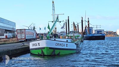
GRINZA 6
Dredging or underwater ops
Current Trip
ENKHUIZERZAND
| Time Travelled | 15 h, 11 mins |
|---|---|
| Remaining Time | --- |
| Distance Travelled | 16.32 nm |
| Remaining Distance | --- |
| AVG Speed | 6.7 Noeuds |
| MAX Speed | 8.8 Noeuds |
| AVG Wind | 8.6 knots |
| MAX Wind | 10.3 knots |
| MIN Temp | 3.6°C / 38.48°F |
| MAX Temp | 7.1°C / 44.78°F |
| Tirant d eau | 2.8 m |
| Position reçue | 1 m depuis |
Current Position
| Longitude | --- |
|---|---|
| Latitude | --- |
| Etat | Moored |
| Vitesse | |
| Parcours | --- |
| Zone | North Sea |
| Station | T-AIS |
| Position reçue | 1 m depuis |
Info
Information
The current position of GRINZA 6 is in North Sea with coordinates 52.77492° / 5.10674° as reported on 2025-12-05 23:14 by AIS to our vessel tracker app. The vessel's current speed is 0 Noeuds
The vessel GRINZA 6 (MMSI: 244700358) is a Dredging or underwater ops It's sailing under the flag of [NL] Netherlands.
In this page you can find informations about the vessels current position, last detected port calls, and current voyage information. If the vessels is not in coverage by AIS you will find the latest position.
The current position of GRINZA 6 is detected by our AIS receivers and we are not responsible for the reliability of the data. The last position was recorded while the vessel was in Coverage by the Ais receivers of our vessel tracking app.
The current draught of GRINZA 6 as reported by AIS is 2.8 meters
Weather
| Temperature | 5°C / 41°F |
|---|---|
| Wind Speed | 16 knots |
| Direction | 173° S |
| Pressure | 1005.1 hPa |
| Humidity | 80.5 % |
| Cloud Coverage | 100 % |
Featured Company
Last Port Calls
| Port | Arrival | Departure | Time In Port |
|---|---|---|---|
| 2025-12-05 08:37 | 2025-12-05 09:04 | 27 m | |
| 2025-12-02 09:56 | 2025-12-02 15:07 | 5 h | |
| 2025-12-01 13:33 | 2025-12-01 17:38 | 4 h | |
| 2025-11-27 14:37 | 2025-11-27 15:39 | 1 h | |
| 2025-11-27 08:06 | 2025-11-27 14:07 | 6 h | |
| 2025-11-26 19:36 | 2025-11-27 07:53 | 12 h | |
| 2025-11-25 15:12 | 2025-11-25 16:19 | 1 h | |
| 2025-11-25 09:08 | 2025-11-25 12:48 | 3 h | |
| 2025-11-24 19:30 | 2025-11-24 20:48 | 1 h | |
| 2025-11-21 09:36 | 2025-11-21 14:18 | 4 h |
Last Trips
| Origin | Departure | Destination | Arrival | Distance | |
|---|---|---|---|---|---|
| 2025-12-02 15:07 | 2025-12-05 08:37 | 33.26 nm | |||
| 2025-12-01 17:38 | 2025-12-02 09:56 | 47.96 nm | |||
| 2025-11-27 15:39 | 2025-12-01 13:33 | 101.26 nm | |||
| 2025-11-27 14:07 | 2025-11-27 14:37 | 2.76 nm | |||
| 2025-11-27 07:53 | 2025-11-27 08:06 | 0.46 nm | |||
| 2025-11-25 16:19 | 2025-11-26 19:36 | 98.42 nm | |||
| 2025-11-25 12:48 | 2025-11-25 15:12 | 13.84 nm | |||
| 2025-11-24 20:48 | 2025-11-25 09:08 | 13.76 nm | |||
| 2025-11-21 14:18 | 2025-11-24 19:30 | 70.95 nm | |||
| 2025-11-20 12:23 | 2025-11-21 09:36 | 46.91 nm |
Events
| Heure | Evenement | Détails | Position/ Destination | Info |
|---|---|---|---|---|
| 2025-12-05 13:39 | Etat Changé | Moored Under way using engine |
52.77489 / 5.10675
ENKHUIZERZAND
|
Vitesse: 0.3 kn Parcours: 511° |
| 2025-12-05 13:38 | Arret | 0.71 nm, North West of MEDEMBLIK |
52.77488 / 5.10669
ENKHUIZERZAND
|
Vitesse: 0.2 kn Parcours: 511° |
| 2025-12-05 12:10 | Démarrage | 5.36 nm, South West of STAVOREN |
52.79978 / 5.30204
ENKHUIZERZAND
|
Vitesse: 6 kn Parcours: 197.5° |
| 2025-12-05 12:06 | Etat Changé | Under way using engine Moored |
52.80149 / 5.30380
ENKHUIZERZAND
|
Vitesse: 1.2 kn Parcours: 511° |
| 2025-12-05 10:45 | Etat Changé | Moored Under way using engine |
52.80129 / 5.30347
ENKHUIZERZAND
|
Vitesse: 0.5 kn Parcours: 511° |
| 2025-12-05 10:44 | Etat Changé | Under way using engine Moored |
52.80130 / 5.30344
ENKHUIZERZAND
|
Vitesse: 1 kn Parcours: 511° |
| 2025-12-05 09:05 | Etat Changé | Moored Under way using engine |
52.80105 / 5.30363
ENKHUIZERZAND
|
Vitesse: 0.7 kn Parcours: 511° |
| 2025-12-05 09:02 | Arret | 5.25 nm, South West of STAVOREN |
52.80115 / 5.30432
ENKHUIZERZAND
|
Vitesse: 0.3 kn Parcours: 511° |
| 2025-12-05 08:04 | PORT DE DEPART |
|
52.77571 / 5.11563
ENKHUIZERZAND
|
Vitesse: 4.9 kn Parcours: 78.5° |
| 2025-12-05 08:02 | Démarrage |
52.77486 / 5.11383
[NL] MEDEMBLIK
|
Vitesse: 3.1 kn Parcours: 28.4° |