
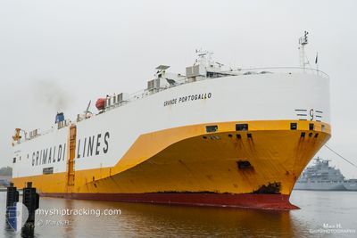
GRANDE PORTOGALLO
Vehicles Carrier
Current Trip
| Time Travelled | 1 day |
|---|---|
| Remaining Time | --- |
| Distance Travelled | 193.53 nm |
| Remaining Distance | 387.62 nm |
| AVG Speed | 11.4 Noeuds |
| MAX Speed | 15 Noeuds |
| AVG Wind | 19.6 knots |
| MAX Wind | 30.8 knots |
| MIN Temp | 5.5°C / 41.9°F |
| MAX Temp | 15.5°C / 59.9°F |
| Tirant d eau | 8.4 m |
| Position reçue | 13 h, 24 m depuis |
Current Position
| Longitude | --- |
|---|---|
| Latitude | --- |
| Etat | Under way using engine |
| Vitesse | 9 Noeuds |
| Parcours | 134.7° |
| Zone | North Atlantic Ocean |
| Station | T-AIS |
| Position reçue | 13 h, 24 m depuis |
Info
Information
The current position of GRANDE PORTOGALLO is in North Atlantic Ocean with coordinates 36.90448° / -75.92861° as reported on 2025-02-16 23:59 by AIS to our vessel tracker app. The vessel's current speed is 9 Noeuds and is heading at the port of DAVISVILLE. The estimated time of arrival as calculated by MyShipTracking vessel tracking app is 2025-02-18 19:30 LT
The vessel GRANDE PORTOGALLO (IMO: 9245598, MMSI: 247065500) is a Vehicles Carrier that was built in 2002 ( 23 Age ). It's sailing under the flag of [IT] Italy.
In this page you can find informations about the vessels current position, last detected port calls, and current voyage information. If the vessels is not in coverage by AIS you will find the latest position.
The current position of GRANDE PORTOGALLO is detected by our AIS receivers and we are not responsible for the reliability of the data. The last position was recorded while the vessel was in Coverage by the Ais receivers of our vessel tracking app.
The current draught of GRANDE PORTOGALLO as reported by AIS is 8.4 meters
Weather
| Temperature | 5.3°C / 41.54°F |
|---|---|
| Wind Speed | 27 knots |
| Direction | 297° WNW |
| Pressure | 1011.4 hPa |
| Humidity | 61.7 % |
| Cloud Coverage | 6 % |
Featured Company
Last Port Calls
| Port | Arrival | Departure | Time In Port |
|---|---|---|---|
| 2025-02-15 05:47 | 2025-02-16 11:51 | 1 d | |
| 2025-02-12 18:29 | 2025-02-13 04:28 | 9 h | |
| 2025-02-08 11:23 | 2025-02-09 03:17 | 15 h | |
| 2025-02-07 00:10 | 2025-02-08 00:38 | 1 d | |
| 2025-01-29 11:01 | 2025-01-30 14:38 | 1 d | |
| 2025-01-26 21:42 | 2025-01-27 11:27 | 13 h | |
| 2025-01-24 13:38 | 2025-01-25 01:27 | 11 h | |
| 2025-01-18 20:42 | 2025-01-20 16:33 | 1 d | |
| 2025-01-17 05:59 | 2025-01-17 19:31 | 13 h | |
| 2025-01-11 11:48 | 2025-01-11 22:27 | 10 h |
Last Trips
| Origin | Departure | Destination | Arrival | Distance | |
|---|---|---|---|---|---|
| 2025-02-12 23:28 | 2025-02-15 00:47 | 683.44 nm | |||
| 2025-02-08 21:17 | 2025-02-12 13:29 | 1404.24 nm | |||
| 2025-02-07 18:38 | 2025-02-08 05:23 | 127.72 nm | |||
| 2025-01-30 09:38 | 2025-02-06 18:10 | 2157.47 nm | |||
| 2025-01-27 06:27 | 2025-01-29 06:01 | 518.05 nm | |||
| 2025-01-24 20:27 | 2025-01-26 16:42 | 679.80 nm | |||
| 2025-01-20 10:33 | 2025-01-24 08:38 | 1425.81 nm | |||
| 2025-01-17 13:31 | 2025-01-18 14:42 | 125.64 nm | |||
| 2025-01-11 17:27 | 2025-01-16 23:59 | 2103.02 nm | |||
| 2025-01-09 07:33 | 2025-01-11 06:48 | 513.68 nm |
Events
| Heure | Evenement | Détails | Position/ Destination | Info |
|---|---|---|---|---|
| 2025-02-17 00:03 | Etat Changé | Default Under way using engine |
36.89649 / -75.91824
USBAL>USDVV
|
Vitesse: 9 kn Parcours: 134.7° |
| 2025-02-16 23:59 | Hors de la zone couverte |
36.90448 / -75.92861
North Atlantic Ocean
USBAL>USDVV
|
Vitesse: 9 kn Parcours: 134.7° |
|
| 2025-02-16 23:58 | Etat Changé | Under way using engine Default |
36.90623 / -75.93085
USBAL>USDVV
|
Vitesse: 9.1 kn Parcours: 135° |
| 2025-02-16 23:47 | Etat Changé | Default Under way using engine |
36.92526 / -75.95385
USBAL>USDVV
|
Vitesse: 9.5 kn Parcours: 137.1° |
| 2025-02-16 23:28 | Etat Changé | Under way using engine Default |
36.96434 / -75.99186
USBAL>USDVV
|
Vitesse: 10.4 kn Parcours: 153° |
| 2025-02-16 23:23 | Etat Changé | Default Under way using engine |
36.97484 / -75.99812
USBAL>USDVV
|
Vitesse: 12.5 kn Parcours: 141.8° |
| 2025-02-16 22:31 | Etat Changé | Under way using engine Default |
37.12933 / -76.13829
USBAL>USDVV
|
Vitesse: 13 kn Parcours: 151° |
| 2025-02-16 22:23 | Dans la zone couverte |
37.12723 / -76.13681
North Atlantic Ocean
USBAL>USDVV
|
Vitesse: 12.8 kn Parcours: 150.8° |
|
| 2025-02-16 14:29 | Etat Changé | Default Under way using engine |
38.78730 / -76.42251
USBAL>USDVV
|
Vitesse: 14.5 kn Parcours: 191° |
| 2025-02-16 14:26 | Hors de la zone couverte |
38.80090 / -76.41904
North Atlantic Ocean
USBAL>USDVV
|
Vitesse: 14.5 kn Parcours: 191° |