
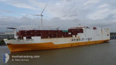
GRANDE LUANDA
Cargo
Current Trip
| Time Travelled | 8 days |
|---|---|
| Remaining Time | --- |
| Distance Travelled | 2766.09 nm |
| Remaining Distance | --- |
| AVG Speed | 15.4 Noeuds |
| MAX Speed | 21.1 Noeuds |
| AVG Wind | 8.8 knots |
| MAX Wind | 15.9 knots |
| MIN Temp | 12.3°C / 54.14°F |
| MAX Temp | 30.1°C / 86.18°F |
| Tirant d eau | 9.2 m |
| Position reçue | 4 d depuis |
Current Position
| Longitude | -58.34322° |
|---|---|
| Latitude | 35.01268° |
| Etat | Under way using engine |
| Vitesse | 17 Noeuds |
| Parcours | 110.4° |
| Zone | North Atlantic Ocean |
| Station | T-AIS |
| Position reçue | 4 d depuis |
Info
Information
The current position of GRANDE LUANDA is in North Atlantic Ocean with coordinates 35.01268° / -58.34322° as reported on 2024-05-25 06:03 by AIS to our vessel tracker app. The vessel's current speed is 17 Noeuds and is heading at the port of DAKAR. The estimated time of arrival as calculated by MyShipTracking vessel tracking app is 2024-05-31 18:00 LT
The vessel GRANDE LUANDA (IMO: 9724738, MMSI: 247342300) is a Cargo It's sailing under the flag of [IT] Italy.
In this page you can find informations about the vessels current position, last detected port calls, and current voyage information. If the vessels is not in coverage by AIS you will find the latest position.
The current position of GRANDE LUANDA is detected by our AIS receivers and we are not responsible for the reliability of the data. The last position was recorded while the vessel was in Coverage by the Ais receivers of our vessel tracking app.
The current draught of GRANDE LUANDA as reported by AIS is 9.2 meters
Weather
| Temperature | 23.4°C / 74.12°F |
|---|---|
| Wind Speed | 9 knots |
| Direction | 65° ENE |
| Pressure | 1021.5 hPa |
| Humidity | 70.4 % |
| Cloud Coverage | 100 % |
Featured Company
Last Port Calls
| Port | Arrival | Departure | Time In Port |
|---|---|---|---|
| 2024-05-20 04:03 | 2024-05-20 23:29 | 19 h | |
| 2024-05-17 20:49 | 2024-05-18 15:54 | 19 h | |
| 2024-05-16 05:51 | 2024-05-17 18:48 | 1 d | |
| 2024-05-04 11:43 | 2024-05-05 01:50 | 14 h | |
| 2024-05-01 15:27 | 2024-05-03 08:00 | 1 d | |
| 2024-04-28 15:05 | 2024-04-29 17:55 | 1 d | |
| 2024-04-16 10:32 | 2024-04-17 05:41 | 19 h | |
| 2024-04-10 16:43 | 2024-04-13 05:40 | 2 d | |
| 2024-04-08 10:22 | 2024-04-08 20:50 | 10 h | |
| 2024-03-30 08:45 | 2024-03-31 09:29 | 1 d |
Last Trips
| Origin | Departure | Destination | Arrival | Distance | |
|---|---|---|---|---|---|
| 2024-05-18 15:54 | 2024-05-20 04:03 | 188.49 nm | |||
| 2024-05-17 18:48 | 2024-05-17 20:49 | 20.37 nm | |||
| 2024-05-05 01:50 | 2024-05-16 05:51 | 2317.25 nm | |||
| 2024-05-03 08:00 | 2024-05-04 11:43 | 464.80 nm | |||
| 2024-04-29 17:55 | 2024-05-01 15:27 | 245.33 nm | |||
| 2024-04-17 05:41 | 2024-04-28 15:05 | 4433.12 nm | |||
| 2024-04-13 05:40 | 2024-04-16 10:32 | 1280.10 nm | |||
| 2024-04-08 20:50 | 2024-04-10 16:43 | 180.34 nm | |||
| 2024-03-31 09:29 | 2024-04-08 10:22 | 3416.40 nm | |||
| 2024-03-29 08:41 | 2024-03-30 08:45 | 223.54 nm |
Events
| Heure | Evenement | Détails | Position/ Destination | Info |
|---|---|---|---|---|
| 2024-05-25 06:08 | Etat Changé | Default Under way using engine |
35.00333 / -58.31667
USILG>SNDKR
|
Vitesse: 17 kn Parcours: 110.4° |
| 2024-05-25 06:03 | Hors de la zone couverte |
35.01268 / -58.34322
North Atlantic Ocean
USILG>SNDKR
|
Vitesse: 17 kn Parcours: 110.4° |
|
| 2024-05-25 03:27 | Etat Changé | Under way using engine Default |
35.28317 / -59.18330
USILG>SNDKR
|
Vitesse: 16.3 kn Parcours: 110° |
| 2024-05-25 03:17 | Dans la zone couverte |
35.28317 / -59.18330
North Atlantic Ocean
USILG>SNDKR
|
Vitesse: 16.3 kn Parcours: 109.9° |
|
| 2024-05-24 19:44 | Etat Changé | Default Under way using engine |
36.00167 / -61.65667
USILG>SNDKR
|
Vitesse: 16.5 kn Parcours: 109.6° |
| 2024-05-24 19:38 | Etat Changé | Under way using engine Default |
36.01168 / -61.68931
USILG>SNDKR
|
Vitesse: 16.4 kn Parcours: 110° |
| 2024-05-24 19:38 | Hors de la zone couverte |
36.01168 / -61.68931
North Atlantic Ocean
USILG>SNDKR
|
Vitesse: 16.5 kn Parcours: 109.6° |
|
| 2024-05-24 19:33 | Etat Changé | Default Under way using engine |
36.01976 / -61.71813
USILG>SNDKR
|
Vitesse: 16.5 kn Parcours: 109.8° |
| 2024-05-24 16:16 | Etat Changé | Under way using engine Default |
36.32317 / -62.77480
USILG>SNDKR
|
Vitesse: 16 kn Parcours: 108° |
| 2024-05-24 16:11 | Etat Changé | Default Under way using engine |
36.32834 / -62.79833
USILG>SNDKR
|
Vitesse: 17 kn Parcours: 108° |