
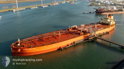
GRAND AMBITION
Tanker
Current Trip
| Time Travelled | 1 day |
|---|---|
| Remaining Time | --- |
| Distance Travelled | 296.81 nm |
| Remaining Distance | --- |
| AVG Speed | 12.5 Noeuds |
| MAX Speed | 15.8 Noeuds |
| AVG Wind | 15.3 knots |
| MAX Wind | 20.9 knots |
| MIN Temp | 13.6°C / 56.48°F |
| MAX Temp | 16°C / 60.8°F |
| Tirant d eau | 11.7 m |
| Position reçue | 10 h, 54 m depuis |
Current Position
| Longitude | -5.81792° |
|---|---|
| Latitude | 49.70847° |
| Etat | Under way using engine |
| Vitesse | 14.9 Noeuds |
| Parcours | 271.4° |
| Zone | Celtic Sea |
| Station | T-AIS |
| Position reçue | 10 h, 54 m depuis |
Info
Information
The current position of GRAND AMBITION is in Celtic Sea with coordinates 49.70847° / -5.81792° as reported on 2024-07-08 00:46 by AIS to our vessel tracker app. The vessel's current speed is 14.9 Noeuds and is heading at the port of CORPUS CHRISTI. The estimated time of arrival as calculated by MyShipTracking vessel tracking app is 2024-07-25 11:00 LT
The vessel GRAND AMBITION (IMO: 9909807, MMSI: 352978157) is a Tanker It's sailing under the flag of [PA] Panama.
In this page you can find informations about the vessels current position, last detected port calls, and current voyage information. If the vessels is not in coverage by AIS you will find the latest position.
The current position of GRAND AMBITION is detected by our AIS receivers and we are not responsible for the reliability of the data. The last position was recorded while the vessel was in Coverage by the Ais receivers of our vessel tracking app.
The current draught of GRAND AMBITION as reported by AIS is 11.7 meters
Weather
| Temperature | 15.3°C / 59.54°F |
|---|---|
| Wind Speed | 20 knots |
| Direction | 101° E |
| Pressure | 1007.1 hPa |
| Humidity | 94.1 % |
| Cloud Coverage | 100 % |
Featured Company
Events
| Heure | Evenement | Détails | Position/ Destination | Info |
|---|---|---|---|---|
| 2024-07-08 00:52 | Etat Changé | Default Under way using engine |
49.70901 / -5.85135
USCRP
|
Vitesse: 14.9 kn Parcours: 271.4° |
| 2024-07-08 00:46 | Hors de la zone couverte |
49.70847 / -5.81792
Celtic Sea
USCRP
|
Vitesse: 14.9 kn Parcours: 271.4° |
|
| 2024-07-08 00:46 | Etat Changé | Under way using engine Default |
49.70841 / -5.81546
USCRP
|
Vitesse: 15 kn Parcours: 271° |
| 2024-07-08 00:36 | Etat Changé | Default Under way using engine |
49.70735 / -5.75257
USCRP
|
Vitesse: 15 kn Parcours: 271.1° |
| 2024-07-08 00:30 | Detecté en mer | United Kingdom part of the Celtic Sea |
49.70699 / -5.71824
Celtic Sea
USCRP
|
Vitesse: 15 kn Parcours: 271.1° |
| 2024-07-08 00:30 | Etat Changé | Under way using engine Default |
49.70699 / -5.71824
USCRP
|
Vitesse: 15 kn Parcours: 271° |
| 2024-07-07 23:44 | Etat Changé | Default Under way using engine |
49.70217 / -5.43804
USCRP
|
Vitesse: 14.2 kn Parcours: 271.6° |
| 2024-07-07 23:27 | Etat Changé | Under way using engine Default |
49.70040 / -5.33683
USCRP
|
Vitesse: 14 kn Parcours: 271° |
| 2024-07-07 23:24 | Etat Changé | Default Under way using engine |
49.70017 / -5.31858
USCRP
|
Vitesse: 14 kn Parcours: 271.2° |
| 2024-07-07 16:10 | Changement de zone | United Kingdom part of the English Channel Guernsey part of the English Channel |
49.98543 / -3.00628
English Channel
USCRP
|
Vitesse: 14.2 kn Parcours: 256.5° |