
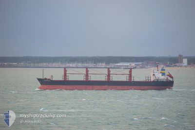
GOLDEN ARSENAL
Bulk Carrier
Current Trip
| Time Travelled | 14 days |
|---|---|
| Remaining Time | 1 day |
| Distance Travelled | 3537.02 nm |
| Remaining Distance | 325.36 nm |
| AVG Speed | 10.7 Noeuds |
| MAX Speed | 14.6 Noeuds |
| AVG Wind | 9.7 knots |
| MAX Wind | 23 knots |
| MIN Temp | 8.8°C / 47.84°F |
| MAX Temp | 22.2°C / 71.96°F |
| Tirant d eau | 8.5 m |
| Position reçue | 2 h, 23 m depuis |
Current Position
| Longitude | 15.36957° |
|---|---|
| Latitude | 35.37092° |
| Etat | At anchor |
| Vitesse | 10.5 Noeuds |
| Parcours | 129.6° |
| Zone | Mediterranean Sea - Eastern Basin |
| Station | T-AIS |
| Position reçue | 2 h, 23 m depuis |
Info
Information
The current position of GOLDEN ARSENAL is in Mediterranean Sea - Eastern Basin with coordinates 35.37092° / 15.36957° as reported on 2024-05-16 22:14 by AIS to our vessel tracker app. The vessel's current speed is 10.5 Noeuds and is heading at the port of BENGHAZI. The estimated time of arrival as calculated by MyShipTracking vessel tracking app is 2024-05-18 03:38 LT
The vessel GOLDEN ARSENAL (IMO: 9493212, MMSI: 375671000) is a Bulk Carrier that was built in 2011 ( 13 Age ). It's sailing under the flag of [VC] St Vincent Grenadines.
In this page you can find informations about the vessels current position, last detected port calls, and current voyage information. If the vessels is not in coverage by AIS you will find the latest position.
The current position of GOLDEN ARSENAL is detected by our AIS receivers and we are not responsible for the reliability of the data. The last position was recorded while the vessel was in Coverage by the Ais receivers of our vessel tracking app.
The current draught of GOLDEN ARSENAL as reported by AIS is 8.5 meters
Weather
| Temperature | 19.3°C / 66.74°F |
|---|---|
| Wind Speed | 11 knots |
| Direction | 295° WNW |
| Pressure | 1010.6 hPa |
| Humidity | 89.6 % |
| Cloud Coverage | 100 % |
Featured Company
Events
| Heure | Evenement | Détails | Position/ Destination | Info |
|---|---|---|---|---|
| 2024-05-16 22:15 | Etat Changé | Default At anchor |
35.36841 / 15.37323
LY BEN
|
Vitesse: 10.5 kn Parcours: 129.6° |
| 2024-05-16 22:14 | Etat Changé | At anchor Default |
35.37092 / 15.36957
LY BEN
|
Vitesse: 10.5 kn Parcours: 130° |
| 2024-05-16 22:14 | Hors de la zone couverte |
35.37092 / 15.36957
Mediterranean Sea - Eastern Basin
LY BEN
|
Vitesse: 10.5 kn Parcours: 129.6° |
|
| 2024-05-16 22:02 | Etat Changé | Default At anchor |
35.39360 / 15.33638
LY BEN
|
Vitesse: 10.5 kn Parcours: 129.6° |
| 2024-05-16 22:01 | Etat Changé | At anchor Default |
35.39579 / 15.33320
LY BEN
|
Vitesse: 10.5 kn Parcours: 127° |
| 2024-05-16 22:01 | Dans la zone couverte |
35.39579 / 15.33320
Mediterranean Sea - Eastern Basin
LY BEN
|
Vitesse: 10.5 kn Parcours: 129.6° |
|
| 2024-05-16 18:16 | Démarrage | 9.71 nm, East of MARSAXLOKK |
35.84360 / 14.74434
LY BEN
|
Vitesse: 4.7 kn Parcours: 131° |
| 2024-05-16 16:22 | Etat Changé | Default At anchor |
35.84724 / 14.73607
LY BEN
|
Vitesse: Parcours: 84° |
| 2024-05-16 16:19 | Etat Changé | At anchor Default |
35.84722 / 14.73612
LY BEN
|
Vitesse: Parcours: 92° |
| 2024-05-16 16:19 | Hors de la zone couverte |
35.84722 / 14.73612
Mediterranean Sea - Eastern Basin
LY BEN
|
Vitesse: Parcours: 186.9° |