
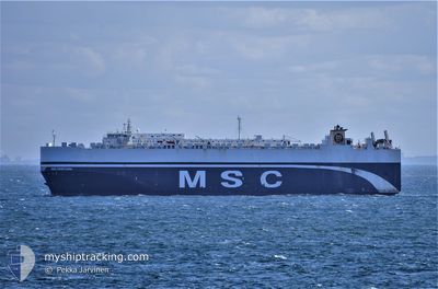
GOLD HOSHI
Vehicles Carrier
Current Trip
| Time Travelled | 1 day |
|---|---|
| Remaining Time | --- |
| Distance Travelled | 431.52 nm |
| Remaining Distance | --- |
| AVG Speed | 13.3 Noeuds |
| MAX Speed | 17.4 Noeuds |
| AVG Wind | 9.7 knots |
| MAX Wind | 19.9 knots |
| MIN Temp | 4.4°C / 39.92°F |
| MAX Temp | 10.5°C / 50.9°F |
| Tirant d eau | 10.5 m |
| Position reçue | Maintenant |
Current Position
| Longitude | 0.09340° |
|---|---|
| Latitude | 50.50053° |
| Etat | Under way using engine |
| Vitesse | 13.2 Noeuds |
| Parcours | 252.3° |
| Zone | English Channel |
| Station | T-AIS |
| Position reçue | Maintenant |
Info
Information
The current position of GOLD HOSHI is in English Channel with coordinates 50.50053° / 0.09340° as reported on 2024-04-27 08:55 by AIS to our vessel tracker app. The vessel's current speed is 13.2 Noeuds and is heading at the port of NANSHA. The estimated time of arrival as calculated by MyShipTracking vessel tracking app is 2024-06-06 12:00 LT
The vessel GOLD HOSHI (IMO: 9453298, MMSI: 371715000) is a Vehicles Carrier that was built in 2011 ( 13 Age ). It's sailing under the flag of [PA] Panama.
In this page you can find informations about the vessels current position, last detected port calls, and current voyage information. If the vessels is not in coverage by AIS you will find the latest position.
The current position of GOLD HOSHI is detected by our AIS receivers and we are not responsible for the reliability of the data. The last position was recorded while the vessel was in Coverage by the Ais receivers of our vessel tracking app.
The current draught of GOLD HOSHI as reported by AIS is 10.5 meters
Weather
| Temperature | 10.5°C / 50.9°F |
|---|---|
| Wind Speed | 5 knots |
| Direction | 196° SSW |
| Pressure | 1001.8 hPa |
| Humidity | 85.3 % |
| Cloud Coverage | 100 % |
Featured Company
Last Port Calls
| Port | Arrival | Departure | Time In Port |
|---|---|---|---|
| 2024-04-20 05:54 | 2024-04-26 01:58 | 5 d | |
| 2024-04-17 04:00 | 2024-04-18 21:45 | 1 d | |
| 2024-04-12 07:12 | 2024-04-12 21:24 | 14 h | |
| 2024-03-01 20:27 | 2024-03-02 07:50 | 11 h | |
| 2024-02-24 23:27 | 2024-02-26 05:27 | 1 d | |
| 2024-02-23 21:52 | 2024-02-24 05:42 | 7 h |
Most Visited Ports (Last year)
| Port | Arrivals | |
|---|---|---|
| 5 | ||
| 4 | ||
| 3 | ||
| 3 | ||
| 3 | ||
| 2 |
Last Trips
| Origin | Departure | Destination | Arrival | Distance | |
|---|---|---|---|---|---|
| 2024-04-18 23:45 | 2024-04-20 07:54 | 378.24 nm | |||
| 2024-04-12 22:24 | 2024-04-17 06:00 | 839.93 nm | |||
| 2024-03-02 15:50 | 2024-04-12 08:12 | 14076.13 nm | |||
| 2024-02-26 14:27 | 2024-03-02 04:27 | 1187.42 nm | |||
| 2024-02-24 14:42 | 2024-02-25 08:27 | 142.95 nm | |||
| 2024-01-27 12:31 | 2024-02-24 06:52 | 10378.97 nm |
Events
| Heure | Evenement | Détails | Position/ Destination | Info |
|---|---|---|---|---|
| 2024-04-27 04:32 | Changement de zone | United Kingdom part of the English Channel United Kingdom part of the North Sea |
51.05906 / 1.49084
English Channel
|
Vitesse: 13 kn Parcours: 220.3° |
| 2024-04-26 23:47 | Changement de zone | United Kingdom part of the North Sea Belgian part of the North Sea |
51.85731 / 2.52594
North Sea
|
Vitesse: 15.6 kn Parcours: 219.6° |
| 2024-04-26 23:44 | Detecté en mer | Belgian part of the North Sea |
51.86737 / 2.53936
North Sea
|
Vitesse: 15.6 kn Parcours: 219.7° |
| 2024-04-26 22:11 | Etat Changé | Under way using engine Default |
52.18178 / 2.96670
CNXSA
|
Vitesse: 16 kn Parcours: 214° |
| 2024-04-26 22:07 | Etat Changé | Default Under way using engine |
52.19667 / 2.98333
CNXSA
|
Vitesse: 16 kn Parcours: 214.7° |
| 2024-04-26 21:59 | Etat Changé | Under way using engine Default |
52.22476 / 3.01545
CNXSA
|
Vitesse: 15.9 kn Parcours: 216° |
| 2024-04-26 21:28 | Etat Changé | Default Under way using engine |
52.33472 / 3.15283
CNXSA
|
Vitesse: 15.7 kn Parcours: 218.3° |
| 2024-04-26 21:23 | Etat Changé | Under way using engine Default |
52.34887 / 3.17085
CNXSA
|
Vitesse: 15 kn Parcours: 215° |
| 2024-04-26 21:23 | Dans la zone couverte |
52.34887 / 3.17085
North Sea
|
Vitesse: 15.7 kn Parcours: 217.9° |
|
| 2024-04-26 16:47 | Hors de la zone couverte |
53.14344 / 4.33486
North Sea
|
Vitesse: 12.9 kn Parcours: 230.6° |