

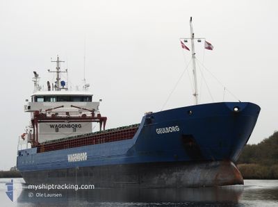
GEULBORG
General Cargo

Current Trip
| Trip Time | 10 days |
|---|---|
| Trip Distance | 2135.20 nm |
| AVG Speed | 8.3 Noeuds |
| MAX Speed | 13.8 Noeuds |
| Tirant d eau | 6.1 m |
| AVG Wind | 22.8 knots |
| MAX Wind | 51.7 knots |
| MIN Temp | 2.6°C / 36.68°F |
| MAX Temp | 16.8°C / 62.24°F |
| Position reçue | 2 d depuis |
Current Position
| Longitude | --- |
|---|---|
| Latitude | --- |
| Etat | Under way using engine |
| Vitesse | 8.8 Noeuds |
| Parcours | 28.6° |
| Zone | Mediterranean Sea - Western Basin |
| Station | T-AIS |
| Position reçue | 2 d depuis |
Information
The current position of GEULBORG is in Mediterranean Sea - Western Basin with coordinates 42.35425° / 3.46208° as reported on 2025-03-25 15:08 by AIS to our vessel tracker app. The vessel's current speed is 8.8 Noeuds and is currently inside the port of SETE.
The vessel GEULBORG (IMO: 9518232, MMSI: 245943000) is a General Cargo that was built in 2010 ( 15 Age ). It's sailing under the flag of [NL] Netherlands.
In this page you can find informations about the vessels current position, last detected port calls, and current voyage information. If the vessels is not in coverage by AIS you will find the latest position.
The current position of GEULBORG is detected by our AIS receivers and we are not responsible for the reliability of the data. The last position was recorded while the vessel was in Coverage by the Ais receivers of our vessel tracking app.
The current draught of GEULBORG as reported by AIS is 6.1 meters
Weather
| Temperature | 16°C / 60.8°F |
|---|---|
| Wind Speed | 6 knots |
| Direction | 326° NW |
| Pressure | 1012.1 hPa |
| Humidity | 46.7 % |
| Cloud Coverage | 100 % |


Featured Company
Last Port Calls
| Port | Arrival | Departure | Time In Port |
|---|---|---|---|
| 2025-03-25 23:34 | |||
| 2025-03-14 10:45 | 2025-03-15 16:13 | 1 d | |
| 2025-03-13 12:41 | 2025-03-13 22:42 | 10 h | |
| 2025-03-13 10:49 | 2025-03-13 11:53 | 1 h | |
| 2025-03-09 12:14 | 2025-03-10 14:49 | 1 d | |
| 2025-02-28 17:42 | 2025-03-06 00:14 | 5 d | |
| 2025-02-11 15:38 | 2025-02-13 14:32 | 1 d | |
| 2025-02-09 15:06 | 2025-02-10 17:19 | 1 d | |
| 2025-02-05 19:09 | 2025-02-06 17:11 | 22 h | |
| 2025-01-25 11:03 | 2025-01-25 12:07 | 1 h |
Last Trips
| Origin | Departure | Destination | Arrival | Distance | |
|---|---|---|---|---|---|
| 2025-03-15 16:13 | 2025-03-25 23:34 | 2135.20 nm | |||
| 2025-03-13 22:42 | 2025-03-14 10:45 | 114.67 nm | |||
| 2025-03-13 11:53 | 2025-03-13 12:41 | 7.33 nm | |||
| 2025-03-10 14:49 | 2025-03-13 10:49 | 690.60 nm | |||
| 2025-03-06 00:14 | 2025-03-09 12:14 | 768.76 nm | |||
| 2025-02-13 14:32 | 2025-02-28 17:42 | 2211.13 nm | |||
| 2025-02-10 17:19 | 2025-02-11 15:38 | 160.49 nm | |||
| 2025-02-06 17:11 | 2025-02-09 15:06 | 713.50 nm | |||
| 2025-01-25 12:07 | 2025-02-05 19:09 | 1164.98 nm | |||
| 2025-01-23 06:18 | 2025-01-25 11:03 | 432.55 nm |
Events
| Heure | Evenement | Détails | Position/ Destination | Info |
|---|---|---|---|---|
| 2025-03-25 22:59 | Arret |
43.40132 / 3.70941
[FR] SETE
|
Vitesse: 0.2 kn Parcours: 344° |
|
| 2025-03-25 22:34 | Port d'arrivée |
|
43.39976 / 3.72850
[FR] SETE
|
Vitesse: 6.8 kn Parcours: 300° |
| 2025-03-25 15:34 | Etat Changé | Default Under way using engine |
42.41513 / 3.48626
FRSET
|
Vitesse: 8.8 kn Parcours: 28.6° |
| 2025-03-25 15:08 | Hors de la zone couverte |
42.35425 / 3.46208
Mediterranean Sea - Western Basin
|
Vitesse: 8.8 kn Parcours: 28.6° |
|
| 2025-03-25 11:22 | Changement de zone | Spanish part of the Mediterranean Sea - Western Basin Spanish part of the Balearic Sea |
41.82420 / 3.28527
Mediterranean Sea - Western Basin
|
Vitesse: 9.4 kn Parcours: 34.2° |
| 2025-03-25 05:39 | Etat Changé | Under way using engine Default |
41.08327 / 2.60452
FRSET
|
Vitesse: 9.7 kn Parcours: 35° |
| 2025-03-25 05:20 | Etat Changé | Default Under way using engine |
41.04126 / 2.56574
FRSET
|
Vitesse: 9.4 kn Parcours: 35.4° |
| 2025-03-25 05:14 | Detecté en mer | Spanish part of the Balearic Sea |
41.02862 / 2.55389
Balearic Sea
FRSET
|
Vitesse: 9.3 kn Parcours: 35.4° |
| 2025-03-25 05:14 | Etat Changé | Under way using engine Default |
41.02862 / 2.55389
FRSET
|
Vitesse: 9.5 kn Parcours: 35° |
| 2025-03-25 05:14 | Dans la zone couverte |
41.02862 / 2.55389
Balearic Sea
FRSET
|
Vitesse: 9.3 kn Parcours: 35.4° |