
GENIUS HIGHWAY
Vehicles Carrier
Current Trip
| Time Travelled | 7 days |
|---|---|
| Remaining Time | --- |
| Distance Travelled | 2778.81 nm |
| Remaining Distance | --- |
| AVG Speed | 15.3 Noeuds |
| MAX Speed | 19.5 Noeuds |
| AVG Wind | 13.3 knots |
| MAX Wind | 26 knots |
| MIN Temp | 19°C / 66.2°F |
| MAX Temp | 25.1°C / 77.18°F |
| Tirant d eau | 8.2 m |
| Position reçue | 7 d depuis |
Current Position
| Longitude | --- |
|---|---|
| Latitude | --- |
| Etat | Under way using engine |
| Vitesse | 16.1 Noeuds |
| Parcours | 271.6° |
| Zone | North Pacific Ocean |
| Station | T-AIS |
| Position reçue | 7 d depuis |
Info
Information
The current position of GENIUS HIGHWAY is in North Pacific Ocean with coordinates 21.13537° / -158.62401° as reported on 2025-02-09 13:35 by AIS to our vessel tracker app. The vessel's current speed is 16.1 Noeuds and is heading at the port of NAGOYA. The estimated time of arrival as calculated by MyShipTracking vessel tracking app is 2025-02-21 04:00 LT
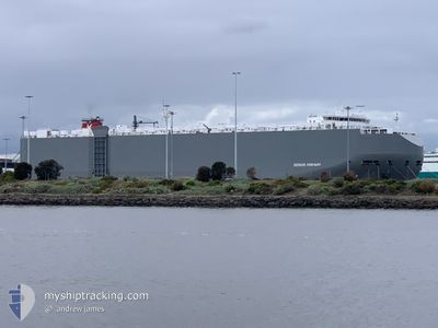
The vessel GENIUS HIGHWAY (IMO: 9672416, MMSI: 311000102) is a Vehicles Carrier that was built in 2014 ( 11 Age ). It's sailing under the flag of [BS] Bahamas.
In this page you can find informations about the vessels current position, last detected port calls, and current voyage information. If the vessels is not in coverage by AIS you will find the latest position.
The current position of GENIUS HIGHWAY is detected by our AIS receivers and we are not responsible for the reliability of the data. The last position was recorded while the vessel was in Coverage by the Ais receivers of our vessel tracking app.
The current draught of GENIUS HIGHWAY as reported by AIS is 8.2 meters
Weather
| Temperature | 21.7°C / 71.06°F |
|---|---|
| Wind Speed | 12 knots |
| Direction | 204° SSW |
| Pressure | 1018.3 hPa |
| Humidity | 65.6 % |
| Cloud Coverage | 70 % |
Featured Company
Last Port Calls
| Port | Arrival | Departure | Time In Port |
|---|---|---|---|
| 2025-02-08 19:41 | 2025-02-09 00:41 | 5 h | |
| 2025-02-02 00:51 | 2025-02-02 15:23 | 14 h | |
| 2025-01-31 04:01 | 2025-01-31 15:29 | 11 h | |
| 2025-01-27 20:06 | 2025-01-28 11:12 | 15 h | |
| 2025-01-24 14:30 | 2025-01-24 22:03 | 7 h | |
| 2025-01-14 05:29 | 2025-01-16 02:59 | 1 d | |
| 2025-01-06 05:20 | 2025-01-06 14:32 | 9 h | |
| 2024-12-28 06:44 | 2024-12-28 16:47 | 10 h | |
| 2024-12-27 07:10 | 2024-12-27 17:05 | 9 h | |
| 2024-12-26 06:38 | 2024-12-26 15:13 | 8 h |
Most Visited Ports (Last year)
| Port | Arrivals | |
|---|---|---|
| 6 | ||
| 5 | ||
| 4 | ||
| 4 | ||
| 4 | ||
| 4 |
Last Trips
| Origin | Departure | Destination | Arrival | Distance | |
|---|---|---|---|---|---|
| 2025-02-02 15:23 | 2025-02-08 19:41 | 2139.78 nm | |||
| 2025-01-31 15:29 | 2025-02-02 00:51 | 415.22 nm | |||
| 2025-01-28 11:12 | 2025-01-31 04:01 | 1037.62 nm | |||
| 2025-01-24 22:03 | 2025-01-27 20:06 | 1198.58 nm | |||
| 2025-01-16 02:59 | 2025-01-24 14:30 | 729.60 nm | |||
| 2025-01-06 14:32 | 2025-01-14 05:29 | 3160.94 nm | |||
| 2024-12-28 16:47 | 2025-01-06 05:20 | 3614.93 nm | |||
| 2024-12-27 17:05 | 2024-12-28 06:44 | 103.42 nm | |||
| 2024-12-26 15:13 | 2024-12-27 07:10 | 121.21 nm | |||
| 2024-12-25 15:37 | 2024-12-26 06:38 | 210.73 nm |
Events
| Heure | Evenement | Détails | Position/ Destination | Info |
|---|---|---|---|---|
| 2025-02-09 13:42 | Etat Changé | Default Under way using engine |
21.13683 / -158.65663
JP NGO
|
Vitesse: 16.1 kn Parcours: 271.6° |
| 2025-02-09 13:35 | Hors de la zone couverte |
21.13537 / -158.62401
North Pacific Ocean
JP NGO
|
Vitesse: 16.1 kn Parcours: 271.6° |
|
| 2025-02-09 10:41 | PORT DE DEPART |
|
21.29208 / -157.87295
JP NGO
|
Vitesse: 7.7 kn Parcours: 208° |
| 2025-02-09 10:14 | Démarrage |
21.31094 / -157.87511
[US] HONOLULU
|
Vitesse: 3.1 kn Parcours: 306° |
|
| 2025-02-09 10:06 | Etat Changé | Under way using engine Moored |
21.31304 / -157.87722
[US] HONOLULU
|
Vitesse: Parcours: 304° |
| 2025-02-09 09:58 | Etat Changé | Moored Default |
21.31302 / -157.87722
[US] HONOLULU
|
Vitesse: Parcours: 304° |
| 2025-02-09 09:55 | Etat Changé | Default Moored |
21.31302 / -157.87723
[US] HONOLULU
|
Vitesse: Parcours: 304° |
| 2025-02-09 09:49 | Etat Changé | Moored Default |
21.31303 / -157.87722
[US] HONOLULU
|
Vitesse: Parcours: 304° |
| 2025-02-09 09:46 | Etat Changé | Default Moored |
21.31303 / -157.87721
[US] HONOLULU
|
Vitesse: Parcours: 304° |
| 2025-02-09 09:40 | Tirant d'eau modifié | 8.2 8.1 |
21.31302 / -157.87718
[US] HONOLULU
|
Vitesse: Parcours: 304° |