
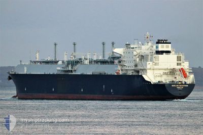
GASLOG SARATOGA
Tanker A
Current Trip
JPISI
| Time Travelled | 1 day |
|---|---|
| Remaining Time | --- |
| Distance Travelled | 284.12 nm |
| Remaining Distance | --- |
| AVG Speed | 14.7 Noeuds |
| MAX Speed | 16.2 Noeuds |
| AVG Wind | 17.9 knots |
| MAX Wind | 37.8 knots |
| MIN Temp | -3.6°C / 25.52°F |
| MAX Temp | 2.5°C / 36.5°F |
| Tirant d eau | 11.2 m |
| Position reçue | 7 d depuis |
Current Position
| Longitude | --- |
|---|---|
| Latitude | --- |
| Etat | Under way using engine |
| Vitesse | 15.4 Noeuds |
| Parcours | 196.9° |
| Zone | Japan Sea |
| Station | T-AIS |
| Position reçue | 7 d depuis |
Info
Information
The current position of GASLOG SARATOGA is in Japan Sea with coordinates 34.90256° / 129.42836° as reported on 2025-02-10 20:47 by AIS to our vessel tracker app. The vessel's current speed is 15.4 Noeuds
The vessel GASLOG SARATOGA (IMO: 9638903, MMSI: 310696000) is a Tanker A It's sailing under the flag of [BM] Bermuda.
In this page you can find informations about the vessels current position, last detected port calls, and current voyage information. If the vessels is not in coverage by AIS you will find the latest position.
The current position of GASLOG SARATOGA is detected by our AIS receivers and we are not responsible for the reliability of the data. The last position was recorded while the vessel was in Coverage by the Ais receivers of our vessel tracking app.
The current draught of GASLOG SARATOGA as reported by AIS is 11.2 meters
Weather
| Temperature | -1.7°C / 28.94°F |
|---|---|
| Wind Speed | 28 knots |
| Direction | 308° NW |
| Pressure | 1015.4 hPa |
| Humidity | 64.3 % |
| Cloud Coverage | 100 % |
Featured Company
Last Port Calls
| Port | Arrival | Departure | Time In Port |
|---|---|---|---|
| 2025-02-16 09:21 | 2025-02-17 12:33 | 1 d | |
| 2025-01-23 23:06 | 2025-01-24 22:32 | 23 h | |
| 2025-01-02 09:09 | 2025-01-03 10:33 | 1 d | |
| 2024-12-15 06:02 | 2024-12-16 06:13 | 1 d |
Most Visited Ports (Last year)
| Port | Arrivals | |
|---|---|---|
| 6 | ||
| 3 | ||
| 1 | ||
| 1 | ||
| 1 | ||
| 1 |
Last Trips
| Origin | Departure | Destination | Arrival | Distance | |
|---|---|---|---|---|---|
| 2025-01-24 22:32 | 2025-02-16 09:21 | 7536.13 nm | |||
| 2025-01-03 10:33 | 2025-01-23 23:06 | 6567.32 nm | |||
| 2024-12-16 06:13 | 2025-01-02 09:09 | 6450.80 nm | |||
| 2024-11-29 12:40 | 2024-12-15 06:02 | 6107.99 nm |
Events
| Heure | Evenement | Détails | Position/ Destination | Info |
|---|---|---|---|---|
| 2025-02-17 03:33 | PORT DE DEPART |
|
43.23310 / 141.29246
JPISI
|
Vitesse: 5.1 kn Parcours: 353° |
| 2025-02-16 00:37 | Arret |
43.21423 / 141.29103
[JP] ISHIKARIWANSHIN
|
Vitesse: 0.3 kn Parcours: 197° |
|
| 2025-02-16 00:21 | Port d'arrivée |
|
43.22279 / 141.29034
[JP] ISHIKARIWANSHIN
|
Vitesse: 6.7 kn Parcours: 122° |
| 2025-02-10 20:53 | Etat Changé | Default Under way using engine |
34.87925 / 129.43733
JPISI
|
Vitesse: 15.4 kn Parcours: 196.9° |
| 2025-02-10 20:47 | Etat Changé | Under way using engine Default |
34.90256 / 129.42836
JPISI
|
Vitesse: 15.8 kn Parcours: 212° |
| 2025-02-10 20:47 | Hors de la zone couverte |
34.90256 / 129.42836
Japan Sea
JPISI
|
Vitesse: 15.4 kn Parcours: 196.9° |
|
| 2025-02-10 20:45 | Etat Changé | Default Under way using engine |
34.90764 / 129.43103
JPISI
|
Vitesse: 13.7 kn Parcours: 263.3° |
| 2025-02-10 20:38 | Changement de zone | Japanese part of the Japan Sea Malaysian part of the Singapore Strait |
34.92914 / 129.45455
Japan Sea
JPISI
|
Vitesse: 13.7 kn Parcours: 263.3° |
| 2025-02-10 20:38 | Etat Changé | Under way using engine Default |
34.92914 / 129.45455
JPISI
|
Vitesse: 13.7 kn Parcours: 275° |
| 2025-02-10 20:38 | Dans la zone couverte |
34.92914 / 129.45455
Japan Sea
JPISI
|
Vitesse: 13.7 kn Parcours: 263.3° |