
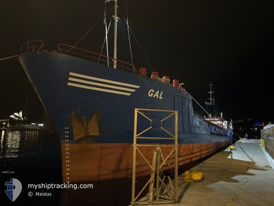
GAL
General Cargo
Current Trip
| Time Travelled | 4 days |
|---|---|
| Remaining Time | 2 days |
| Distance Travelled | 398.06 nm |
| Remaining Distance | 480.51 nm |
| AVG Speed | 5.3 Noeuds |
| MAX Speed | 6.8 Noeuds |
| AVG Wind | 18.6 knots |
| MAX Wind | 25 knots |
| MIN Temp | 12.5°C / 54.5°F |
| MAX Temp | 21.1°C / 69.98°F |
| Tirant d eau | 3.4 m |
| Position reçue | 1 d depuis |
Current Position
| Longitude | --- |
|---|---|
| Latitude | --- |
| Etat | Under way using engine |
| Vitesse | 5.8 Noeuds |
| Parcours | 92.6° |
| Zone | Mediterranean Sea - Eastern Basin |
| Station | T-AIS |
| Position reçue | 1 d depuis |
Info
Information
The current position of GAL is in Mediterranean Sea - Eastern Basin with coordinates 36.10166° / 29.66470° as reported on 2024-11-23 08:39 by AIS to our vessel tracker app. The vessel's current speed is 5.8 Noeuds and is heading at the port of LARNACA. The estimated time of arrival as calculated by MyShipTracking vessel tracking app is 2024-11-27 00:06 LT
The vessel GAL (IMO: 8502145, MMSI: 630001035) is a General Cargo that was built in 1986 ( 38 Age ). It's sailing under the flag of [GW] Guinea-Bissau.
In this page you can find informations about the vessels current position, last detected port calls, and current voyage information. If the vessels is not in coverage by AIS you will find the latest position.
The current position of GAL is detected by our AIS receivers and we are not responsible for the reliability of the data. The last position was recorded while the vessel was in Coverage by the Ais receivers of our vessel tracking app.
The current draught of GAL as reported by AIS is 3.4 meters
Weather
| Temperature | 14.6°C / 58.28°F |
|---|---|
| Wind Speed | 13 knots |
| Direction | 3° N |
| Pressure | 1019.5 hPa |
| Humidity | 28.3 % |
| Cloud Coverage | --- |
Featured Company
Last Port Calls
| Port | Arrival | Departure | Time In Port |
|---|---|---|---|
| 2024-11-18 08:00 | 2024-11-20 07:08 | 1 d | |
| 2024-11-12 05:58 | 2024-11-13 14:23 | 1 d | |
| 2024-11-04 18:47 | 2024-11-06 16:56 | 1 d | |
| 2024-10-28 16:27 | 2024-10-29 14:58 | 22 h | |
| 2024-10-24 11:11 | 2024-10-24 23:24 | 12 h | |
| 2024-10-22 09:14 | 2024-10-22 15:22 | 6 h | |
| 2024-10-21 04:57 | 2024-10-21 11:39 | 6 h | |
| 2024-10-16 01:31 | 2024-10-17 01:17 | 23 h | |
| 2024-10-11 03:33 | 2024-10-11 15:51 | 12 h | |
| 2024-10-03 15:21 | 2024-10-05 07:53 | 1 d |
Last Trips
| Origin | Departure | Destination | Arrival | Distance | |
|---|---|---|---|---|---|
| 2024-11-13 16:23 | 2024-11-18 10:00 | 325.69 nm | |||
| 2024-11-06 19:56 | 2024-11-12 07:58 | 449.31 nm | |||
| 2024-10-29 16:58 | 2024-11-04 21:47 | 375.44 nm | |||
| 2024-10-25 02:24 | 2024-10-28 18:27 | 171.65 nm | |||
| 2024-10-22 18:22 | 2024-10-24 14:11 | 219.94 nm | |||
| 2024-10-21 14:39 | 2024-10-22 12:14 | 16.47 nm | |||
| 2024-10-17 04:17 | 2024-10-21 07:57 | 220.02 nm | |||
| 2024-10-11 18:51 | 2024-10-16 04:31 | 526.56 nm | |||
| 2024-10-05 10:53 | 2024-10-11 06:33 | 634.43 nm | |||
| 2024-10-01 12:17 | 2024-10-03 18:21 | 170.87 nm |
Events
| Heure | Evenement | Détails | Position/ Destination | Info |
|---|---|---|---|---|
| 2024-11-23 08:39 | Hors de la zone couverte |
36.10166 / 29.66470
Mediterranean Sea - Eastern Basin
CYLCA
|
Vitesse: 5.8 kn Parcours: 92.6° |
|
| 2024-11-23 08:19 | Detecté en mer | Turkish part of the Mediterranean Sea - Eastern Basin |
36.10375 / 29.62516
Mediterranean Sea - Eastern Basin
CYLCA
|
Vitesse: 5.8 kn Parcours: 100.9° |
| 2024-11-23 07:56 | Changement de zone | Greek part of the Mediterranean Sea - Eastern Basin Turkish part of the Mediterranean Sea - Eastern Basin |
36.11069 / 29.57819
Mediterranean Sea - Eastern Basin
CYLCA
|
Vitesse: 5.7 kn Parcours: 101.5° |
| 2024-11-23 07:54 | Dans la zone couverte |
36.11069 / 29.57819
Mediterranean Sea - Eastern Basin
CYLCA
|
Vitesse: 5.7 kn Parcours: 101.5° |
|
| 2024-11-23 04:20 | Hors de la zone couverte |
36.25071 / 29.17989
Mediterranean Sea - Eastern Basin
CYLCA
|
Vitesse: 5.2 kn Parcours: 110.6° |
|
| 2024-11-23 04:20 | Detecté en mer | Turkish part of the Mediterranean Sea - Eastern Basin |
36.25071 / 29.17989
Mediterranean Sea - Eastern Basin
CYLCA
|
Vitesse: 5.2 kn Parcours: 110.6° |
| 2024-11-23 04:20 | Dans la zone couverte |
36.25071 / 29.17989
Mediterranean Sea - Eastern Basin
CYLCA
|
Vitesse: 5.2 kn Parcours: 110.6° |
|
| 2024-11-22 22:02 | Etat Changé | Default Under way using engine |
36.40839 / 28.52240
CYLCA
|
Vitesse: 5.3 kn Parcours: 108.5° |
| 2024-11-22 21:56 | Etat Changé | Under way using engine Default |
36.41094 / 28.51237
CYLCA
|
Vitesse: 5.4 kn Parcours: 106° |
| 2024-11-22 21:56 | Hors de la zone couverte |
36.41094 / 28.51237
Mediterranean Sea - Eastern Basin
CYLCA
|
Vitesse: 5.3 kn Parcours: 108.5° |