

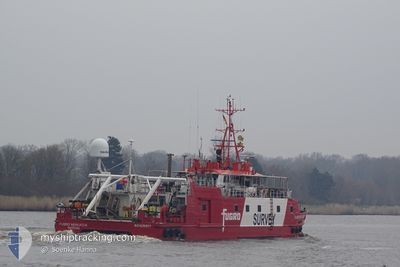
FUGRO MERCATOR
Research/Survey Vessel

Current Trip
ITLIV
| Time Travelled | 8 days |
|---|---|
| Remaining Time | --- |
| Distance Travelled | 366.41 nm |
| Remaining Distance | --- |
| AVG Speed | 4.3 Noeuds |
| MAX Speed | 7.9 Noeuds |
| AVG Wind | 10.7 knots |
| MAX Wind | 24 knots |
| MIN Temp | 7.3°C / 45.14°F |
| MAX Temp | 14.5°C / 58.1°F |
| Tirant d eau | 1.5 m |
| Position reçue | 3 h, 31 m depuis |
Current Position
| Longitude | --- |
|---|---|
| Latitude | --- |
| Etat | Restricted manoeuverability |
| Vitesse | 0.6 Noeuds |
| Parcours | 117° |
| Zone | Tyrrhenian Sea |
| Station | T-AIS |
| Position reçue | 3 h, 31 m depuis |
Information
The current position of FUGRO MERCATOR is in Tyrrhenian Sea with coordinates 42.56114° / 10.10088° as reported on 2025-02-27 11:58 by AIS to our vessel tracker app. The vessel's current speed is 0.6 Noeuds
The vessel FUGRO MERCATOR (IMO: 9299977, MMSI: 311000786) is a Research/Survey Vessel that was built in 2003 ( 22 Age ). It's sailing under the flag of [BS] Bahamas.
In this page you can find informations about the vessels current position, last detected port calls, and current voyage information. If the vessels is not in coverage by AIS you will find the latest position.
The current position of FUGRO MERCATOR is detected by our AIS receivers and we are not responsible for the reliability of the data. The last position was recorded while the vessel was in Coverage by the Ais receivers of our vessel tracking app.
The current draught of FUGRO MERCATOR as reported by AIS is 1.5 meters
Weather
| Temperature | 13.7°C / 56.66°F |
|---|---|
| Wind Speed | 4 knots |
| Direction | 154° SSE |
| Pressure | 1016.2 hPa |
| Humidity | 68.8 % |
| Cloud Coverage | --- |


Featured Company
Last Port Calls
| Port | Arrival | Departure | Time In Port |
|---|---|---|---|
| 2025-02-18 07:39 | 2025-02-18 20:09 | 12 h | |
| 2025-02-04 09:41 | 2025-02-10 08:49 | 5 d | |
| 2025-01-31 09:53 | 2025-01-31 11:37 | 1 h | |
| 2025-01-25 17:09 | 2025-01-30 07:53 | 4 d | |
| 2025-01-17 14:53 | 2025-01-18 07:17 | 16 h | |
| 2024-12-18 16:59 | 2025-01-13 17:41 | 26 d | |
| 2024-12-17 09:14 | 2024-12-17 09:49 | 35 m | |
| 2024-12-16 15:43 | 2024-12-16 17:48 | 2 h | |
| 2024-12-16 07:39 | 2024-12-16 10:29 | 2 h | |
| 2024-12-12 09:50 | 2024-12-12 10:14 | 24 m |
Last Trips
| Origin | Departure | Destination | Arrival | Distance | |
|---|---|---|---|---|---|
| 2025-02-10 08:49 | 2025-02-18 07:39 | 372.38 nm | |||
| 2025-01-31 11:37 | 2025-02-04 09:41 | 106.54 nm | |||
| 2025-01-30 07:53 | 2025-01-31 09:53 | 46.89 nm | |||
| 2025-01-18 07:17 | 2025-01-25 17:09 | 302.00 nm | |||
| 2025-01-13 17:41 | 2025-01-17 14:53 | 238.19 nm | |||
| 2024-12-17 09:49 | 2024-12-18 16:59 | 66.48 nm | |||
| 2024-12-16 17:48 | 2024-12-17 09:14 | 47.23 nm | |||
| 2024-12-16 10:29 | 2024-12-16 15:43 | 10.02 nm | |||
| 2024-12-12 10:14 | 2024-12-16 07:39 | 274.90 nm | |||
| 2024-12-09 16:21 | 2024-12-12 09:50 | 167.57 nm |
Events
| Heure | Evenement | Détails | Position/ Destination | Info |
|---|---|---|---|---|
| 2025-02-27 13:12 | Arret | 11.37 nm, South West of MARINA DI CAMPO |
42.58019 / 10.11468
ITLIV
|
Vitesse: 0.2 kn Parcours: 42° |
| 2025-02-27 12:57 | Démarrage | 11.61 nm, South West of MARINA DI CAMPO |
42.57690 / 10.11141
ITLIV
|
Vitesse: 3.1 kn Parcours: 31° |
| 2025-02-27 12:17 | Arret | 12.25 nm, South West of MARINA DI CAMPO |
42.56819 / 10.10284
ITLIV
|
Vitesse: Parcours: 50° |
| 2025-02-27 12:14 | Etat Changé | Default Restricted manoeuverability |
42.56802 / 10.10323
ITLIV
|
Vitesse: 0.6 kn Parcours: 117° |
| 2025-02-27 11:58 | Etat Changé | Restricted manoeuverability Default |
42.56114 / 10.10088
ITLIV
|
Vitesse: 3.8 kn Parcours: 84° |
| 2025-02-27 11:58 | Hors de la zone couverte |
42.56114 / 10.10088
Tyrrhenian Sea
|
Vitesse: 0.6 kn Parcours: 117.8° |
|
| 2025-02-27 11:54 | Etat Changé | Default Restricted manoeuverability |
42.56125 / 10.09852
ITLIV
|
Vitesse: 4.7 kn Parcours: 85° |
| 2025-02-27 11:51 | Etat Changé | Restricted manoeuverability Default |
42.56110 / 10.09332
ITLIV
|
Vitesse: 4.7 kn Parcours: 85° |
| 2025-02-27 11:49 | Dans la zone couverte |
42.56110 / 10.09332
Tyrrhenian Sea
|
Vitesse: 4.7 kn Parcours: 87.5° |
|
| 2025-02-27 10:47 | Hors de la zone couverte |
42.56323 / 10.09409
Tyrrhenian Sea
|
Vitesse: 3.3 kn Parcours: 67.5° |