
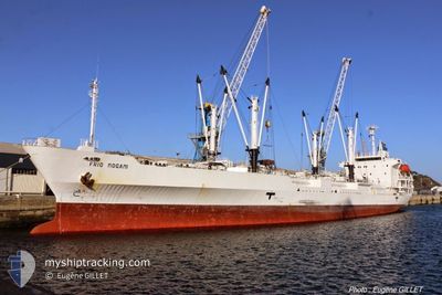
ARGOS REEFER
Reefer
Current Trip
MAVIL->MRNDB
| Time Travelled | --- |
|---|---|
| Remaining Time | --- |
| Distance Travelled | 11003.39 nm |
| Remaining Distance | --- |
| AVG Speed | 12.1 Noeuds |
| MAX Speed | 14.4 Noeuds |
| AVG Wind | 14.7 knots |
| MAX Wind | 35.2 knots |
| MIN Temp | 2.6°C / 36.68°F |
| MAX Temp | 27.8°C / 82.04°F |
| Tirant d eau | 4.9 m |
| Position reçue | 2 d depuis |
Current Position
| Longitude | 55.66435° |
|---|---|
| Latitude | -20.59100° |
| Etat | Under way using engine |
| Vitesse | 12 Noeuds |
| Parcours | 75° |
| Zone | Indian Ocean |
| Station | T-AIS |
| Position reçue | 2 d depuis |
Info
Information
The current position of ARGOS REEFER is in Indian Ocean with coordinates -20.59100° / 55.66435° as reported on 2024-04-25 23:02 by AIS to our vessel tracker app. The vessel's current speed is 12 Noeuds
The vessel ARGOS REEFER (IMO: 9184548, MMSI: 357735000) is a Reefer that was built in 1999 ( 25 Age ). It's sailing under the flag of [PA] Panama.
In this page you can find informations about the vessels current position, last detected port calls, and current voyage information. If the vessels is not in coverage by AIS you will find the latest position.
The current position of ARGOS REEFER is detected by our AIS receivers and we are not responsible for the reliability of the data. The last position was recorded while the vessel was in Coverage by the Ais receivers of our vessel tracking app.
The current draught of ARGOS REEFER as reported by AIS is 4.9 meters
Weather
| Temperature | 27.7°C / 81.86°F |
|---|---|
| Wind Speed | 6 knots |
| Direction | 159° SSE |
| Pressure | 1010.3 hPa |
| Humidity | 76.4 % |
| Cloud Coverage | 84 % |
Featured Company
Events
| Heure | Evenement | Détails | Position/ Destination | Info |
|---|---|---|---|---|
| 2024-04-26 20:55 | Démarrage | 1.61 nm, West of PORT LOUIS |
-20.13223 / 57.45532
MAVIL->MRNDB
|
Vitesse: 4.2 kn Parcours: 14° |
| 2024-04-26 12:54 | Arret | 1.25 nm, West of PORT LOUIS |
-20.14382 / 57.46053
MAVIL->MRNDB
|
Vitesse: 0.2 kn Parcours: 26° |
| 2024-04-26 12:27 | Démarrage | 1.4 nm, West of PORT LOUIS |
-20.13507 / 57.45833
MAVIL->MRNDB
|
Vitesse: 4.8 kn Parcours: 185° |
| 2024-04-26 12:07 | Arret | 1.42 nm, North West of PORT LOUIS |
-20.12980 / 57.46022
MAVIL->MRNDB
|
Vitesse: 0.3 kn Parcours: 93° |
| 2024-04-26 11:43 | Démarrage | 3.24 nm, West of PORT LOUIS |
-20.13323 / 57.42563
MAVIL->MRNDB
|
Vitesse: 4.7 kn Parcours: 45° |
| 2024-04-26 08:11 | Arret | 2.57 nm, North West of PORT LOUIS |
-20.11365 / 57.44705
MAVIL->MRNDB
|
Vitesse: 0.3 kn Parcours: 39° |
| 2024-04-25 23:10 | Etat Changé | Default Under way using engine |
-20.58385 / 55.69338
MAVIL->MRNDB
|
Vitesse: 12 kn Parcours: 75° |
| 2024-04-25 23:02 | Hors de la zone couverte |
-20.59100 / 55.66435
Indian Ocean
|
Vitesse: 12 kn Parcours: 75° |
|
| 2024-04-25 17:35 | Changement de zone | R�union part of the Indian Ocean High seas of the South Atlantic Ocean |
-21.05585 / 54.61210
Indian Ocean
|
Vitesse: 12.9 kn Parcours: 53° |
| 2024-04-25 17:35 | Etat Changé | Under way using engine Default |
-21.05585 / 54.61210
MAVIL->MRNDB
|
Vitesse: 13.1 kn Parcours: 52° |