
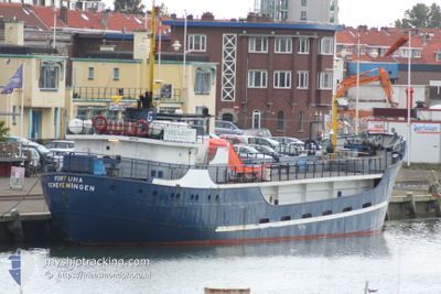
FORTUNA
Standby Safety Vessel
Current Trip
DRURIDGE BAY
| Time Travelled | 5 days |
|---|---|
| Remaining Time | --- |
| Distance Travelled | 104.84 nm |
| Remaining Distance | --- |
| AVG Speed | 5.3 Noeuds |
| MAX Speed | 7.5 Noeuds |
| AVG Wind | 17.5 knots |
| MAX Wind | 21.8 knots |
| MIN Temp | 5.9°C / 42.62°F |
| MAX Temp | 7.4°C / 45.32°F |
| Tirant d eau | 2.8 m |
| Position reçue | 1 d depuis |
Current Position
| Longitude | -1.18320° |
|---|---|
| Latitude | 55.02103° |
| Etat | Under way using engine |
| Vitesse | 3.1 Noeuds |
| Parcours | 47° |
| Zone | North Sea |
| Station | T-AIS |
| Position reçue | 1 d depuis |
Info
Information
The current position of FORTUNA is in North Sea with coordinates 55.02103° / -1.18320° as reported on 2024-04-24 18:33 by AIS to our vessel tracker app. The vessel's current speed is 3.1 Noeuds
The vessel FORTUNA (IMO: 5127152, MMSI: 245581000) is a Standby Safety Vessel that was built in 1954 ( 70 Age ). It's sailing under the flag of [NL] Netherlands.
In this page you can find informations about the vessels current position, last detected port calls, and current voyage information. If the vessels is not in coverage by AIS you will find the latest position.
The current position of FORTUNA is detected by our AIS receivers and we are not responsible for the reliability of the data. The last position was recorded while the vessel was in Coverage by the Ais receivers of our vessel tracking app.
The current draught of FORTUNA as reported by AIS is 2.8 meters
Weather
| Temperature | 6°C / 42.8°F |
|---|---|
| Wind Speed | 5 knots |
| Direction | 28° NNE |
| Pressure | 1013.4 hPa |
| Humidity | 65.3 % |
| Cloud Coverage | 52 % |
Featured Company
Last Port Calls
| Port | Arrival | Departure | Time In Port |
|---|---|---|---|
| 2024-04-21 09:06 | |||
| 2024-04-03 06:11 | 2024-04-03 14:08 | 7 h | |
| 2024-03-18 21:23 | 2024-03-28 12:17 | 9 d | |
| 2024-03-16 08:43 | 2024-03-16 14:21 | 5 h | |
| 2024-03-10 08:58 | 2024-03-16 05:17 | 5 d | |
| 2024-03-01 06:25 | 2024-03-02 06:18 | 23 h | |
| 2024-02-13 07:46 | 2024-02-28 14:48 | 15 d |
Most Visited Ports (Last year)
| Port | Arrivals | |
|---|---|---|
| 9 | ||
| 3 | ||
| 3 | ||
| 2 | ||
| 2 | ||
| 1 |
Last Trips
| Origin | Departure | Destination | Arrival | Distance | |
|---|---|---|---|---|---|
| 2024-03-28 13:17 | 2024-04-03 07:11 | 364.37 nm | |||
| 2024-03-16 15:21 | 2024-03-18 22:23 | 24.27 nm | |||
| 2024-03-16 06:17 | 2024-03-16 09:43 | 17.51 nm | |||
| 2024-03-02 06:18 | 2024-03-10 09:58 | 448.99 nm | |||
| 2024-02-28 15:48 | 2024-03-01 06:25 | 281.60 nm | |||
| 2024-01-22 14:33 | 2024-02-13 08:46 | 902.73 nm |
Events
| Heure | Evenement | Détails | Position/ Destination | Info |
|---|---|---|---|---|
| 2024-04-24 18:33 | Hors de la zone couverte |
55.02103 / -1.18320
North Sea
|
Vitesse: 3.1 kn Parcours: 49.1° |
|
| 2024-04-24 15:27 | Dans la zone couverte |
54.93623 / -1.30181
North Sea
|
Vitesse: 1.3 kn Parcours: 6.9° |
|
| 2024-04-24 13:31 | Hors de la zone couverte |
54.93726 / -1.31531
North Sea
|
Vitesse: 6 kn Parcours: 175.8° |
|
| 2024-04-24 11:06 | Dans la zone couverte |
55.15211 / -1.36070
North Sea
|
Vitesse: 4.9 kn Parcours: 178.6° |
|
| 2024-04-24 09:04 | Hors de la zone couverte |
55.09808 / -1.34370
North Sea
|
Vitesse: 2.7 kn Parcours: 350.4° |
|
| 2024-04-24 08:56 | Démarrage | 4.51 nm, East of SEATON SLUICE |
55.09318 / -1.34327
DRURIDGE BAY
|
Vitesse: 3.1 kn Parcours: 350° |
| 2024-04-24 03:34 | Arret | 4.19 nm, North East of SUNDERLAND |
54.95450 / -1.28296
DRURIDGE BAY
|
Vitesse: 0.3 kn Parcours: 345° |
| 2024-04-24 02:13 | Dans la zone couverte |
54.93289 / -1.26828
North Sea
|
Vitesse: 0.9 kn Parcours: 17.6° |
|
| 2024-04-24 01:04 | Hors de la zone couverte |
54.91360 / -1.26373
North Sea
|
Vitesse: 1.4 kn Parcours: 298.7° |
|
| 2024-04-23 21:03 | Dans la zone couverte |
54.93715 / -1.27321
North Sea
|
Vitesse: 2.9 kn Parcours: 355° |