
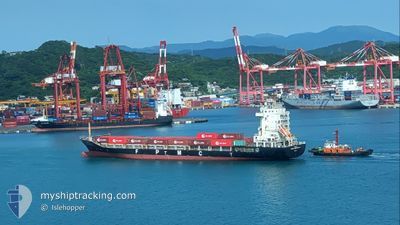
FORMOSACONTAINER NO4
Cargo D
Current Trip
| Time Travelled | 12 days |
|---|---|
| Remaining Time | --- |
| Distance Travelled | 573.70 nm |
| Remaining Distance | 455.67 nm |
| AVG Speed | 12.6 Noeuds |
| MAX Speed | 17 Noeuds |
| AVG Wind | 13.1 knots |
| MAX Wind | 27 knots |
| MIN Temp | 12.4°C / 54.32°F |
| MAX Temp | 20.7°C / 69.26°F |
| Tirant d eau | 7.3 m |
| Position reçue | 13 d depuis |
Current Position
| Longitude | --- |
|---|---|
| Latitude | --- |
| Etat | Under way using engine |
| Vitesse | 12 Noeuds |
| Parcours | 266° |
| Zone | South China Sea |
| Station | T-AIS |
| Position reçue | 13 d depuis |
Info
Information
The current position of FORMOSACONTAINER NO4 is in South China Sea with coordinates 22.54834° / 120.29411° as reported on 2025-02-02 21:25 by AIS to our vessel tracker app. The vessel's current speed is 12 Noeuds and is heading at the port of TAICHUNG. The estimated time of arrival as calculated by MyShipTracking vessel tracking app is 2025-02-03 14:00 LT
The vessel FORMOSACONTAINER NO4 (IMO: 9404508, MMSI: 416024000) is a Cargo D It's sailing under the flag of [TW] Taiwan.
In this page you can find informations about the vessels current position, last detected port calls, and current voyage information. If the vessels is not in coverage by AIS you will find the latest position.
The current position of FORMOSACONTAINER NO4 is detected by our AIS receivers and we are not responsible for the reliability of the data. The last position was recorded while the vessel was in Coverage by the Ais receivers of our vessel tracking app.
The current draught of FORMOSACONTAINER NO4 as reported by AIS is 7.3 meters
Weather
| Temperature | 20.7°C / 69.26°F |
|---|---|
| Wind Speed | 4 knots |
| Direction | 114° ESE |
| Pressure | 1017 hPa |
| Humidity | 77.5 % |
| Cloud Coverage | 96 % |
Featured Company
Last Port Calls
| Port | Arrival | Departure | Time In Port |
|---|---|---|---|
| 2025-02-04 11:49 | 2025-02-04 21:09 | 9 h | |
| 2025-02-03 20:19 | 2025-02-03 23:53 | 3 h | |
| 2025-02-03 01:47 | 2025-02-03 05:33 | 3 h | |
| 2025-01-25 23:15 | 2025-01-26 09:21 | 10 h | |
| 2025-01-25 08:36 | 2025-01-25 14:33 | 5 h | |
| 2025-01-24 14:17 | 2025-01-25 00:41 | 10 h | |
| 2025-01-18 19:39 | 2025-01-19 04:22 | 8 h | |
| 2025-01-18 02:14 | 2025-01-18 10:28 | 8 h | |
| 2025-01-16 14:57 | 2025-01-17 19:01 | 1 d | |
| 2025-01-10 02:05 | 2025-01-10 10:17 | 8 h |
Last Trips
| Origin | Departure | Destination | Arrival | Distance | |
|---|---|---|---|---|---|
| 2025-02-03 23:53 | 2025-02-04 11:49 | 109.76 nm | |||
| 2025-02-03 05:33 | 2025-02-03 20:19 | 125.74 nm | |||
| 2025-01-26 09:21 | 2025-02-03 01:47 | 887.11 nm | |||
| 2025-01-25 14:33 | 2025-01-25 23:15 | 123.90 nm | |||
| 2025-01-25 00:41 | 2025-01-25 08:36 | 110.02 nm | |||
| 2025-01-19 04:22 | 2025-01-24 14:17 | 1004.15 nm | |||
| 2025-01-18 10:28 | 2025-01-18 19:39 | 126.40 nm | |||
| 2025-01-17 19:01 | 2025-01-18 02:14 | 107.03 nm | |||
| 2025-01-10 10:17 | 2025-01-16 14:57 | 1028.40 nm | |||
| 2025-01-09 17:57 | 2025-01-10 02:05 | 125.25 nm |
Events
| Heure | Evenement | Détails | Position/ Destination | Info |
|---|---|---|---|---|
| 2025-02-07 04:45 | Arret | 3.19 nm, North West of HUANGPU |
23.08475 / 113.48013
TW TXG
|
Vitesse: 0.2 kn Parcours: 302° |
| 2025-02-07 03:49 | Démarrage | 1.24 nm, West of HUANGPU |
23.04875 / 113.50794
TW TXG
|
Vitesse: 4.1 kn Parcours: 317° |
| 2025-02-06 23:49 | Arret | 1.14 nm, South West of HUANGPU |
23.04715 / 113.51076
TW TXG
|
Vitesse: Parcours: 332° |