
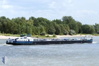
FLORA
Tanker D
Current Trip
GREFFERN RHEINMUNSTE
| Time Travelled | 16 h, 59 mins |
|---|---|
| Remaining Time | --- |
| Distance Travelled | 59.10 nm |
| Remaining Distance | --- |
| AVG Speed | 12 Noeuds |
| MAX Speed | 13.1 Noeuds |
| AVG Wind | 6 knots |
| MAX Wind | 11 knots |
| MIN Temp | 8.3°C / 46.94°F |
| MAX Temp | 10.1°C / 50.18°F |
| Tirant d eau | 2.4 m |
| Position reçue | 4 m depuis |
Current Position
| Longitude | --- |
|---|---|
| Latitude | --- |
| Etat | Under way using engine |
| Vitesse | 11.8 Noeuds |
| Parcours | 324° |
| Zone | North Sea |
| Station | T-AIS |
| Position reçue | 4 m depuis |
Info
Information
The current position of FLORA is in North Sea with coordinates 49.66458° / 8.36548° as reported on 2025-12-07 11:24 by AIS to our vessel tracker app. The vessel's current speed is 11.8 Noeuds
The vessel FLORA (MMSI: 244387072) is a Tanker D It's sailing under the flag of [NL] Netherlands.
In this page you can find informations about the vessels current position, last detected port calls, and current voyage information. If the vessels is not in coverage by AIS you will find the latest position.
The current position of FLORA is detected by our AIS receivers and we are not responsible for the reliability of the data. The last position was recorded while the vessel was in Coverage by the Ais receivers of our vessel tracking app.
The current draught of FLORA as reported by AIS is 2.4 meters
Weather
| Temperature | 10.3°C / 50.54°F |
|---|---|
| Wind Speed | 6 knots |
| Direction | 230° SW |
| Pressure | 1012.9 hPa |
| Humidity | 83.4 % |
| Cloud Coverage | 100 % |
Featured Company
Last Port Calls
| Port | Arrival | Departure | Time In Port |
|---|---|---|---|
| 2025-12-06 10:58 | 2025-12-06 19:29 | 8 h | |
| 2025-12-05 21:19 | |||
| 2025-12-05 21:15 | |||
| 2025-12-05 14:31 | 2025-12-05 15:00 | 28 m | |
| 2025-12-04 10:43 | 2025-12-04 10:55 | 12 m | |
| 2025-12-03 06:31 | 2025-12-03 12:43 | 6 h | |
| 2025-12-01 00:42 | 2025-12-01 10:38 | 9 h | |
| 2025-11-22 21:09 | 2025-11-24 10:08 | 1 d | |
| 2025-11-22 08:40 | 2025-11-22 18:45 | 10 h | |
| 2025-11-20 18:16 | 2025-11-21 06:51 | 12 h |
Last Trips
| Origin | Departure | Destination | Arrival | Distance | |
|---|---|---|---|---|---|
| 2025-12-05 21:15 | 2025-12-06 10:58 | 23.88 nm | |||
| 2025-12-05 15:00 | 2025-12-05 21:19 | 29.35 nm | |||
| 2025-12-04 10:55 | 2025-12-05 14:31 | 88.88 nm | |||
| 2025-12-03 12:43 | 2025-12-04 10:43 | 50.75 nm | |||
| 2025-12-01 10:38 | 2025-12-03 06:31 | 156.17 nm | |||
| 2025-11-24 10:08 | 2025-12-01 00:42 | 34.95 nm | |||
| 2025-11-22 18:45 | 2025-11-22 21:09 | 20.78 nm | |||
| 2025-11-21 06:51 | 2025-11-22 08:40 | 130.20 nm | |||
| 2025-11-19 18:01 | 2025-11-20 18:16 | 164.84 nm | |||
| 2025-11-17 10:12 | 2025-11-19 17:57 | 89.34 nm |
Events
| Heure | Evenement | Détails | Position/ Destination | Info |
|---|---|---|---|---|
| 2025-12-07 11:16 | Etat Changé | Under way using engine Default |
49.64135 / 8.37614
GREFFERN RHEINMUNSTE
|
Vitesse: 11 kn Parcours: 329° |
| 2025-12-07 10:55 | Etat Changé | Default Under way using engine |
49.58167 / 8.42333
GREFFERN RHEINMUNSTE
|
Vitesse: 9.2 kn Parcours: 318° |
| 2025-12-07 10:24 | Etat Changé | Under way using engine Default |
49.49044 / 8.44591
GREFFERN RHEINMUNSTE
|
Vitesse: 10 kn Parcours: 339° |
| 2025-12-07 10:10 | Etat Changé | Default Under way using engine |
49.47333 / 8.46167
GREFFERN RHEINMUNSTE
|
Vitesse: 12.9 kn Parcours: 347.2° |
| 2025-12-07 09:18 | Etat Changé | Under way using engine Default |
49.34345 / 8.47638
GREFFERN RHEINMUNSTE
|
Vitesse: 12 kn Parcours: 54° |
| 2025-12-07 09:04 | Dans la zone couverte |
49.34345 / 8.47638
North Sea
|
Vitesse: 12.5 kn Parcours: 50.7° |
|
| 2025-12-07 06:22 | Démarrage | 4.98 nm, South of MUNCHHAUSEN |
48.83833 / 8.11333
GREFFERN RHEINMUNSTE
|
Vitesse: 8 kn Parcours: 7° |
| 2025-12-06 19:25 | Arret | 5.78 nm, North East of RHEINMUNSTE |
48.82333 / 8.11167
GREFFERN RHEINMUNSTE
|
Vitesse: Parcours: -1° |
| 2025-12-06 18:29 | PORT DE DEPART |
|
48.80833 / 8.09500
GREFFERN RHEINMUNSTE
|
Vitesse: Parcours: -1° |
| 2025-12-06 09:58 | Arret |
48.75834 / 8.01500
[DE] RHEINMUNSTE
|
Vitesse: Parcours: -1° |