

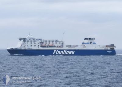
FINNLADY
Ro-Ro/Passenger Ship

Current Trip
| Time Travelled | 1 day |
|---|---|
| Remaining Time | 4 h, 38 mins |
| Distance Travelled | 523.91 nm |
| Remaining Distance | --- |
| AVG Speed | 20.1 Noeuds |
| MAX Speed | 21.2 Noeuds |
| AVG Wind | 8 knots |
| MAX Wind | 14.2 knots |
| MIN Temp | -2.8°C / 26.96°F |
| MAX Temp | 3.3°C / 37.94°F |
| Tirant d eau | 6.7 m |
| Position reçue | 1 m depuis |
Current Position
| Longitude | --- |
|---|---|
| Latitude | --- |
| Etat | Under way using engine |
| Vitesse | 20.6 Noeuds |
| Parcours | 65.4° |
| Zone | Baltic Sea |
| Station | T-AIS |
| Position reçue | 1 m depuis |
Information
The current position of FINNLADY is in Baltic Sea with coordinates 59.36393° / 22.89623° as reported on 2025-02-04 02:53 by AIS to our vessel tracker app. The vessel's current speed is 20.6 Noeuds and is heading at the port of VUOSAARI. The estimated time of arrival as calculated by MyShipTracking vessel tracking app is 2025-02-04 07:32 LT
The vessel FINNLADY (IMO: 9336268, MMSI: 230987000) is a Ro-Ro/Passenger Ship that was built in 2007 ( 18 Age ). It's sailing under the flag of [FI] Finland.
In this page you can find informations about the vessels current position, last detected port calls, and current voyage information. If the vessels is not in coverage by AIS you will find the latest position.
The current position of FINNLADY is detected by our AIS receivers and we are not responsible for the reliability of the data. The last position was recorded while the vessel was in Coverage by the Ais receivers of our vessel tracking app.
The current draught of FINNLADY as reported by AIS is 6.7 meters
Weather
| Temperature | -2.9°C / 26.78°F |
|---|---|
| Wind Speed | 7 knots |
| Direction | 350° N |
| Pressure | 1024.2 hPa |
| Humidity | 78.7 % |
| Cloud Coverage | 100 % |


Featured Company
Last Port Calls
| Port | Arrival | Departure | Time In Port |
|---|---|---|---|
| 2025-02-02 19:27 | 2025-02-03 00:44 | 5 h | |
| 2025-02-01 07:43 | 2025-02-01 13:07 | 5 h | |
| 2025-01-30 19:24 | 2025-01-31 01:27 | 6 h | |
| 2025-01-29 07:49 | 2025-01-29 13:15 | 5 h | |
| 2025-01-26 19:33 | 2025-01-28 01:44 | 1 d | |
| 2025-01-25 07:35 | 2025-01-25 13:51 | 6 h | |
| 2025-01-23 19:26 | 2025-01-24 01:32 | 6 h | |
| 2025-01-22 07:31 | 2025-01-22 13:03 | 5 h | |
| 2025-01-19 19:30 | 2025-01-21 01:19 | 1 d | |
| 2025-01-18 06:32 | 2025-01-18 13:23 | 6 h |
Most Visited Ports (Last year)
| Port | Arrivals | |
|---|---|---|
| 107 | ||
| 106 | ||
| 1 |
Last Trips
| Origin | Departure | Destination | Arrival | Distance | |
|---|---|---|---|---|---|
| 2025-02-01 15:07 | 2025-02-02 20:27 | 617.85 nm | |||
| 2025-01-31 02:27 | 2025-02-01 09:43 | 618.10 nm | |||
| 2025-01-29 15:15 | 2025-01-30 20:24 | 617.50 nm | |||
| 2025-01-28 02:44 | 2025-01-29 09:49 | 619.57 nm | |||
| 2025-01-25 15:51 | 2025-01-26 20:33 | 617.64 nm | |||
| 2025-01-24 02:32 | 2025-01-25 09:35 | 618.14 nm | |||
| 2025-01-22 15:03 | 2025-01-23 20:26 | 618.02 nm | |||
| 2025-01-21 02:19 | 2025-01-22 09:31 | 618.83 nm | |||
| 2025-01-18 15:23 | 2025-01-19 20:30 | 618.63 nm | |||
| 2025-01-17 02:51 | 2025-01-18 08:32 | 618.36 nm |
Events
| Heure | Evenement | Détails | Position/ Destination | Info |
|---|---|---|---|---|
| 2025-02-04 02:37 | Detecté en mer | Estonian part of the Baltic Sea |
59.32810 / 22.74237
Baltic Sea
FITRV
|
Vitesse: 20.3 kn Parcours: 65.2° |
| 2025-02-04 02:37 | Etat Changé | Under way using engine Default |
59.32810 / 22.74237
FITRV
|
Vitesse: 20.4 kn Parcours: 66° |
| 2025-02-04 02:37 | Dans la zone couverte |
59.32810 / 22.74237
Baltic Sea
FITRV
|
Vitesse: 20.3 kn Parcours: 65.2° |
|
| 2025-02-03 20:05 | Etat Changé | Default Under way using engine |
57.77111 / 19.87981
FITRV
|
Vitesse: 20.3 kn Parcours: 37.8° |
| 2025-02-03 20:05 | Hors de la zone couverte |
57.77030 / 19.87863
Baltic Sea
FITRV
|
Vitesse: 20.3 kn Parcours: 37.8° |
|
| 2025-02-03 19:56 | Etat Changé | Under way using engine Default |
57.73108 / 19.82126
FITRV
|
Vitesse: 20.8 kn Parcours: 38° |
| 2025-02-03 19:49 | Etat Changé | Default Under way using engine |
57.69833 / 19.77335
FITRV
|
Vitesse: 20.7 kn Parcours: 38.1° |
| 2025-02-03 19:40 | Etat Changé | Under way using engine Default |
57.65597 / 19.71146
FITRV
|
Vitesse: 20.6 kn Parcours: 38° |
| 2025-02-03 19:33 | Etat Changé | Default Under way using engine |
57.62622 / 19.66802
FITRV
|
Vitesse: 20.7 kn Parcours: 37.7° |
| 2025-02-03 19:27 | Etat Changé | Under way using engine Default |
57.59957 / 19.62918
FITRV
|
Vitesse: 20.6 kn Parcours: 38° |