
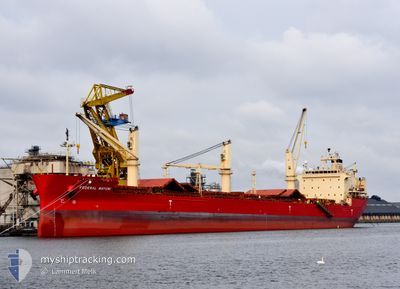
FEDERAL MAYUMI
Bulk Carrier
Current Trip
| Time Travelled | 3 days |
|---|---|
| Remaining Time | --- |
| Distance Travelled | 570.58 nm |
| Remaining Distance | --- |
| AVG Speed | 12.4 Noeuds |
| MAX Speed | 16.4 Noeuds |
| AVG Wind | 15.3 knots |
| MAX Wind | 26 knots |
| MIN Temp | 7.9°C / 46.22°F |
| MAX Temp | 15.2°C / 59.36°F |
| Tirant d eau | 5.8 m |
| Position reçue | 3 m depuis |
Current Position
| Longitude | --- |
|---|---|
| Latitude | --- |
| Etat | At anchor |
| Vitesse | |
| Parcours | 108° |
| Zone | English Channel |
| Station | T-AIS |
| Position reçue | 3 m depuis |
Info
Information
The current position of FEDERAL MAYUMI is in English Channel with coordinates 49.34250° / -0.19614° as reported on 2025-03-07 20:06 by AIS to our vessel tracker app. The vessel's current speed is 0 Noeuds
The vessel FEDERAL MAYUMI (IMO: 9529578, MMSI: 538004646) is a Bulk Carrier that was built in 2012 ( 13 Age ). It's sailing under the flag of [MH] Marshall Is.
In this page you can find informations about the vessels current position, last detected port calls, and current voyage information. If the vessels is not in coverage by AIS you will find the latest position.
The current position of FEDERAL MAYUMI is detected by our AIS receivers and we are not responsible for the reliability of the data. The last position was recorded while the vessel was in Coverage by the Ais receivers of our vessel tracking app.
The current draught of FEDERAL MAYUMI as reported by AIS is 5.8 meters
Weather
| Temperature | 9.9°C / 49.82°F |
|---|---|
| Wind Speed | 8 knots |
| Direction | 127° SE |
| Pressure | 1010.5 hPa |
| Humidity | 89.2 % |
| Cloud Coverage | 14 % |
Featured Company
Last Port Calls
| Port | Arrival | Departure | Time In Port |
|---|---|---|---|
| 2025-02-27 22:22 | 2025-03-04 18:09 | 4 d | |
| 2025-02-02 13:00 | 2025-02-08 21:04 | 6 d | |
| 2025-01-20 21:09 | 2025-01-24 02:19 | 3 d |
Last Trips
| Origin | Departure | Destination | Arrival | Distance | |
|---|---|---|---|---|---|
| 2025-02-08 16:04 | 2025-02-27 22:22 | 2767.02 nm | |||
| 2025-01-23 21:19 | 2025-02-02 08:00 | 505.02 nm | |||
| 2024-12-19 19:55 | 2025-01-20 16:09 | 6729.06 nm |
Events
| Heure | Evenement | Détails | Position/ Destination | Info |
|---|---|---|---|---|
| 2025-03-07 16:33 | Etat Changé | At anchor Default |
49.34351 / -.19453
FRCFR
|
Vitesse: 0.1 kn Parcours: 157° |
| 2025-03-07 16:30 | Etat Changé | Default At anchor |
49.34355 / -.19467
FRCFR
|
Vitesse: Parcours: 160° |
| 2025-03-07 10:45 | Etat Changé | At anchor Default |
49.34379 / -.19360
FRCFR
|
Vitesse: Parcours: 182° |
| 2025-03-07 10:42 | Etat Changé | Default At anchor |
49.34375 / -.19352
FRCFR
|
Vitesse: 0.1 kn Parcours: 179° |
| 2025-03-07 05:33 | Etat Changé | At anchor Default |
49.34350 / -.19487
FRCFR
|
Vitesse: Parcours: 149° |
| 2025-03-07 05:30 | Etat Changé | Default At anchor |
49.34353 / -.19484
FRCFR
|
Vitesse: 0.1 kn Parcours: 147° |
| 2025-03-06 18:24 | Etat Changé | At anchor Default |
49.34327 / -.19533
FRCFR
|
Vitesse: Parcours: 140° |
| 2025-03-06 18:15 | Etat Changé | Default At anchor |
49.34333 / -.19527
FRCFR
|
Vitesse: Parcours: 140° |
| 2025-03-06 15:21 | Etat Changé | At anchor Under way using engine |
49.34318 / -.19287
FRCFR
|
Vitesse: 0.3 kn Parcours: 193° |
| 2025-03-06 15:17 | Arret | 4.02 nm, North East of OUISTREHAM |
49.34298 / -.19306
FRCFR
|
Vitesse: 0.3 kn Parcours: 181° |