
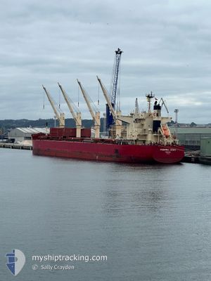
FEDERAL IZUMI
Cargo
Current Trip
| Time Travelled | 2 days |
|---|---|
| Remaining Time | 15 days |
| Distance Travelled | 372.65 nm |
| Remaining Distance | 4008.31 nm |
| AVG Speed | 10.1 Noeuds |
| MAX Speed | 13.9 Noeuds |
| AVG Wind | 5.7 knots |
| MAX Wind | 13 knots |
| MIN Temp | 20°C / 68°F |
| MAX Temp | 30.4°C / 86.72°F |
| Tirant d eau | 12.1 m |
| Position reçue | 11 h, 39 m depuis |
Current Position
| Longitude | --- |
|---|---|
| Latitude | --- |
| Etat | Under way using engine |
| Vitesse | 9.9 Noeuds |
| Parcours | 245.2° |
| Zone | North Atlantic Ocean |
| Station | T-AIS |
| Position reçue | 11 h, 39 m depuis |
Info
Information
The current position of FEDERAL IZUMI is in North Atlantic Ocean with coordinates 35.19971° / -8.32376° as reported on 2024-10-02 11:45 by AIS to our vessel tracker app. The vessel's current speed is 9.9 Noeuds and is heading at the port of CARTAGENA. The estimated time of arrival as calculated by MyShipTracking vessel tracking app is 2024-10-18 02:22 LT
The vessel FEDERAL IZUMI (IMO: 9883015, MMSI: 356585000) is a Cargo It's sailing under the flag of [PA] Panama.
In this page you can find informations about the vessels current position, last detected port calls, and current voyage information. If the vessels is not in coverage by AIS you will find the latest position.
The current position of FEDERAL IZUMI is detected by our AIS receivers and we are not responsible for the reliability of the data. The last position was recorded while the vessel was in Coverage by the Ais receivers of our vessel tracking app.
The current draught of FEDERAL IZUMI as reported by AIS is 12.1 meters
Weather
| Temperature | 21.8°C / 71.24°F |
|---|---|
| Wind Speed | 11 knots |
| Direction | 352° N |
| Pressure | 1017 hPa |
| Humidity | 88.3 % |
| Cloud Coverage | 94 % |
Featured Company
Last Port Calls
| Port | Arrival | Departure | Time In Port |
|---|---|---|---|
| 2024-09-26 11:23 | 2024-09-30 16:59 | 4 d | |
| 2024-09-05 12:58 | 2024-09-14 12:45 | 8 d | |
| 2024-08-21 12:45 | 2024-08-23 03:28 | 1 d | |
| 2024-08-08 12:36 | 2024-08-15 20:33 | 7 d |
Most Visited Ports (Last year)
| Port | Arrivals | |
|---|---|---|
| 2 | ||
| 2 | ||
| 2 | ||
| 1 | ||
| 1 | ||
| 1 |
Last Trips
| Origin | Departure | Destination | Arrival | Distance | |
|---|---|---|---|---|---|
| 2024-09-14 14:45 | 2024-09-26 13:23 | 920.25 nm | |||
| 2024-08-23 00:28 | 2024-09-05 14:58 | 3496.77 nm | |||
| 2024-08-15 17:33 | 2024-08-21 09:45 | 738.75 nm | |||
| 2024-07-23 14:22 | 2024-08-08 09:36 | 3236.43 nm |
Events
| Heure | Evenement | Détails | Position/ Destination | Info |
|---|---|---|---|---|
| 2024-10-02 18:20 | Etat Changé | Under way using engine Default |
34.69051 / -9.44900
COCTG
|
Vitesse: 10.2 kn Parcours: 240° |
| 2024-10-02 11:48 | Etat Changé | Default Under way using engine |
35.19622 / -8.33227
COCTG
|
Vitesse: 9.9 kn Parcours: 245.2° |
| 2024-10-02 11:45 | Hors de la zone couverte |
35.19971 / -8.32376
North Atlantic Ocean
COCTG
|
Vitesse: 9.9 kn Parcours: 245.2° |
|
| 2024-10-02 11:39 | Etat Changé | Under way using engine Default |
35.20826 / -8.30378
COCTG
|
Vitesse: 10 kn Parcours: 239° |
| 2024-10-02 11:30 | Etat Changé | Default Under way using engine |
35.22089 / -8.27775
COCTG
|
Vitesse: 10 kn Parcours: 243° |
| 2024-10-02 11:12 | Etat Changé | Under way using engine Default |
35.24478 / -8.22390
COCTG
|
Vitesse: 9.9 kn Parcours: 243° |
| 2024-10-02 11:01 | Etat Changé | Default Under way using engine |
35.25860 / -8.19138
COCTG
|
Vitesse: 10.1 kn Parcours: 239.8° |
| 2024-10-02 10:18 | Etat Changé | Under way using engine Default |
35.31686 / -8.06185
COCTG
|
Vitesse: 10.5 kn Parcours: 243° |
| 2024-10-02 09:37 | Etat Changé | Default Under way using engine |
35.37035 / -7.92531
COCTG
|
Vitesse: 11.5 kn Parcours: 247.6° |
| 2024-10-02 09:14 | Etat Changé | Under way using engine Default |
35.39823 / -7.84255
COCTG
|
Vitesse: 11.5 kn Parcours: 247° |