
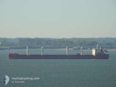
FEDERAL DART
Cargo
Current Trip
| Time Travelled | 9 days |
|---|---|
| Remaining Time | 2 days |
| Distance Travelled | 2546.04 nm |
| Remaining Distance | 942.07 nm |
| AVG Speed | 11.8 Noeuds |
| MAX Speed | 16 Noeuds |
| AVG Wind | 9.1 knots |
| MAX Wind | 19.2 knots |
| MIN Temp | 4.7°C / 40.46°F |
| MAX Temp | 29.1°C / 84.38°F |
| Tirant d eau | 10.7 m |
| Position reçue | 11 h, 47 m depuis |
Current Position
| Longitude | -80.18497° |
|---|---|
| Latitude | 24.33434° |
| Etat | Under way using engine |
| Vitesse | 12.1 Noeuds |
| Parcours | 237° |
| Zone | North Atlantic Ocean |
| Station | T-AIS |
| Position reçue | 11 h, 47 m depuis |
Info
Information
The current position of FEDERAL DART is in North Atlantic Ocean with coordinates 24.33434° / -80.18497° as reported on 2024-05-28 02:19 by AIS to our vessel tracker app. The vessel's current speed is 12.1 Noeuds and is heading at the port of VERACRUZ. The estimated time of arrival as calculated by MyShipTracking vessel tracking app is 2024-05-31 02:47 LT
The vessel FEDERAL DART (IMO: 9805245, MMSI: 538007827) is a Cargo It's sailing under the flag of [MH] Marshall Is.
In this page you can find informations about the vessels current position, last detected port calls, and current voyage information. If the vessels is not in coverage by AIS you will find the latest position.
The current position of FEDERAL DART is detected by our AIS receivers and we are not responsible for the reliability of the data. The last position was recorded while the vessel was in Coverage by the Ais receivers of our vessel tracking app.
The current draught of FEDERAL DART as reported by AIS is 10.7 meters
Weather
| Temperature | 28.1°C / 82.58°F |
|---|---|
| Wind Speed | 7 knots |
| Direction | 113° ESE |
| Pressure | 1017.4 hPa |
| Humidity | 75.7 % |
| Cloud Coverage | --- |
Featured Company
Last Port Calls
| Port | Arrival | Departure | Time In Port |
|---|---|---|---|
| 2024-05-17 08:40 | 2024-05-19 04:24 | 1 d | |
| 2024-05-16 20:38 | 2024-05-16 23:17 | 2 h | |
| 2024-05-15 11:43 | 2024-05-15 12:22 | 38 m | |
| 2024-05-13 06:17 | 2024-05-13 07:13 | 55 m | |
| 2024-05-10 04:36 | 2024-05-12 00:17 | 1 d | |
| 2024-05-03 14:47 | 2024-05-10 03:20 | 6 d | |
| 2024-05-02 19:21 | 2024-05-02 19:54 | 33 m | |
| 2024-04-28 06:50 | 2024-05-01 17:15 | 3 d | |
| 2024-04-26 20:43 | 2024-04-26 21:19 | 36 m | |
| 2024-04-24 01:17 | 2024-04-26 17:44 | 2 d |
Most Visited Ports (Last year)
| Port | Arrivals | |
|---|---|---|
| 6 | ||
| 6 | ||
| 5 | ||
| 4 | ||
| 3 | ||
| 2 |
Last Trips
| Origin | Departure | Destination | Arrival | Distance | |
|---|---|---|---|---|---|
| 2024-05-16 23:17 | 2024-05-17 08:40 | 126.30 nm | |||
| 2024-05-15 12:22 | 2024-05-16 20:38 | 297.59 nm | |||
| 2024-05-13 07:13 | 2024-05-15 11:43 | 525.28 nm | |||
| 2024-05-12 00:17 | 2024-05-13 06:17 | 242.30 nm | |||
| 2024-05-10 03:20 | 2024-05-10 04:36 | 6.99 nm | |||
| 2024-05-02 19:54 | 2024-05-03 14:47 | 232.53 nm | |||
| 2024-05-01 17:15 | 2024-05-02 19:21 | 284.93 nm | |||
| 2024-04-26 21:19 | 2024-04-28 06:50 | 227.89 nm | |||
| 2024-04-26 17:44 | 2024-04-26 20:43 | 27.27 nm | |||
| 2024-04-22 13:52 | 2024-04-24 01:17 | 315.82 nm |
Events
| Heure | Evenement | Détails | Position/ Destination | Info |
|---|---|---|---|---|
| 2024-05-28 02:37 | Etat Changé | Default Under way using engine |
24.30253 / -80.23759
MXVER
|
Vitesse: 12.1 kn Parcours: 237° |
| 2024-05-28 02:19 | Hors de la zone couverte |
24.33434 / -80.18497
North Atlantic Ocean
MXVER
|
Vitesse: 12.1 kn Parcours: 237° |
|
| 2024-05-28 02:01 | Etat Changé | Under way using engine Default |
24.36809 / -80.12679
MXVER
|
Vitesse: 12.5 kn Parcours: 238° |
| 2024-05-28 01:45 | Etat Changé | Default Under way using engine |
24.39693 / -80.07639
MXVER
|
Vitesse: 12.5 kn Parcours: 238.2° |
| 2024-05-28 01:41 | Etat Changé | Under way using engine Default |
24.40493 / -80.06248
MXVER
|
Vitesse: 12.6 kn Parcours: 243° |
| 2024-05-28 01:41 | Dans la zone couverte |
24.40493 / -80.06248
North Atlantic Ocean
MXVER
|
Vitesse: 12.5 kn Parcours: 238.2° |
|
| 2024-05-27 23:25 | Etat Changé | Default Under way using engine |
24.66342 / -79.64858
MXVER
|
Vitesse: 11.9 kn Parcours: 226.2° |
| 2024-05-27 23:16 | Hors de la zone couverte |
24.68367 / -79.62545
North Atlantic Ocean
MXVER
|
Vitesse: 11.9 kn Parcours: 226.2° |
|
| 2024-05-27 23:03 | Etat Changé | Under way using engine Default |
24.71646 / -79.59199
MXVER
|
Vitesse: 12.5 kn Parcours: 194° |
| 2024-05-27 22:47 | Dans la zone couverte |
24.71646 / -79.59199
North Atlantic Ocean
MXVER
|
Vitesse: 12.1 kn Parcours: 215.4° |