
FEDERAL CARIBOU
Cargo
Current Trip
| Time Travelled | 12 days |
|---|---|
| Remaining Time | --- |
| Distance Travelled | 3202.01 nm |
| Remaining Distance | --- |
| AVG Speed | 10.6 Noeuds |
| MAX Speed | 14.1 Noeuds |
| AVG Wind | 9.1 knots |
| MAX Wind | 21.9 knots |
| MIN Temp | 6.4°C / 43.52°F |
| MAX Temp | 29.2°C / 84.56°F |
| Tirant d eau | 10.9 m |
| Position reçue | 15 h, 49 m depuis |
Current Position
| Longitude | -51.32347° |
|---|---|
| Latitude | -0.45301° |
| Etat | Under way using engine |
| Vitesse | 10.3 Noeuds |
| Parcours | 260° |
| Zone | South Atlantic Ocean |
| Station | T-AIS |
| Position reçue | 15 h, 49 m depuis |
Info
Information
The current position of FEDERAL CARIBOU is in South Atlantic Ocean with coordinates -0.45301° / -51.32347° as reported on 2024-05-18 18:36 by AIS to our vessel tracker app. The vessel's current speed is 10.3 Noeuds and is heading at the port of SANTAREM. The estimated time of arrival as calculated by MyShipTracking vessel tracking app is 2024-05-19 01:00 LT
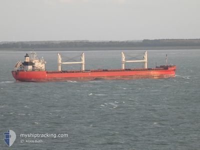
The vessel FEDERAL CARIBOU (IMO: 9671096, MMSI: 538006472) is a Cargo It's sailing under the flag of [MH] Marshall Is.
In this page you can find informations about the vessels current position, last detected port calls, and current voyage information. If the vessels is not in coverage by AIS you will find the latest position.
The current position of FEDERAL CARIBOU is detected by our AIS receivers and we are not responsible for the reliability of the data. The last position was recorded while the vessel was in Coverage by the Ais receivers of our vessel tracking app.
The current draught of FEDERAL CARIBOU as reported by AIS is 10.9 meters
Weather
| Temperature | 23.4°C / 74.12°F |
|---|---|
| Wind Speed | 4 knots |
| Direction | 61° ENE |
| Pressure | 1012.8 hPa |
| Humidity | 97.6 % |
| Cloud Coverage | 83 % |
Featured Company
Last Port Calls
| Port | Arrival | Departure | Time In Port |
|---|---|---|---|
| 2024-05-05 21:57 | 2024-05-06 22:58 | 1 d | |
| 2024-04-24 00:52 | 2024-04-24 02:58 | 2 h | |
| 2024-04-22 16:37 | 2024-04-22 17:12 | 35 m | |
| 2024-04-21 10:08 | 2024-04-21 14:16 | 4 h | |
| 2024-04-20 08:41 | 2024-04-20 09:37 | 56 m | |
| 2024-04-15 14:09 | 2024-04-19 08:02 | 3 d | |
| 2024-04-05 17:51 | 2024-04-10 08:55 | 4 d | |
| 2024-03-31 21:22 | 2024-03-31 22:05 | 43 m | |
| 2024-03-30 09:59 | 2024-03-30 10:42 | 42 m | |
| 2024-03-18 23:16 | 2024-03-19 02:37 | 3 h |
Most Visited Ports (Last year)
| Port | Arrivals | |
|---|---|---|
| 8 | ||
| 6 | ||
| 6 | ||
| 3 | ||
| 3 | ||
| 2 |
Last Trips
| Origin | Departure | Destination | Arrival | Distance | |
|---|---|---|---|---|---|
| 2024-04-24 02:58 | 2024-05-05 21:57 | 1265.54 nm | |||
| 2024-04-22 17:12 | 2024-04-24 00:52 | 296.75 nm | |||
| 2024-04-21 14:16 | 2024-04-22 16:37 | 229.50 nm | |||
| 2024-04-20 09:37 | 2024-04-21 10:08 | 283.56 nm | |||
| 2024-04-19 08:02 | 2024-04-20 08:41 | 211.93 nm | |||
| 2024-04-10 08:55 | 2024-04-15 14:09 | 244.41 nm | |||
| 2024-03-31 22:05 | 2024-04-05 17:51 | 573.84 nm | |||
| 2024-03-30 10:42 | 2024-03-31 21:22 | 297.10 nm | |||
| 2024-03-19 02:37 | 2024-03-30 09:59 | 3318.93 nm | |||
| 2024-03-18 20:54 | 2024-03-18 23:16 | 33.27 nm |
Events
| Heure | Evenement | Détails | Position/ Destination | Info |
|---|---|---|---|---|
| 2024-05-18 18:44 | Etat Changé | Default Under way using engine |
-.45678 / -51.34544
BR_STM
|
Vitesse: 10.3 kn Parcours: 260° |
| 2024-05-18 18:36 | Hors de la zone couverte |
-.45301 / -51.32347
South Atlantic Ocean
BR_STM
|
Vitesse: 10.3 kn Parcours: 260° |
|
| 2024-05-18 18:31 | Etat Changé | Under way using engine Default |
-.45038 / -51.30825
BR_STM
|
Vitesse: 10.6 kn Parcours: 254° |
| 2024-05-18 18:28 | Etat Changé | Default Under way using engine |
-.44858 / -51.30073
BR_STM
|
Vitesse: 10.6 kn Parcours: 254.3° |
| 2024-05-18 18:05 | Etat Changé | Under way using engine Default |
-.43030 / -51.23539
BR_STM
|
Vitesse: 10.7 kn Parcours: 256° |
| 2024-05-18 17:23 | Etat Changé | Default Under way using engine |
-.36137 / -51.12938
BR_STM
|
Vitesse: 11.9 kn Parcours: 231.4° |
| 2024-05-18 17:15 | Etat Changé | Under way using engine Default |
-.34243 / -51.10878
BR_STM
|
Vitesse: 12 kn Parcours: 219° |
| 2024-05-18 17:10 | Etat Changé | Default Under way using engine |
-.33169 / -51.09999
BR_STM
|
Vitesse: 12 kn Parcours: 219.6° |
| 2024-05-18 15:28 | Changement de zone | Brazilian part of the South Atlantic Ocean Brazilian part of the North Atlantic Ocean |
-.00177 / -51.01253
South Atlantic Ocean
BR_STM
|
Vitesse: 11.3 kn Parcours: 195.2° |
| 2024-05-18 14:49 | Changement de zone | Brazilian part of the North Atlantic Ocean Brazilian part of the South Atlantic Ocean |
.00134 / -51.02970
North Atlantic Ocean
BR_STM
|
Vitesse: 4.5 kn Parcours: 41.5° |