
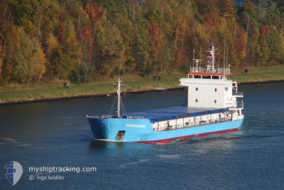
FATMA S
General Cargo
Current Trip
| Trip Time | 2 days |
|---|---|
| Trip Distance | 9.08 nm |
| AVG Speed | 4.9 Noeuds |
| MAX Speed | 8 Noeuds |
| Tirant d eau | 3.5 m |
| AVG Wind | 9.4 knots |
| MAX Wind | 15 knots |
| MIN Temp | 19.4°C / 66.92°F |
| MAX Temp | 28.6°C / 83.48°F |
| Position reçue | 3 d depuis |
Current Position
| Longitude | 34.64583° |
|---|---|
| Latitude | 36.74753° |
| Etat | At anchor |
| Vitesse | |
| Parcours | 184° |
| Zone | Mediterranean Sea - Eastern Basin |
| Station | T-AIS |
| Position reçue | 3 d depuis |
Info
Information
The current position of FATMA S is in Mediterranean Sea - Eastern Basin with coordinates 36.74753° / 34.64583° as reported on 2024-05-11 11:04 by AIS to our vessel tracker app. The vessel's current speed is 0 Noeuds and is currently inside the port of MERSIN.
The vessel FATMA S (IMO: 9006265, MMSI: 577559000) is a General Cargo that was built in 1991 ( 33 Age ). It's sailing under the flag of [VU] Vanuatu.
In this page you can find informations about the vessels current position, last detected port calls, and current voyage information. If the vessels is not in coverage by AIS you will find the latest position.
The current position of FATMA S is detected by our AIS receivers and we are not responsible for the reliability of the data. The last position was recorded while the vessel was in Coverage by the Ais receivers of our vessel tracking app.
The current draught of FATMA S as reported by AIS is 3.5 meters
Weather
| Temperature | 21.3°C / 70.34°F |
|---|---|
| Wind Speed | 11 knots |
| Direction | 208° SSW |
| Pressure | 1011.7 hPa |
| Humidity | 58.8 % |
| Cloud Coverage | --- |
Featured Company
Last Port Calls
| Port | Arrival | Departure | Time In Port |
|---|---|---|---|
| 2024-05-11 21:52 | |||
| 2024-05-09 12:28 | 2024-05-09 20:16 | 7 h | |
| 2024-05-08 03:37 | 2024-05-08 13:28 | 9 h | |
| 2024-05-07 19:08 | 2024-05-08 03:17 | 8 h | |
| 2024-05-06 05:38 | 2024-05-06 15:11 | 9 h | |
| 2024-04-28 08:36 | 2024-04-29 16:06 | 1 d | |
| 2024-04-13 05:37 | 2024-04-13 16:44 | 11 h | |
| 2024-04-10 05:33 | 2024-04-10 22:02 | 16 h | |
| 2024-03-25 20:27 | 2024-03-26 04:40 | 8 h | |
| 2024-03-24 06:28 | 2024-03-24 15:49 | 9 h |
Most Visited Ports (Last year)
| Port | Arrivals | |
|---|---|---|
| 12 | ||
| 9 | ||
| 8 | ||
| 8 | ||
| 7 | ||
| 3 |
Last Trips
| Origin | Departure | Destination | Arrival | Distance | |
|---|---|---|---|---|---|
| 2024-05-09 23:16 | 2024-05-12 00:52 | 9.08 nm | |||
| 2024-05-08 16:28 | 2024-05-09 15:28 | 189.01 nm | |||
| 2024-05-08 06:17 | 2024-05-08 06:37 | 1.44 nm | |||
| 2024-04-29 18:06 | 2024-05-07 22:08 | 1044.61 nm | |||
| 2024-04-29 18:06 | 2024-05-06 07:38 | 718.46 nm | |||
| 2024-04-11 01:02 | 2024-04-28 10:36 | 1179.12 nm | |||
| 2024-04-11 01:02 | 2024-04-13 07:37 | 371.80 nm | |||
| 2024-03-26 06:40 | 2024-04-10 08:33 | 233.45 nm | |||
| 2024-03-19 08:38 | 2024-03-25 22:27 | 1031.97 nm | |||
| 2024-03-19 08:38 | 2024-03-24 08:28 | 704.95 nm |
Events
| Heure | Evenement | Détails | Position/ Destination | Info |
|---|---|---|---|---|
| 2024-05-11 22:17 | Arret |
36.79599 / 34.63784
[TR] MERSIN
|
Vitesse: Parcours: 12° |
|
| 2024-05-11 21:52 | Port d'arrivée |
|
36.78507 / 34.64835
[TR] MERSIN
|
Vitesse: 6 kn Parcours: 296° |
| 2024-05-11 21:13 | Démarrage | 2.86 nm, South of MERSIN |
36.74988 / 34.65593
TRMES
|
Vitesse: 6.9 kn Parcours: 63° |
| 2024-05-11 11:07 | Etat Changé | Default At anchor |
36.74751 / 34.64576
TRMES
|
Vitesse: Parcours: 184° |
| 2024-05-11 11:04 | Etat Changé | At anchor Default |
36.74753 / 34.64583
TRMES
|
Vitesse: Parcours: 185° |
| 2024-05-11 11:04 | Hors de la zone couverte |
36.74753 / 34.64583
Mediterranean Sea - Eastern Basin
|
Vitesse: Parcours: 259.1° |
|
| 2024-05-11 10:49 | Etat Changé | Default At anchor |
36.74755 / 34.64609
TRMES
|
Vitesse: 0.1 kn Parcours: 177° |
| 2024-05-11 10:43 | Etat Changé | At anchor Default |
36.74755 / 34.64584
TRMES
|
Vitesse: 0.1 kn Parcours: 187° |
| 2024-05-11 10:19 | Etat Changé | Default At anchor |
36.74754 / 34.64643
TRMES
|
Vitesse: 0.5 kn Parcours: 166° |
| 2024-05-11 10:07 | Etat Changé | At anchor Default |
36.74751 / 34.64640
TRMES
|
Vitesse: 0.3 kn Parcours: 190° |