
FARESIA
Wing in ground
Current Trip
| Trip Time | 5 h, 1 mins |
|---|---|
| Trip Distance | 51.95 nm |
| AVG Speed | 11.1 Noeuds |
| MAX Speed | 13 Noeuds |
| Tirant d eau | 2 m |
| AVG Wind | 5.4 knots |
| MAX Wind | 6.2 knots |
| MIN Temp | 14.6°C / 58.28°F |
| MAX Temp | 18.3°C / 64.94°F |
| Position reçue | 1 m depuis |
Current Position
| Longitude | 4.40648° |
|---|---|
| Latitude | 51.89115° |
| Etat | Under way using engine |
| Vitesse | |
| Parcours | --- |
| Zone | North Sea |
| Station | T-AIS |
| Position reçue | 1 m depuis |
Info
Information
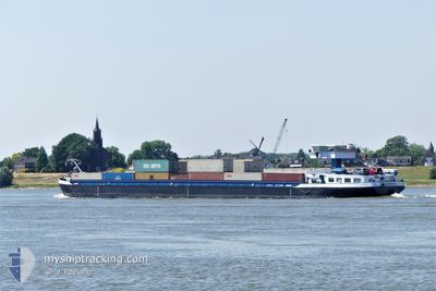
The current position of FARESIA is in North Sea with coordinates 51.89115° / 4.40648° as reported on 2024-05-07 00:45 by AIS to our vessel tracker app. The vessel's current speed is 0 Noeuds and is currently inside the port of ROTTERDAM WAALHAVEN.
The vessel FARESIA (MMSI: 244660194) is a Wing in ground It's sailing under the flag of [NL] Netherlands.
In this page you can find informations about the vessels current position, last detected port calls, and current voyage information. If the vessels is not in coverage by AIS you will find the latest position.
The current position of FARESIA is detected by our AIS receivers and we are not responsible for the reliability of the data. The last position was recorded while the vessel was in Coverage by the Ais receivers of our vessel tracking app.
The current draught of FARESIA as reported by AIS is 2 meters
Weather
| Temperature | 11.9°C / 53.42°F |
|---|---|
| Wind Speed | 4 knots |
| Direction | 62° ENE |
| Pressure | 1013.6 hPa |
| Humidity | 84.3 % |
| Cloud Coverage | 100 % |
Featured Company
Last Port Calls
| Port | Arrival | Departure | Time In Port |
|---|---|---|---|
| 2024-05-06 18:31 | |||
| 2024-05-06 12:47 | 2024-05-06 13:30 | 42 m | |
| 2024-05-06 02:12 | 2024-05-06 10:31 | 8 h | |
| 2024-05-04 22:20 | 2024-05-05 11:10 | 12 h | |
| 2024-05-03 17:11 | 2024-05-04 22:16 | 1 d | |
| 2024-05-02 19:36 | 2024-05-03 09:02 | 13 h | |
| 2024-05-01 11:58 | 2024-05-02 08:57 | 20 h | |
| 2024-05-01 06:46 | 2024-05-01 10:39 | 3 h | |
| 2024-04-30 12:46 | 2024-05-01 06:21 | 17 h | |
| 2024-04-29 21:47 | 2024-04-30 05:39 | 7 h |
Most Visited Ports (Last year)
| Port | Arrivals | |
|---|---|---|
| 168 | ||
| 114 | ||
| 96 | ||
| 35 | ||
| 27 | ||
| 24 |
Last Trips
| Origin | Departure | Destination | Arrival | Distance | |
|---|---|---|---|---|---|
| 2024-05-06 15:30 | 2024-05-06 20:31 | 51.95 nm | |||
| 2024-05-06 12:31 | 2024-05-06 14:47 | 18.59 nm | |||
| 2024-05-05 13:10 | 2024-05-06 04:12 | 82.55 nm | |||
| 2024-05-05 00:16 | 2024-05-05 00:20 | 0.77 nm | |||
| 2024-05-03 11:02 | 2024-05-03 19:11 | 82.22 nm | |||
| 2024-05-02 10:57 | 2024-05-02 21:36 | 83.24 nm | |||
| 2024-05-01 12:39 | 2024-05-01 13:58 | 14.43 nm | |||
| 2024-05-01 08:21 | 2024-05-01 08:46 | 2.52 nm | |||
| 2024-04-30 07:39 | 2024-04-30 14:46 | 61.69 nm | |||
| 2024-04-29 20:28 | 2024-04-29 23:47 | 16.41 nm |
Events
| Heure | Evenement | Détails | Position/ Destination | Info |
|---|---|---|---|---|
| 2024-05-06 18:38 | Arret |
51.89117 / 4.40653
[NL] ROTTERDAM WAALHAVEN
|
Vitesse: Parcours: 511° |
|
| 2024-05-06 18:31 | Port d'arrivée |
|
51.89277 / 4.40111
[NL] ROTTERDAM WAALHAVEN
|
Vitesse: 3.9 kn Parcours: 125.5° |
| 2024-05-06 15:13 | Démarrage | 0.99 nm, West of ZALTBOMMEL |
51.81665 / 5.22295
DEWOR03900CITYX04430
|
Vitesse: 6.5 kn Parcours: 70.7° |
| 2024-05-06 14:59 | Arret | 1.11 nm, West of ZALTBOMMEL |
51.81495 / 5.21923
DEWOR03900CITYX04430
|
Vitesse: 0.3 kn Parcours: 511° |
| 2024-05-06 13:30 | PORT DE DEPART |
|
51.89642 / 5.53489
DEWOR03900CITYX04430
|
Vitesse: 11.4 kn Parcours: 223.1° |
| 2024-05-06 13:28 | Démarrage |
51.90178 / 5.54101
[NL] OCHTEN
|
Vitesse: 8.6 kn Parcours: 215.1° |
|
| 2024-05-06 12:54 | Arret |
51.90348 / 5.54251
[NL] OCHTEN
|
Vitesse: 0.3 kn Parcours: 511° |
|
| 2024-05-06 12:47 | Port d'arrivée |
|
51.89856 / 5.53737
[NL] OCHTEN
|
Vitesse: 4.2 kn Parcours: 336° |
| 2024-05-06 11:41 | Démarrage | 0.5 nm, North of NIJMEGEN |
51.85542 / 5.82424
DEWOR03900CITYX04430
|
Vitesse: 5.3 kn Parcours: 27.6° |
| 2024-05-06 11:23 | Arret | 0.39 nm, North of NIJMEGEN |
51.85366 / 5.82283
DEWOR03900CITYX04430
|
Vitesse: 0.2 kn Parcours: 511° |