
EXPRESS ROME
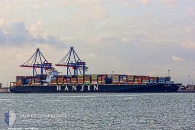
Container Ship
Current Trip
| Time Travelled | 2 days |
|---|---|
| Remaining Time | --- |
| Distance Travelled | 253.91 nm |
| Remaining Distance | --- |
| AVG Speed | 11.4 Noeuds |
| MAX Speed | 14.1 Noeuds |
| AVG Wind | 14.8 knots |
| MAX Wind | 22 knots |
| MIN Temp | 12.7°C / 54.86°F |
| MAX Temp | 16.4°C / 61.52°F |
| Tirant d eau | 13.8 m |
| Position reçue | 1 h, 44 m depuis |
Current Position
| Longitude | 7.71956° |
|---|---|
| Latitude | 54.07868° |
| Etat | At anchor |
| Vitesse | 0.1 Noeuds |
| Parcours | 152° |
| Zone | North Sea |
| Station | T-AIS |
| Position reçue | 1 h, 44 m depuis |
Info
Information
The current position of EXPRESS ROME is in North Sea with coordinates 54.07868° / 7.71956° as reported on 2024-05-16 15:43 by AIS to our vessel tracker app. The vessel's current speed is 0.1 Noeuds
The vessel EXPRESS ROME (IMO: 9484936, MMSI: 636015019) is a Container Ship that was built in 2011 ( 13 Age ). It's sailing under the flag of [LR] Liberia.
In this page you can find informations about the vessels current position, last detected port calls, and current voyage information. If the vessels is not in coverage by AIS you will find the latest position.
The current position of EXPRESS ROME is detected by our AIS receivers and we are not responsible for the reliability of the data. The last position was recorded while the vessel was in Coverage by the Ais receivers of our vessel tracking app.
The current draught of EXPRESS ROME as reported by AIS is 13.8 meters
Weather
| Temperature | 16°C / 60.8°F |
|---|---|
| Wind Speed | 14 knots |
| Direction | 107° ESE |
| Pressure | 1006.5 hPa |
| Humidity | 80.6 % |
| Cloud Coverage | 65 % |
Featured Company
Last Port Calls
| Port | Arrival | Departure | Time In Port |
|---|---|---|---|
| 2024-05-13 02:25 | 2024-05-14 13:27 | 1 d | |
| 2024-04-11 18:33 | 2024-04-12 23:38 | 1 d | |
| 2024-04-09 06:49 | 2024-04-09 07:01 | 12 m | |
| 2024-04-08 07:53 | 2024-04-09 06:41 | 22 h | |
| 2024-03-30 20:14 | 2024-04-02 10:51 | 2 d |
Most Visited Ports (Last year)
| Port | Arrivals | |
|---|---|---|
| 6 | ||
| 6 | ||
| 5 | ||
| 3 | ||
| 3 | ||
| 3 |
Last Trips
| Origin | Departure | Destination | Arrival | Distance | |
|---|---|---|---|---|---|
| 2024-04-13 05:08 | 2024-05-13 04:25 | 11213.73 nm | |||
| 2024-04-09 12:31 | 2024-04-12 00:03 | 469.51 nm | |||
| 2024-04-09 12:11 | 2024-04-09 12:19 | 0.22 nm | |||
| 2024-04-02 14:51 | 2024-04-08 13:23 | 1337.64 nm | |||
| 2024-02-28 13:28 | 2024-03-31 00:14 | 11586.12 nm |
Events
| Heure | Evenement | Détails | Position/ Destination | Info |
|---|---|---|---|---|
| 2024-05-16 15:46 | Etat Changé | Default At anchor |
54.07851 / 7.71939
DEHAM
|
Vitesse: 0.1 kn Parcours: 152° |
| 2024-05-16 15:43 | Etat Changé | At anchor Default |
54.07868 / 7.71956
DEHAM
|
Vitesse: 0.1 kn Parcours: 157° |
| 2024-05-16 15:43 | Hors de la zone couverte |
54.07868 / 7.71956
North Sea
|
Vitesse: 0.1 kn Parcours: 79.2° |
|
| 2024-05-16 15:16 | Etat Changé | Default At anchor |
54.07922 / 7.72102
DEHAM
|
Vitesse: Parcours: 167° |
| 2024-05-16 15:04 | Etat Changé | At anchor Default |
54.07925 / 7.72145
DEHAM
|
Vitesse: Parcours: 173° |
| 2024-05-16 14:55 | Etat Changé | Default At anchor |
54.07927 / 7.72178
DEHAM
|
Vitesse: 0.1 kn Parcours: 174° |
| 2024-05-16 14:52 | Etat Changé | At anchor Default |
54.07925 / 7.72189
DEHAM
|
Vitesse: Parcours: 179° |
| 2024-05-16 14:52 | Dans la zone couverte |
54.07925 / 7.72189
North Sea
|
Vitesse: 0.1 kn Parcours: 79.2° |
|
| 2024-05-16 11:16 | Etat Changé | Default At anchor |
54.07619 / 7.71760
DEHAM
|
Vitesse: Parcours: 86° |
| 2024-05-16 11:10 | Hors de la zone couverte |
54.07620 / 7.71769
North Sea
|
Vitesse: Parcours: 9.4° |