
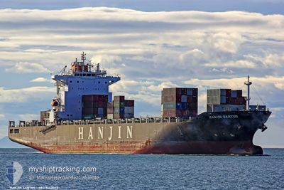
EXPRESS BRAZIL
Container Ship
Current Trip
| Time Travelled | 2 days |
|---|---|
| Remaining Time | --- |
| Distance Travelled | 1009.30 nm |
| Remaining Distance | --- |
| AVG Speed | 15.3 Noeuds |
| MAX Speed | 19.5 Noeuds |
| AVG Wind | 15.6 knots |
| MAX Wind | 20 knots |
| MIN Temp | 26°C / 78.8°F |
| MAX Temp | 28.2°C / 82.76°F |
| Tirant d eau | 10 m |
| Position reçue | 9 h, 0 m depuis |
Current Position
| Longitude | --- |
|---|---|
| Latitude | --- |
| Etat | Under way using engine |
| Vitesse | 14.7 Noeuds |
| Parcours | 95.5° |
| Zone | Caribbean Sea |
| Station | T-AIS |
| Position reçue | 9 h, 0 m depuis |
Info
Information
The current position of EXPRESS BRAZIL is in Caribbean Sea with coordinates 12.31484° / -65.77318° as reported on 2026-01-08 00:58 by AIS to our vessel tracker app. The vessel's current speed is 14.7 Noeuds and is heading at the port of MACAPA. The estimated time of arrival as calculated by MyShipTracking vessel tracking app is 2026-01-12 04:30 LT
The vessel EXPRESS BRAZIL (IMO: 9443023, MMSI: 248574000) is a Container Ship that was built in 2010 ( 16 Age ). It's sailing under the flag of [MT] Malta.
In this page you can find informations about the vessels current position, last detected port calls, and current voyage information. If the vessels is not in coverage by AIS you will find the latest position.
The current position of EXPRESS BRAZIL is detected by our AIS receivers and we are not responsible for the reliability of the data. The last position was recorded while the vessel was in Coverage by the Ais receivers of our vessel tracking app.
The current draught of EXPRESS BRAZIL as reported by AIS is 10 meters
Weather
| Temperature | 26.1°C / 78.98°F |
|---|---|
| Wind Speed | 16 knots |
| Direction | 84° E |
| Pressure | 1012.5 hPa |
| Humidity | 77.7 % |
| Cloud Coverage | 53 % |
Featured Company
Last Port Calls
| Port | Arrival | Departure | Time In Port |
|---|---|---|---|
| 2026-01-04 19:47 | 2026-01-05 11:48 | 16 h | |
| 2025-12-30 05:43 | 2025-12-30 21:34 | 15 h | |
| 2025-12-16 12:34 | 2025-12-18 10:29 | 1 d | |
| 2025-12-06 18:54 | 2025-12-07 18:48 | 23 h | |
| 2025-11-30 08:32 | 2025-12-01 06:15 | 21 h | |
| 2025-11-22 11:51 | 2025-11-23 19:48 | 1 d | |
| 2025-11-21 05:29 | 2025-11-21 15:00 | 9 h | |
| 2025-11-14 09:31 | 2025-11-15 14:10 | 1 d | |
| 2025-11-04 14:07 | 2025-11-07 06:14 | 2 d |
Most Visited Ports (Last year)
| Port | Arrivals | |
|---|---|---|
| 9 | ||
| 9 | ||
| 8 | ||
| 4 | ||
| 2 | ||
| 1 |
Last Trips
| Origin | Departure | Destination | Arrival | Distance | |
|---|---|---|---|---|---|
| 2025-12-30 21:34 | 2026-01-04 19:47 | 294.26 nm | |||
| 2025-12-18 10:29 | 2025-12-30 05:43 | 3127.21 nm | |||
| 2025-12-07 18:48 | 2025-12-16 12:34 | 2794.87 nm | |||
| 2025-12-01 06:15 | 2025-12-06 18:54 | 452.75 nm | |||
| 2025-11-23 19:48 | 2025-11-30 08:32 | 1188.87 nm | |||
| 2025-11-21 15:00 | 2025-11-22 11:51 | 273.11 nm | |||
| 2025-11-15 14:10 | 2025-11-21 05:29 | 1778.75 nm | |||
| 2025-11-07 06:14 | 2025-11-14 09:31 | 1637.00 nm | |||
| 2025-10-26 23:30 | 2025-11-04 14:07 | 3013.80 nm |
Events
| Heure | Evenement | Détails | Position/ Destination | Info |
|---|---|---|---|---|
| 2026-01-08 01:14 | Etat Changé | Default Under way using engine |
12.30850 / -65.70803
MACAPA
|
Vitesse: 14.7 kn Parcours: 95.5° |
| 2026-01-08 00:58 | Hors de la zone couverte |
12.31484 / -65.77318
Caribbean Sea
MACAPA
|
Vitesse: 14.7 kn Parcours: 95.5° |
|
| 2026-01-07 23:08 | Changement de zone | Venezuelan part of the Caribbean Sea Aruban part of the Caribbean Sea |
12.36709 / -66.23397
Caribbean Sea
MACAPA
|
Vitesse: 14.9 kn Parcours: 96.2° |
| 2026-01-07 23:08 | Etat Changé | Under way using engine Default |
12.36709 / -66.23397
MACAPA
|
Vitesse: 14 kn Parcours: 96° |
| 2026-01-07 22:50 | Dans la zone couverte |
12.36709 / -66.23397
Caribbean Sea
MACAPA
|
Vitesse: 14.9 kn Parcours: 96.2° |
|
| 2026-01-07 08:15 | Etat Changé | Default Under way using engine |
12.80114 / -70.11326
MACAPA
|
Vitesse: 15.3 kn Parcours: 90.3° |
| 2026-01-07 08:10 | Etat Changé | Under way using engine Default |
12.80158 / -70.13603
MACAPA
|
Vitesse: 15.3 kn Parcours: 90° |
| 2026-01-07 08:10 | Hors de la zone couverte |
12.80158 / -70.13603
Caribbean Sea
MACAPA
|
Vitesse: 15.3 kn Parcours: 90.3° |
|
| 2026-01-07 07:43 | Etat Changé | Default Under way using engine |
12.79868 / -70.25381
MACAPA
|
Vitesse: 15.5 kn Parcours: 87.3° |
| 2026-01-07 07:28 | Changement de zone | Aruban part of the Caribbean Sea Colombian part of the Caribbean Sea |
12.79570 / -70.31976
Caribbean Sea
MACAPA
|
Vitesse: 15.4 kn Parcours: 87.2° |