
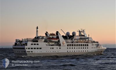
EXPLORIS ONE
Passengers Ship
Current Trip
CUVERUND;
| Time Travelled | 8 days |
|---|---|
| Remaining Time | --- |
| Distance Travelled | 1497.06 nm |
| Remaining Distance | --- |
| AVG Speed | 10 Noeuds |
| MAX Speed | 13.7 Noeuds |
| AVG Wind | 8.9 knots |
| MAX Wind | 28.3 knots |
| MIN Temp | -11.1°C / 12.02°F |
| MAX Temp | 8.7°C / 47.66°F |
| Tirant d eau | 4.7 m |
| Position reçue | 10 h, 52 m depuis |
Current Position
| Longitude | --- |
|---|---|
| Latitude | --- |
| Etat | Under way using engine |
| Vitesse | 11.4 Noeuds |
| Parcours | 344.9° |
| Zone | Southern Ocean |
| Station | T-AIS |
| Position reçue | 10 h, 52 m depuis |
Info
Information
The current position of EXPLORIS ONE is in Southern Ocean with coordinates -62.79653° / -63.69924° as reported on 2025-02-17 21:11 by AIS to our vessel tracker app. The vessel's current speed is 11.4 Noeuds
The vessel EXPLORIS ONE (IMO: 8806747, MMSI: 311562000) is a Passengers Ship that was built in 1989 ( 36 Age ). It's sailing under the flag of [BS] Bahamas.
In this page you can find informations about the vessels current position, last detected port calls, and current voyage information. If the vessels is not in coverage by AIS you will find the latest position.
The current position of EXPLORIS ONE is detected by our AIS receivers and we are not responsible for the reliability of the data. The last position was recorded while the vessel was in Coverage by the Ais receivers of our vessel tracking app.
The current draught of EXPLORIS ONE as reported by AIS is 4.7 meters
Weather
| Temperature | 2.5°C / 36.5°F |
|---|---|
| Wind Speed | 26 knots |
| Direction | 216° SW |
| Pressure | 982.6 hPa |
| Humidity | 76.9 % |
| Cloud Coverage | 100 % |
Featured Company
Last Port Calls
| Port | Arrival | Departure | Time In Port |
|---|---|---|---|
| 2025-02-08 21:52 | 2025-02-09 21:18 | 23 h | |
| 2025-01-30 00:44 | 2025-01-30 21:21 | 20 h | |
| 2025-01-13 20:28 | 2025-01-14 21:33 | 1 d | |
| 2025-01-04 01:00 | 2025-01-04 21:03 | 20 h | |
| 2024-12-22 23:28 | 2024-12-23 22:00 | 22 h | |
| 2024-12-16 10:34 | 2024-12-17 00:58 | 14 h | |
| 2024-12-01 08:15 | 2024-12-03 19:50 | 2 d |
Most Visited Ports (Last year)
| Port | Arrivals | |
|---|---|---|
| 6 | ||
| 3 | ||
| 3 | ||
| 2 | ||
| 2 | ||
| 2 |
Last Trips
| Origin | Departure | Destination | Arrival | Distance | |
|---|---|---|---|---|---|
| 2025-01-30 18:21 | 2025-02-08 18:52 | 1642.83 nm | |||
| 2025-01-14 18:33 | 2025-01-29 21:44 | 3223.05 nm | |||
| 2025-01-04 18:03 | 2025-01-13 17:28 | 1671.39 nm | |||
| 2024-12-23 19:00 | 2025-01-03 22:00 | 2127.41 nm | |||
| 2024-12-16 21:58 | 2024-12-22 20:28 | 1345.45 nm | |||
| 2024-12-03 16:50 | 2024-12-16 07:34 | 3494.91 nm | |||
| 2024-11-29 18:34 | 2024-12-01 05:15 | 255.43 nm |
Events
| Heure | Evenement | Détails | Position/ Destination | Info |
|---|---|---|---|---|
| 2025-02-17 21:25 | Etat Changé | Default Under way using engine |
-62.75313 / -63.72284
CUVERUND;
|
Vitesse: 11.4 kn Parcours: 344.9° |
| 2025-02-17 21:11 | Hors de la zone couverte |
-62.79653 / -63.69924
Southern Ocean
|
Vitesse: 11.4 kn Parcours: 344.9° |
|
| 2025-02-17 20:31 | Etat Changé | Under way using engine Default |
-62.92087 / -63.62714
CUVERUND;
|
Vitesse: 12 kn Parcours: 344° |
| 2025-02-17 20:14 | Etat Changé | Default Under way using engine |
-62.97532 / -63.59232
CUVERUND;
|
Vitesse: 12 kn Parcours: 344.5° |
| 2025-02-17 20:04 | Etat Changé | Under way using engine Default |
-63.00653 / -63.57207
CUVERUND;
|
Vitesse: 12 kn Parcours: 345° |
| 2025-02-17 19:57 | Etat Changé | Default Under way using engine |
-63.02941 / -63.55732
CUVERUND;
|
Vitesse: 12 kn Parcours: 347.5° |
| 2025-02-17 19:47 | Etat Changé | Under way using engine Default |
-63.06005 / -63.54281
CUVERUND;
|
Vitesse: 11.8 kn Parcours: 348° |
| 2025-02-17 19:40 | Dans la zone couverte |
-63.05463 / -63.54529
Southern Ocean
|
Vitesse: 12 kn Parcours: 347.5° |
|
| 2025-02-17 11:30 | Démarrage |
-64.67337 / -62.62335
CUVERUND;
|
Vitesse: 6.4 kn Parcours: 26° |
|
| 2025-02-17 07:52 | Hors de la zone couverte |
-64.66049 / -62.62555
Southern Ocean
CUVERUND;
|
Vitesse: 7.1 kn Parcours: 179.4° |