
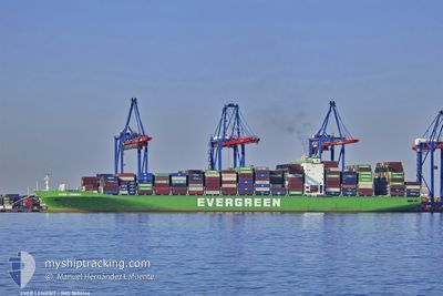
EVER LENIENT
Container Ship
Current Trip
| Time Travelled | 8 days |
|---|---|
| Remaining Time | --- |
| Distance Travelled | 1752.20 nm |
| Remaining Distance | 6.88 nm |
| AVG Speed | 13.1 Noeuds |
| MAX Speed | 18.2 Noeuds |
| AVG Wind | 9.2 knots |
| MAX Wind | 23 knots |
| MIN Temp | 18.9°C / 66.02°F |
| MAX Temp | 29.1°C / 84.38°F |
| Tirant d eau | 14.3 m |
| Position reçue | 3 d depuis |
Current Position
| Longitude | --- |
|---|---|
| Latitude | --- |
| Etat | Under way using engine |
| Vitesse | 15.2 Noeuds |
| Parcours | 308.1° |
| Zone | Malacca Strait |
| Station | T-AIS |
| Position reçue | 3 d depuis |
Info
Information
The current position of EVER LENIENT is in Malacca Strait with coordinates 2.21557° / 101.96510° as reported on 2026-01-03 17:42 by AIS to our vessel tracker app. The vessel's current speed is 15.2 Noeuds and is heading at the port of PORT KLANG. The estimated time of arrival as calculated by MyShipTracking vessel tracking app is 2026-01-04 05:00 LT
The vessel EVER LENIENT (IMO: 9604146, MMSI: 235102677) is a Container Ship that was built in 2014 ( 12 Age ). It's sailing under the flag of [GB] United Kingdom.
In this page you can find informations about the vessels current position, last detected port calls, and current voyage information. If the vessels is not in coverage by AIS you will find the latest position.
The current position of EVER LENIENT is detected by our AIS receivers and we are not responsible for the reliability of the data. The last position was recorded while the vessel was in Coverage by the Ais receivers of our vessel tracking app.
The current draught of EVER LENIENT as reported by AIS is 14.3 meters
Weather
| Temperature | 27.2°C / 80.96°F |
|---|---|
| Wind Speed | 13 knots |
| Direction | 78° ENE |
| Pressure | 1010.8 hPa |
| Humidity | 78.2 % |
| Cloud Coverage | 100 % |
Featured Company
Last Port Calls
| Port | Arrival | Departure | Time In Port |
|---|---|---|---|
| 2025-12-29 20:13 | 2025-12-30 09:55 | 13 h | |
| 2025-12-26 16:48 | 2025-12-27 09:56 | 17 h | |
| 2025-12-21 13:37 | 2025-12-22 13:46 | 1 d | |
| 2025-12-04 08:29 | 2025-12-05 13:17 | 1 d |
Last Trips
| Origin | Departure | Destination | Arrival | Distance | |
|---|---|---|---|---|---|
| 2025-12-27 09:56 | 2025-12-29 20:13 | 809.43 nm | |||
| 2025-12-22 13:46 | 2025-12-26 16:48 | 274.78 nm | |||
| 2025-12-05 13:17 | 2025-12-21 13:37 | 2809.43 nm | |||
| 2025-10-22 14:51 | 2025-12-04 08:29 | 9502.12 nm |
Events
| Heure | Evenement | Détails | Position/ Destination | Info |
|---|---|---|---|---|
| 2026-01-05 06:21 | Arret | 13.68 nm, South of PORT KLANG |
2.78721 / 101.25971
CNDCB>MYPKG
|
Vitesse: 0.2 kn Parcours: 141° |
| 2026-01-05 03:57 | Démarrage | 18.03 nm, South West of PORT KLANG |
2.83947 / 101.09142
CNDCB>MYPKG
|
Vitesse: 3.4 kn Parcours: 124° |
| 2026-01-05 01:41 | Arret | 17.04 nm, South West of PORT KLANG |
2.82433 / 101.12193
CNDCB>MYPKG
|
Vitesse: 0.1 kn Parcours: 162° |
| 2026-01-05 00:33 | Démarrage | 15.14 nm, South West of PORT KLANG |
2.82150 / 101.16637
CNDCB>MYPKG
|
Vitesse: 3.6 kn Parcours: 325° |
| 2026-01-04 22:33 | Arret | 16.26 nm, South West of PORT KLANG |
2.82809 / 101.13547
CNDCB>MYPKG
|
Vitesse: 0.3 kn Parcours: 317° |
| 2026-01-04 21:33 | Démarrage | 14.52 nm, South West of PORT KLANG |
2.81375 / 101.18969
CNDCB>MYPKG
|
Vitesse: 3.5 kn Parcours: 275° |
| 2026-01-04 20:01 | Arret | 14.45 nm, South West of PORT KLANG |
2.81147 / 101.19425
CNDCB>MYPKG
|
Vitesse: 0.1 kn Parcours: 19° |
| 2026-01-04 19:37 | Démarrage | 15.28 nm, South West of PORT KLANG |
2.80565 / 101.17966
CNDCB>MYPKG
|
Vitesse: 3.6 kn Parcours: 89° |
| 2026-01-04 18:25 | Arret | 15.45 nm, South West of PORT KLANG |
2.80302 / 101.17833
CNDCB>MYPKG
|
Vitesse: 0.1 kn Parcours: 127° |
| 2026-01-04 14:25 | Démarrage | 17.29 nm, South West of PORT KLANG |
2.80277 / 101.13448
CNDCB>MYPKG
|
Vitesse: 3.9 kn Parcours: 233° |