
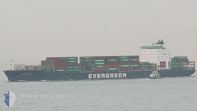
EVER BLINK
Cargo D
Current Trip
| Time Travelled | 4 days |
|---|---|
| Remaining Time | 9 h, 49 mins |
| Distance Travelled | 1838.29 nm |
| Remaining Distance | 153.49 nm |
| AVG Speed | 15.8 Noeuds |
| MAX Speed | 18.9 Noeuds |
| AVG Wind | 15.2 knots |
| MAX Wind | 25.7 knots |
| MIN Temp | 18.9°C / 66.02°F |
| MAX Temp | 28.1°C / 82.58°F |
| Tirant d eau | 11.2 m |
| Position reçue | 1 m depuis |
Current Position
| Longitude | --- |
|---|---|
| Latitude | --- |
| Etat | Under way using engine |
| Vitesse | 14.7 Noeuds |
| Parcours | 143° |
| Zone | Java Sea |
| Station | T-AIS |
| Position reçue | 1 m depuis |
Info
Information
The current position of EVER BLINK is in Java Sea with coordinates -5.56839° / 111.18398° as reported on 2025-12-09 18:48 by AIS to our vessel tracker app. The vessel's current speed is 14.7 Noeuds and is heading at the port of SURABAYA. The estimated time of arrival as calculated by MyShipTracking vessel tracking app is 2025-12-10 11:38 LT
The vessel EVER BLINK (IMO: 9790098, MMSI: 416040000) is a Cargo D It's sailing under the flag of [TW] Taiwan.
In this page you can find informations about the vessels current position, last detected port calls, and current voyage information. If the vessels is not in coverage by AIS you will find the latest position.
The current position of EVER BLINK is detected by our AIS receivers and we are not responsible for the reliability of the data. The last position was recorded while the vessel was in Coverage by the Ais receivers of our vessel tracking app.
The current draught of EVER BLINK as reported by AIS is 11.2 meters
Weather
| Temperature | 27.9°C / 82.22°F |
|---|---|
| Wind Speed | 13 knots |
| Direction | 281° W |
| Pressure | 1008.3 hPa |
| Humidity | 77.5 % |
| Cloud Coverage | 100 % |
Featured Company
Last Port Calls
| Port | Arrival | Departure | Time In Port |
|---|---|---|---|
| 2025-12-05 00:05 | 2025-12-05 10:50 | 10 h | |
| 2025-12-02 18:09 | 2025-12-03 15:42 | 21 h | |
| 2025-12-01 21:59 | 2025-12-02 08:13 | 10 h | |
| 2025-12-01 07:59 | 2025-12-01 16:10 | 8 h | |
| 2025-11-28 07:13 | 2025-11-28 17:21 | 10 h | |
| 2025-11-26 20:33 | 2025-11-27 09:08 | 12 h | |
| 2025-11-25 16:59 | 2025-11-26 11:29 | 18 h | |
| 2025-11-24 08:10 | 2025-11-24 18:14 | 10 h | |
| 2025-11-23 06:25 | 2025-11-24 06:16 | 23 h | |
| 2025-11-20 03:57 | 2025-11-20 12:09 | 8 h |
Last Trips
| Origin | Departure | Destination | Arrival | Distance | |
|---|---|---|---|---|---|
| 2025-12-03 15:42 | 2025-12-05 00:05 | 403.92 nm | |||
| 2025-12-02 08:13 | 2025-12-02 18:09 | 138.41 nm | |||
| 2025-12-01 16:10 | 2025-12-01 21:59 | 86.05 nm | |||
| 2025-11-28 17:21 | 2025-12-01 07:59 | 950.00 nm | |||
| 2025-11-27 09:08 | 2025-11-28 07:13 | 252.03 nm | |||
| 2025-11-26 11:29 | 2025-11-26 20:33 | 130.78 nm | |||
| 2025-11-24 18:14 | 2025-11-25 16:59 | 134.27 nm | |||
| 2025-11-24 06:16 | 2025-11-24 08:10 | 14.75 nm | |||
| 2025-11-20 12:09 | 2025-11-23 06:25 | 1172.50 nm | |||
| 2025-11-19 12:31 | 2025-11-20 03:57 | 208.19 nm |
Events
| Heure | Evenement | Détails | Position/ Destination | Info |
|---|---|---|---|---|
| 2025-12-09 17:16 | Changement de zone | Indonesian part of the Java Sea Chinese part of the South China Sea |
-5.25136 / 110.95411
Java Sea
CN NSA >ID SUB
|
Vitesse: 15.4 kn Parcours: 139.1° |
| 2025-12-09 17:16 | Dans la zone couverte |
-5.25136 / 110.95411
Java Sea
CN NSA >ID SUB
|
Vitesse: 15.4 kn Parcours: 139.1° |
|
| 2025-12-05 05:17 | Etat Changé | Default Under way using engine |
22.22029 / 113.79797
CN NSA >ID SUB
|
Vitesse: 13.8 kn Parcours: 174° |
| 2025-12-05 05:11 | Hors de la zone couverte |
22.24478 / 113.80019
South China Sea
CN NSA >ID SUB
|
Vitesse: 13.8 kn Parcours: 174° |
|
| 2025-12-05 02:50 | PORT DE DEPART |
|
22.63397 / 113.68854
CN NSA >ID SUB
|
Vitesse: 4.1 kn Parcours: 143° |
| 2025-12-05 02:49 | Démarrage |
22.63477 / 113.68778
[CN] NANSHA
|
Vitesse: 3.5 kn Parcours: 143° |
|
| 2025-12-05 02:22 | Etat Changé | Under way using engine Default |
22.63295 / 113.68497
[CN] NANSHA
|
Vitesse: 0.1 kn Parcours: 348° |
| 2025-12-05 02:22 | Tirant d'eau modifié | 11.2 11.1 |
22.63296 / 113.68497
[CN] NANSHA
|
Vitesse: 0.1 kn Parcours: 348° |
| 2025-12-05 02:22 | Changement d'ETA | 2025/12/10 09:00 2025/12/04 13:30 |
22.63296 / 113.68497
[CN] NANSHA
|
Vitesse: 0.1 kn Parcours: 348° |
| 2025-12-05 01:52 | Etat Changé | Default Moored |
22.63297 / 113.68499
[CN] NANSHA
|
Vitesse: 0.1 kn Parcours: 348° |