
EVA MASTER
Cargo
Current Trip
| Time Travelled | 6 h, 56 mins |
|---|---|
| Remaining Time | --- |
| Distance Travelled | 79.50 nm |
| Remaining Distance | --- |
| AVG Speed | 11.7 Noeuds |
| MAX Speed | 13.5 Noeuds |
| AVG Wind | 6.6 knots |
| MAX Wind | 8.3 knots |
| MIN Temp | 14.3°C / 57.74°F |
| MAX Temp | 18.8°C / 65.84°F |
| Tirant d eau | 10.1 m |
| Position reçue | 4 m depuis |
Current Position
| Longitude | --- |
|---|---|
| Latitude | --- |
| Etat | Under way using engine |
| Vitesse | 12.1 Noeuds |
| Parcours | 152.8° |
| Zone | Gulf of Mexico |
| Station | T-AIS |
| Position reçue | 4 m depuis |
Info
Information
The current position of EVA MASTER is in Gulf of Mexico with coordinates 29.44721° / -87.47618° as reported on 2025-02-26 10:02 by AIS to our vessel tracker app. The vessel's current speed is 12.1 Noeuds and is heading at the port of ROTTERDAM. The estimated time of arrival as calculated by MyShipTracking vessel tracking app is 2025-03-15 12:00 LT
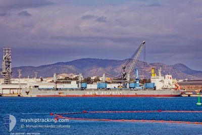
The vessel EVA MASTER (IMO: 9932139, MMSI: 352001835) is a Cargo It's sailing under the flag of [PA] Panama.
In this page you can find informations about the vessels current position, last detected port calls, and current voyage information. If the vessels is not in coverage by AIS you will find the latest position.
The current position of EVA MASTER is detected by our AIS receivers and we are not responsible for the reliability of the data. The last position was recorded while the vessel was in Coverage by the Ais receivers of our vessel tracking app.
The current draught of EVA MASTER as reported by AIS is 10.1 meters
Weather
| Temperature | 18.8°C / 65.84°F |
|---|---|
| Wind Speed | 7 knots |
| Direction | 294° WNW |
| Pressure | 1015 hPa |
| Humidity | 73.3 % |
| Cloud Coverage | --- |
Featured Company
Last Port Calls
| Port | Arrival | Departure | Time In Port |
|---|---|---|---|
| 2025-02-20 16:47 | 2025-02-26 03:11 | 5 d | |
| 2025-02-13 14:39 | 2025-02-17 14:31 | 3 d | |
| 2025-02-05 14:12 | 2025-02-08 20:57 | 3 d | |
| 2025-01-30 06:20 | 2025-02-03 03:19 | 3 d | |
| 2024-12-14 10:19 | 2024-12-30 18:48 | 16 d | |
| 2024-12-09 22:39 | 2024-12-13 07:20 | 3 d | |
| 2024-12-06 08:12 |
Most Visited Ports (Last year)
| Port | Arrivals | |
|---|---|---|
| 1 | ||
| 1 | ||
| 1 | ||
| 1 | ||
| 1 | ||
| 1 |
Last Trips
| Origin | Departure | Destination | Arrival | Distance | |
|---|---|---|---|---|---|
| 2025-02-17 08:31 | 2025-02-20 10:47 | 244.89 nm | |||
| 2025-02-08 15:57 | 2025-02-13 08:39 | 1238.21 nm | |||
| 2025-02-02 22:19 | 2025-02-05 09:12 | 671.74 nm | |||
| 2024-12-30 21:48 | 2025-01-30 01:20 | 6478.73 nm | |||
| 2024-12-13 09:20 | 2024-12-14 13:19 | 307.09 nm | |||
| 2024-12-06 09:12 | 2024-12-10 00:39 | 1092.10 nm |
Events
| Heure | Evenement | Détails | Position/ Destination | Info |
|---|---|---|---|---|
| 2025-02-26 09:12 | Etat Changé | Under way using engine Default |
29.58597 / -87.58674
NLRTM
|
Vitesse: 12.1 kn Parcours: 143° |
| 2025-02-26 08:58 | Etat Changé | Default Under way using engine |
29.62211 / -87.61829
NLRTM
|
Vitesse: 12.2 kn Parcours: 146.3° |
| 2025-02-26 08:54 | Etat Changé | Under way using engine Default |
29.63340 / -87.62794
NLRTM
|
Vitesse: 12.2 kn Parcours: 146° |
| 2025-02-26 08:40 | Dans la zone couverte |
29.63340 / -87.62794
Gulf of Mexico
NLRTM
|
Vitesse: 12.2 kn Parcours: 146.3° |
|
| 2025-02-26 06:59 | Etat Changé | Default Under way using engine |
29.95374 / -87.88440
NLRTM
|
Vitesse: 12.2 kn Parcours: 144.6° |
| 2025-02-26 06:59 | Hors de la zone couverte |
29.95419 / -87.88477
Gulf of Mexico
NLRTM
|
Vitesse: 12.2 kn Parcours: 144.6° |
|
| 2025-02-26 06:17 | Etat Changé | Under way using engine Default |
30.06755 / -87.97637
NLRTM
|
Vitesse: 11.5 kn Parcours: 146° |
| 2025-02-26 06:16 | Etat Changé | Default Under way using engine |
30.07306 / -87.98132
NLRTM
|
Vitesse: 11.7 kn Parcours: 135.3° |
| 2025-02-26 06:03 | Tirant d'eau modifié | 10.1 6.8 |
30.10462 / -88.01758
NLRTM
|
Vitesse: 11.8 kn Parcours: 124.5° |
| 2025-02-26 06:03 | Changement de destination | NLRTM US MOB |
30.10462 / -88.01758
NLRTM
|
Vitesse: 11.8 kn Parcours: 124.5° |